Shapefile Study guides, Class notes & Summaries
Looking for the best study guides, study notes and summaries about Shapefile? On this page you'll find 35 study documents about Shapefile.
Page 4 out of 35 results
Sort by

-
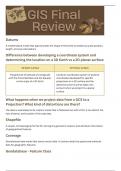
Study Guide for Final GEOG 360 GIS Fundamentals
- Class notes • 6 pages • 2023
-
- $7.99
- + learn more
This document was inspired by the study guide given to students to study for the final exam in the course. The content reviews Chapters 1 through 14 concepts in the textbook "GIS Fundamentals: A First Text on Geographic Information Systems" by Paul Bolstad.

-
CSU GR 311 Mastering Arc GIS, Price Chapter 1 | Questions with 100% Correct Answers | Updated & Verified
- Exam (elaborations) • 3 pages • 2022
-
- $3.49
- + learn more
How many feature datasets are there in the oregondata geodatabase in the mgisdataOregon folder? List their names. How many total feature classes does the geodatabase have? How many rasters? - Answer: 2 features datasets, namely, Transportation and Water. 9 or 14 total features (14 - if features inside feature datasets are counted, I will count either answer correct). 5 rasters. Method: Open catalog window. Go to and expand mgisdata > Oregon folder > geodatabase and find the answer...

-
SPECIAL ISSUE 1719 Kenya Gazette Supplement No. 216 26th November, 2021 (Legislative Supplement No. 97
- Exam (elaborations) • 41 pages • 2024
-
- $40.99
- + learn more
SPECIAL ISSUE 1719 Kenya Gazette Supplement No. 216 26th November, 2021 (Legislative Supplement No. 97) LEGAL NOTICE NO. 243 THE PHYSICAL AND LAND USE PLANNING ACT (No. 13 of 2019) THE PHYSICAL AND LAND USE PLANNING (PLANNING FEES) REGULATIONS, 2021 ARRANGEMENT OF REGULATIONS Regulation 1—Citation. 2—Interpretation. 3—Object of the Regulations. 4—Determination of planning fees. 5—Planning fees of the National Government. 6—Planning fees of County Governments. 7—Wai...

-
Downloading and extracting shape files for ArcGIS (protocol)
- Presentation • 8 pages • 2021
- Available in package deal
-
- $5.49
- + learn more
Powerpoint presentation detailing how to download and extract a shapefile to be used in ArcGIS.

-
GEOG 462Final Summary.
- Summary • 37 pages • 2021
-
- $18.49
- + learn more
• Using ArcGIS o Setting up a workspace in ArcGIS Lab 1 – Seeing up a workspace in ArcGIS o 1. Create a folder in which you will store all data, geodatabases and map documents o 2. Download the data associated with this lab. Be sure that you unzip the data and put the folder of unzipped data into the folder you created for this class. o 3. Store relative pathnames. Storing relative pathnames means that ArcMap will remember how to get to any data you input based on where it is l...

Did you know that on average a seller on Stuvia earns $82 per month selling study resources? Hmm, hint, hint. Discover all about earning on Stuvia


