
Floodplain Manager Certification CFM Verified Study Guide - Practice Exam Solutions
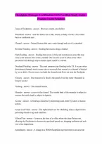
Floodplain Manager Certification CFM Verified Study Guide - Practice Exam Solutions Types of floodplains - answer - Riverine, coastal, and shallow Watershed - answer - area that drains into a lake, stream, or body of water. Also called basin or catchment area. Channel - answer - Ground features that carry water through and out of a watershed Riverine Flooding - answer - flooding that occurs along a channel Flash flooding - answer - flooding that occurs in hilly and mountainous areas that may come scant minutes after a heavy rainfall. One can also occur in urban areas where pavements and drainage improvements speed runoff to a stream. Overbank Flooding - answer - The most common type flooding in the US. It occurs when downstream channels receive more rain or snowmelt than normal, or a channel is blocked by ice or debris. Excess water overloads the channels and flows out onto the floodplain Velocity - answer - One measure of a flood is the speed of moving water. Measured in feet per second Thalweg - answer - The channel bottom Meander - answer - a curve in the channel. The outside bank of the meander is subject to erosion, the inside bank is subject to deposits Accrete - answer - to build up a shoreline by depositing sand, either by nature or human actions Actual Cash Value - answer - The replacement cost for a building, minus a depreciation percentage based on age and condition. Alluvial Fan - answer - An area at the base of a valley where the slope flattens out, allowing the floodwater to decrease in speed and spread out, dropping sediment and rock over a fan-shaped area. Amendment - answer - A change to a FEMA floodplain map that removes an area that was inadvertently included in the Special Flood Hazard Area Approximate studies - answer - Flood hazard mapping done using approximate study methods that show the approximate outline of the base floodplain. An approximate study does not produce a base flood elevation. Base Flood Depth - answer - A measurement of the base flood in feet above ground, used for shallow flooding Basement - answer - Any area of the building having its flood subgrade (below ground level) on all sides Base floodplain - answer - the area of water and land inundated by the base flood Basin - answer - Also known as a Watershed, an area that drains into a lake, stream or other body of water. Bathymetry - answer - The measurement of depths of water in the ocean or lakes Bench marks - answer - Monuments on the ground that show the elevation of the spot above sea level. Also called Elevation Reference Marks. Building - answer - A walled and roofed structure including a gas or liquid storage tank that is principally above ground as well as a manufactured home. Also known as structure Building Condition Survey - answer - A windshield survey conducted to obtain a preliminary evaluation of the extent and severity of damage to buildings after a disaster CAP - answer - Community Assistance Program Cfs - answer - cubic feet per second, the unit by which discharges are measured (A cubic foot of water is about 7.5 gallons) CLOMA - answer - Conditional Letter of Map Amendment CLOMR - answer - Conditional Letter Of Map Revision Closed Basin Lake - answer - A lake that has either no outlet or relatively small one, where rainfall or groundwater can cause the lake's level to ride faster than it can drain Coastal high hazard area - answer - the part of the coastal floodplain extending from offshore to the inland limit of the primary coastal dune along an open coast and any other area subject to high velocity wave action from storms and seismic sources. Wave heights during the base flood will generally be three feet or more in height above the stillwater elevation CBRA - answer - The coastal barrier resources Act which identified undeveloped portions of coastal barriers Community Assistance Program - answer - A FEMA program that funds state activities that help communities in the NFIP Community -
Document information
- Uploaded on
- October 31, 2026
- Number of pages
- 12
- Written in
- 2026/2027
- Type
- Exam (elaborations)
- Contains
- Questions & answers