
1.2a - Geohistory (Geosphere)
dinsdag 8 september 2026 09:00
Historic Geology
• First studies of rocks by ancient Greeks: Theophrastus wrote Peri Lithon (On stones)
- Also some work by Romans (Pliny the elder and younger (Vesuvius))
• Georgius Agricola
- Wrote 'De ortu et causis subterraneorum' on basic geology (1544) and 'De re metallica' (1556) → autorative text on mining for about 200 years after publication.
→ Translated in English in the early 1900s.
• Steno (Niels Stensen) (1638-1686)
- Formulated three basic principles (1669)
→ Principle of original horizontality
→ Principle of superposition
→ Principle of lateral continuity
• James Hutton (1726-1797)
- First modern geologist
- "Present is key to the past" (uniformitarianism)
- Suggested that the Earth was much older than the Bible said.
• William Smith (1769-1839)
- Noticed that there was a logical order in rock strata, which could also be found elsewhere, and you could identify different beds by fossil content. → Principle of faunal succesion.
- Drew many cross sections to show order. Also made the first geological map of a country.
• Charles Lyell (1797-1879)
- Book: Principles of Geology (1830-35) → well written, explains Hutton.
- Advocated uniformitarianism, opposed catastrophism.
- Renamed and defined some geological timezones.
- Good friend of Darwin.
Definition of stratigraphy (different periods)
• Cretaceous
• Jurassic
• Triassic
• Permian
• Carboniferous
• Devonian
• Silurian
• Cambrian
• Periods were mainly defined on fossils, real ages were still a matter of debate.
• Earth and solar system were formed around 4.53 to 4.58 billion years ago.
Continental drift
• Dutch cartographer Cornelius Ortelius noticed the coastline of Latin America and Africa matched very well. But his ideas didn 't convince anybody.
• In 1915 Alfred Wegener suggested that all continents were joined during the Permian. Supercontinent Pangaea driften apart ever since. He called this theory continental drift.
- He also looked at geological structure, sedimentology, fossils and climatic evidence.
- Wegener had no good explanation for the mechanism.
Sea floor spreading
• Harry Hess 1906: oceanic crust formed at volcanic mid -oceanic ridge.
• Proof through paleomagnetism
- Magnetic minerals align along earth's magnetic field during deposition and solidifying.
- Earth's magnetic field changes
• Symmetric pattern following the changes in the Earth's magnetic field. → New rock was formed at the ridges
Data
• During the cold war the world wide net of seimsometers to detect nuclear explosions also observed earthquakes. There was a st range pattern worldwide (along the ridges of different tectonic plates).
• Also during the cold war: looking for submarines with magnetic field: symmetric pattern of variations in paleomagnetism of th e ocean floor.
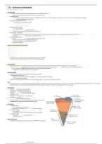
Earth structure
• Oceanic crust (about 5 km) (mainly silicates)
• Continental crust (25 km) (mainly silicates)
• Solid upper mantle (100 km) (mainly silicates)
• Viscous asthenonsphere (part of mantle) (100-200 km)
• Solid lower mantle
• Fluid outer core (Fe, Ni) (gives us magnetic field)
• Solid inner core (Fe, Ni)
• Lithosphere: crust+ solid upper part mantle
• Boundary between litho- and asthenosphere is called Moho. This boundary
• (and the others) are determined by speed of seismic waves
Plate margins
• Divergent margins
- Plates move away from each other: extension.
- First uplift and volcanism → rift valley → rift sea → ocean basin
• Convergent margins
- Plates collide: contraction
- -Ocean-continent, ocean-ocean or continent-continent collision
• Transform margins
- Plates glide horzontally along each other: strike slip
- Large displacements
Plate tectonics, how?
• Driving force is probably convection of the interior of the Earth → its purpose is cooling the Earth.
Geosphere Page 1
, Geosphere Page 2
dinsdag 8 september 2026 09:00
Historic Geology
• First studies of rocks by ancient Greeks: Theophrastus wrote Peri Lithon (On stones)
- Also some work by Romans (Pliny the elder and younger (Vesuvius))
• Georgius Agricola
- Wrote 'De ortu et causis subterraneorum' on basic geology (1544) and 'De re metallica' (1556) → autorative text on mining for about 200 years after publication.
→ Translated in English in the early 1900s.
• Steno (Niels Stensen) (1638-1686)
- Formulated three basic principles (1669)
→ Principle of original horizontality
→ Principle of superposition
→ Principle of lateral continuity
• James Hutton (1726-1797)
- First modern geologist
- "Present is key to the past" (uniformitarianism)
- Suggested that the Earth was much older than the Bible said.
• William Smith (1769-1839)
- Noticed that there was a logical order in rock strata, which could also be found elsewhere, and you could identify different beds by fossil content. → Principle of faunal succesion.
- Drew many cross sections to show order. Also made the first geological map of a country.
• Charles Lyell (1797-1879)
- Book: Principles of Geology (1830-35) → well written, explains Hutton.
- Advocated uniformitarianism, opposed catastrophism.
- Renamed and defined some geological timezones.
- Good friend of Darwin.
Definition of stratigraphy (different periods)
• Cretaceous
• Jurassic
• Triassic
• Permian
• Carboniferous
• Devonian
• Silurian
• Cambrian
• Periods were mainly defined on fossils, real ages were still a matter of debate.
• Earth and solar system were formed around 4.53 to 4.58 billion years ago.
Continental drift
• Dutch cartographer Cornelius Ortelius noticed the coastline of Latin America and Africa matched very well. But his ideas didn 't convince anybody.
• In 1915 Alfred Wegener suggested that all continents were joined during the Permian. Supercontinent Pangaea driften apart ever since. He called this theory continental drift.
- He also looked at geological structure, sedimentology, fossils and climatic evidence.
- Wegener had no good explanation for the mechanism.
Sea floor spreading
• Harry Hess 1906: oceanic crust formed at volcanic mid -oceanic ridge.
• Proof through paleomagnetism
- Magnetic minerals align along earth's magnetic field during deposition and solidifying.
- Earth's magnetic field changes
• Symmetric pattern following the changes in the Earth's magnetic field. → New rock was formed at the ridges
Data
• During the cold war the world wide net of seimsometers to detect nuclear explosions also observed earthquakes. There was a st range pattern worldwide (along the ridges of different tectonic plates).
• Also during the cold war: looking for submarines with magnetic field: symmetric pattern of variations in paleomagnetism of th e ocean floor.
Earth structure
• Oceanic crust (about 5 km) (mainly silicates)
• Continental crust (25 km) (mainly silicates)
• Solid upper mantle (100 km) (mainly silicates)
• Viscous asthenonsphere (part of mantle) (100-200 km)
• Solid lower mantle
• Fluid outer core (Fe, Ni) (gives us magnetic field)
• Solid inner core (Fe, Ni)
• Lithosphere: crust+ solid upper part mantle
• Boundary between litho- and asthenosphere is called Moho. This boundary
• (and the others) are determined by speed of seismic waves
Plate margins
• Divergent margins
- Plates move away from each other: extension.
- First uplift and volcanism → rift valley → rift sea → ocean basin
• Convergent margins
- Plates collide: contraction
- -Ocean-continent, ocean-ocean or continent-continent collision
• Transform margins
- Plates glide horzontally along each other: strike slip
- Large displacements
Plate tectonics, how?
• Driving force is probably convection of the interior of the Earth → its purpose is cooling the Earth.
Geosphere Page 1
, Geosphere Page 2


