IBOLC Entrance Exam 2026 - Comprehensive
Study Set questions and answers with complete
solutions verified
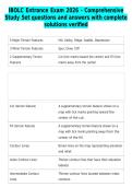
5 Major Terrain Features Hill, Valley, Ridge, Saddle, Depression
3 Minor Terrain Features Spur, Draw, Cliff
2 Supplementary Terrain Cut (tick marks toward the center) and Fill (tick
Features marks away from the center)
Cut (terrain feature) A supplementary terrain feature shown on a
map with tick marks pointing toward the
center of the cut.
Fill (terrain feature) A supplementary terrain feature shown on a
map with tick marks pointing away from the
center of the fill.
Contour Lines Brown lines on the map representing elevation
and relief.
Index Contour Lines Thicker contour lines that have their elevation
labeled.
Intermediate Contour Thinner contour lines located between index
Lines contours.
, Contour Interval The vertical distance between contour lines,
found in the marginal data of a military map.
Map Color: Black Cultural (man-made) features such as buildings
and roads, surveyed spot elevations, and all
labels.
Map Color: Brown Relief and contour lines.
Map Color: Blue Water features.
Study Set questions and answers with complete
solutions verified
5 Major Terrain Features Hill, Valley, Ridge, Saddle, Depression
3 Minor Terrain Features Spur, Draw, Cliff
2 Supplementary Terrain Cut (tick marks toward the center) and Fill (tick
Features marks away from the center)
Cut (terrain feature) A supplementary terrain feature shown on a
map with tick marks pointing toward the
center of the cut.
Fill (terrain feature) A supplementary terrain feature shown on a
map with tick marks pointing away from the
center of the fill.
Contour Lines Brown lines on the map representing elevation
and relief.
Index Contour Lines Thicker contour lines that have their elevation
labeled.
Intermediate Contour Thinner contour lines located between index
Lines contours.
, Contour Interval The vertical distance between contour lines,
found in the marginal data of a military map.
Map Color: Black Cultural (man-made) features such as buildings
and roads, surveyed spot elevations, and all
labels.
Map Color: Brown Relief and contour lines.
Map Color: Blue Water features.