

Written by students who passed Immediately available after payment Read online or as PDF Wrong document? Swap it for free 4.6 TrustPilot
logo-home
Document preview thumbnail
Preview 2 out of 9 pages
Exam (elaborations)

NR 658 Exam 2 With Complete Solution

Document preview thumbnail
Preview 2 out of 9 pages

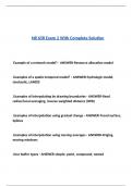
NR 658 Exam 2 With Complete Solution Example of a network model? - ANSWER-Resource allocation model .Examples of a spatio-temporal model? - ANSWER-hydrologic model, stochastic, LANDIS .Examples of interpolating by drawing boundaries - ANSWER-fixed radius/local averaging, inverse weighted distance (IWD) .Examples of interpolation using gradual change - ANSWER-Trend surface, Splines .Examples of interpolation using moving averages - ANSWER-Kriging, moving windows .four buffer types - ANSWER-simple, point, compound, nested .four local raster functions - ANSWER-mathematical, boolean, reclassification, multilayer overlay .four types of sampling - ANSWER-random, systematic, stratified, cluster .four types of spatial data accuracy - ANSWER-positional, attribute, logical, completeness .How is attribute accuracy measured? - ANSWER-An error matrix table .How many spatial operations are there? - ANSWER-100's .Manual classification vs automatic classification - ANSWER-manual- cumbersome (-), control boundaries (+) automatic- uses rules, saves time (+), do not control boundaries (-) .Obvious sources of error - ANSWER-data age, areal coverage, map scale .other names for classification - ANSWER-reclassification, recoding .processing errors - ANSWER-numeric errors, misuse of logic, classification/generalization issues .Raster vs Vector buffers - ANSWER-Raster- buffer around individual cells. Count the cells to create. Vector- buffers around points, lines, polygons. Creates POLYGONS as output. simple buffers will dissolve features if they overlap (use compound/nested instead). .Raster vs Vector overlay - ANSWER-Raster- simple (align cells). Cell size might need resample. Vector- more complex alignment (slivers) .Sources of error from natural variation - ANSWER-positional accuracy, data entry error, training .Three interpolation methods - ANSWER-Interpolation by drawing boundaries, interpolation using gradual change, methods using moving averages .three types of standards - ANSWER-data standards, analysis standards, professional or certification standards .What are four overlay tools? - ANSWER-clip- takes information from the clipped layer union- combines data from both layers where there is data intersect- combines all data from both layers erase- opposite of clip, takes out layer area .What are overlay functions? - ANSWER-Powerful spatial analysis tool that combines spatial and attribute data from two or more layers. .What are raster neighborhood operations? - ANSWER-Raster data technique that utilizes a moving window (kernel) for filtering and computing interspersion, juxtaposition, and fragmentation.

Content preview

NR 658 Exam 2 With Complete Solution


Example of a network model? - ANSWER-Resource allocation model


.Examples of a spatio-temporal model? - ANSWER-hydrologic model,
stochastic, LANDIS


.Examples of interpolating by drawing boundaries - ANSWER-fixed
radius/local averaging, inverse weighted distance (IWD)


.Examples of interpolation using gradual change - ANSWER-Trend surface,
Splines


.Examples of interpolation using moving averages - ANSWER-Kriging,
moving windows


.four buffer types - ANSWER-simple, point, compound, nested

, .four local raster functions - ANSWER-mathematical, boolean,
reclassification, multilayer overlay


.four types of sampling - ANSWER-random, systematic, stratified, cluster


.four types of spatial data accuracy - ANSWER-positional, attribute, logical,
completeness


.How is attribute accuracy measured? - ANSWER-An error matrix table


.How many spatial operations are there? - ANSWER-100's


.Manual classification vs automatic classification - ANSWER-manual-
cumbersome (-), control boundaries (+)

automatic- uses rules, saves time (+), do not control boundaries (-)


.Obvious sources of error - ANSWER-data age, areal coverage, map scale


.other names for classification - ANSWER-reclassification, recoding


.processing errors - ANSWER-numeric errors, misuse of logic,

Document information

Uploaded on
April 9, 2025
Number of pages
9
Written in
2024/2025
Type
Exam (elaborations)
Contains
Questions & answers
$9.49

Wrong document? Swap it for free Within 14 days of purchase and before downloading, you can choose a different document. You can simply spend the amount again.
Written by students who passed
Immediately available after payment
Read online or as PDF

Seller avatar
Reputation scores are based on the amount of documents a seller has sold for a fee and the reviews they have received for those documents. There are three levels: Bronze, Silver and Gold. The better the reputation, the more your can rely on the quality of the sellers work.
Docwyne6
3.5
(6)
Sold
33
Followers
11
Items
1700
Last sold
2 weeks ago


Why students choose Stuvia

Created by fellow students, verified by reviews

Quality you can trust: written by students who passed their tests and reviewed by others who've used these notes.

Didn't get what you expected? Choose another document

No worries! You can instantly pick a different document that better fits what you're looking for.

Pay as you like, start learning right away

No subscription, no commitments. Pay the way you're used to via credit card and download your PDF document instantly.

Student with book image

“Bought, downloaded, and aced it. It really can be that simple.”

Alisha Student

Working on your references?

Create accurate citations in APA, MLA and Harvard with our free citation generator.

Working on your references?

Frequently asked questions
