Private Pilot Stage 3 Quiz 3 (2022/2023) Already Graded A
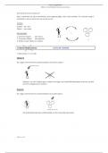
Private Pilot Stage 3 Quiz 3 (2022/2023) Already Graded A Under what condition may an aircraft operate from a satellite airport within Class C airspace? The pilot must contact ATC as soon as practicable after takeoff. Under what condition, if any, may pilots fly through a restricted area? With the controlling agency's authorization. (Refer to Figure 23, area 3.) The top of the group obstruction approximately 11 nautical miles from the Savannah VORTAC on the 009° radial is 454 feet MSL. (Refer to Figure 21, area 3.) What type military flight operations should a pilot expect along IR 644? IFR training flights above 1,500 feet AGL at speeds in excess of 250 knots. Which statement about longitude and latitude is true? Lines of longitude cross the Equator at right angles. Airspace at an airport with a part-time control tower is classified as Class D airspace only when the associated control tower is in operation. (Refer to Figure 25.) Determine the magnetic heading for a flight from Dallas Executive (area 3) to Fort Worth Meacham (area 4). The wind is from 030° at 10 knots, the true airspeed is 135 knots, and the magnetic variation is 7° east. 286°. (Refer to Figure 27.) An aircraft departs an airport in the mountain standard time zone at 1615 MST for a 2-hour 15-minute flight to an airport located in the Pacific standard time zone. The estimated time of arrival at the destination airport should be 1730 PST. (Refer to Figure 75, west of Area 6.) During preflight planning, your course is plotted to fly through R-2305. Where would you find additional information regarding this airspace? On the Sectional Chart in the Special Use Airspace area. How far will an aircraft travel in 2-1/2 minutes with a groundspeed of 98 knots? 4.08 NM. (Refer to Figure 25, area 4.) The floor of Class B airspace overlying Hicks Airport (T67) north-northwest of Fort Worth Meacham Field is 4,000 feet MSL. (Refer to Figure 24, area 2.) What minimum altitude is necessary to vertically clear the obstacle on the southeast side of Winnsboro Airport by 500 feet? 1,403 feet MSL. (Refer to Figure 26, area 1.) Identify the airspace over Tomlinson Airport. Class G airspace - surface up to but not including 1,200 feet AGL, Class E airspace - 1,200 feet AGL up to but not including 18,000 feet MSL. (Refer to Figure 27.) An aircraft departs an airport in the Pacific standard time zone at 1030 PST for a 4-hour flight to an airport located in the central standard time zone. The landing should be at what coordinated universal time? 2230Z. (Refer to figure 22.) Determine the magnetic heading for a flight from St. Maries Airport (area 4) to Priest River Airport (area 1). The wind is from 340° at 10 knots, and the true airspeed is 90 knots. 329°. (Refer to Figure 20, area 5.) The CAUTION box denotes what hazard to aircraft? Unmarked balloon on cable to 3,008 feet MSL. (Refer to Figure 26, area 3.) When flying over Arrowwood National Wildlife Refuge, a pilot should fly no lower than 2,000 feet AGL. The vertical limit of Class C airspace above the primary airport is normally 4,000 feet AGL. (Refer to Figure 21, area 2.) Which airport is located at approximately 47°35'30"N latitude and 100°43'00"W longitude? MAKEEFF. (Refer to Figure 25.) At which airports is fixed-wing Special VFR not authorized? Dallas-Fort Worth International and Dallas Love Field. (Refer to Figures 23 and 58.) Determine the compass heading for a flight from Claxton-Evans County Airport (area 2) to Hampton Varnville Airport (area 1). The wind is from 280° at 08 knots, the true airspeed is 85 knots, and the magnetic variation is 5 degrees West. 042°. (Refer to Figure 25, area 4.) The airspace directly overlying Fort Worth Meacham is Class D airspace to 3,200 feet MSL. Responsibility for collision avoidance in an alert area rests with all pilots. The lateral dimensions of Class D airspace are based on the instrument procedures for which the controlled airspace is established. (Refer to figure 20, area 1.) The NALF Fentress (NFE) Airport is in what type of airspace? Class E. If a true heading of 135° results in a ground track of 130° and a true airspeed of 135 knots results in a groundspeed of 140 knots, the wind would be from 246° and 13 knots. Which initial action should a pilot take prior to entering Class C airspace? Contact approach control on the appropriate frequency. (Refer to Figure 20, area 1.) What minimum radio equipment is required to land and take off at Norfolk International? Mode C transponder and two-way radio. In which type of airspace are VFR flights prohibited? Class A. (Refer to Figure 26.) Determine the magnetic course from Tomlinson Airport (area 1) to Jamestown Airport (area 4). 153°. (Refer to Figure 68.) The line from point A to point B of the wind triangle represents true heading and airspeed. (Refer to Figure 27.) An aircraft departs an airport in the eastern daylight time zone at 0945 EDT for a 2-hour flight to an airport located in the central daylight time zone. The landing should be at what coordinated universal time? 1545Z. (Refer to Figure 26, area 2.) What is the approximate latitude and longitude of Cooperstown Airport? 47°25'N - 98°06'W. Unless otherwise specified, Federal Airways include that Class E airspace extending upward from 1,200 feet above the surface up to and including 17,999 feet MSL. (Refer to Figure 27.) An aircraft departs an airport in the central standard time zone at 0930 CST for a 2-hour flight to an airport located in the mountain standard time zone. The landing should be at what time? 1030 MST. A non-tower satellite airport, within the same Class D airspace as that designated for the primary airport, requires radio communications be established and maintained with the primary airport's control tower. With certain exceptions, Class E airspace extends upward from either 700 feet or 1,200 feet AGL to, but does not include, 18,000 feet MSL. (Refer to Figure 21.) Determine the magnetic heading for a flight from Mercer County Regional Airport (area 3) to Minot International (area 1). The wind is from 330° at 25 knots, the true airspeed is 100 knots, and the magnetic variation is 10° east. 352°. (Refer to Figure 26, area 5.) The airspace overlying and within 5 miles of Barnes County Airport is Class G airspace from the surface to 700 feet AGL. (Refer to Figure 24.) Determine the magnetic course from Airpark East Airport (area 1) to Winnsboro Airport (area 2). Magnetic variation is 6°30'E. 075°. (Refer to Figure 59, area 3.) The airspace directly overlying the town of Findlay is surface area Class E airspace. (Refer to Figure 21.) The terrain elevation of the light tan area between Minot (area 1) and Audubon Lake (area 2) varies from 2,000 feet to 2,500 feet MSL. (Refer to Figure 69.) What minimum equipment is required for a flight from Kleberg Co. Airport (area 7) to Corpus Christi Intl. Airport (area 3)? Two-way radio and Mode C transponder with altitude reporting equipment. (Refer to Figure 22.) Determine the magnetic heading for a flight from Sandpoint Airport (area 1) to St. Maries Airport (area 4). The wind is from 215° at 25 knots and the true airspeed is 125 knots. 172°. How far will an aircraft travel in 7.5 minutes with a ground speed of 114 knots? 14.25 NM. A blue segmented circle on a Sectional Chart depicts which class airspace? Class D. When converting from true course to magnetic heading, a pilot should add westerly variation and subtract left wind correction angle. (Refer to Figure 27.) An aircraft departs an airport in the mountain standard time zone at 1515 MST for a 2-hour 30-minute flight to an airport located in the Pacific standard time zone. What is the estimated time of arrival at the destination airport? 1645 PST. All operations within Class C airspace must be in an aircraft equipped with a 4096-code transponder with Mode C encoding capability. (Refer to Figure 21.) What is the estimated time en route from Mercer County Regional Airport (area 3) to Minot International (area 1)? The wind is from 330° at 25 knots and the true airspeed is 100 knots. Add 3-1/2 minutes for departure and climb-out. 47 minutes. (Refer to Figure 27.) An aircraft departs an airport in the central standard time zone at 0845 CST for a 2-hour flight to an airport located in the mountain standard time zone. The landing should be at what coordinated universal time? 1645Z. (Refer to Figure 25, area 8.) What minimum altitude is required to fly over the Cedar Hill TV towers in the congested area south of Dallas Executive (RBD)? 3,549 feet MSL. (Refer to Figure 20 area 4.) What hazards to aircraft may exist in restricted areas such as R-5302B? Unusual, often invisible, hazards such as aerial gunnery or guided missiles. (Refer to Figure 24, area 1.) What minimum altitude is necessary to vertically clear the obstacle on the northeast side of Airpark East Airport by 500 feet? 1,273 feet MSL. (Refer to Figure 25.) Determine the magnetic heading for a flight from Fort Worth Meacham (area 4) to Denton Muni (area 1). The wind is from 330° at 25 knots, the true airspeed is 110 knots, and the magnetic variation is 7° east. 004°. Which is true concerning the blue and magenta colors used to depict airports on Sectional Aeronautical Charts? Airports with control towers underlying Class B, C, D, and E airspace are shown in blue. (Refer to Figure 75.) What is the time en route from the Gila Bend VORTAC to Buckeye VOR along V461 at a TAS of 125 knots and forecasted winds from 180 at 17 knots? Approximately 13 minutes. (Refer to Figure 23.) Determine the magnetic heading for a flight from Allendale County Airport (area 1) to Claxton-Evans County Airport (area 2). The wind is from 090° at 16 knots, the true airspeed is 90 knots, and the magnetic variation is 6 degrees West. 209°. (Refer to Figure 25, area 2.) The floor of Class B airspace at Addison Airport is 3,000 feet MSL. (Refer to figure 25, area 7.) The airspace overlying Collin Co RGL McKinney (TKI) is controlled from the surface to 2,900 feet MSL. (Refer to Figure 20, area 3.) Determine the approximate latitude and longitude of Currituck County Airport. 36°24'N - 76°01'W. Pilots flying over a national wildlife refuge are requested to fly no lower than 2,000 feet AGL. On a cross-country flight, point A is crossed at 1500 hours and the plan is to reach point B at 1530 hours. Use the following information to determine the indicated airspeed required to reach point B on schedule.Distance between A and B 70 NMForecast wind 310° at 15 ktsPressure altitude 8,000 ftAmbient temperature -10 °CTrue course 270°The required indicated airspeed would be approximately 137 knots. What minimum pilot certification is required for operation within Class B airspace? Private Pilot Certificate or Student Pilot Certificate with appropriate logbook endorsements. What action should a pilot take when operating under VFR in a Military Operations Area (MOA)? Exercise extreme caution when military activity is being conducted. (Refer to Figure 23, area 3.) What is the floor of the Savannah Class C airspace at the shelf area (outer circle)? 1,300 feet MSL. (Refer to Figure 22, area 3.) Determine the approximate latitude and longitude of Shoshone County Airport. 47°33'N - 116°11'W. When a control tower, located on an airport within Class D airspace, ceases operation for the day, what happens to the airspace designation? The airspace reverts to Class E or a combination of Class E and G airspace during the hours the tower is not in operation. Two-way radio communication must be established with the Air Traffic Control facility having jurisdiction over the area prior to entering which class airspace? Class C. (Refer to Figure 23, area 3.) What is the height of the lighted obstacle approximately 6 nautical miles southwest of Savannah International? 1,548 feet MSL. (Refer to Figure 22, area 3.) The vertical limits of that portion of Class E airspace designated as a Federal Airway over Magee Airport are 1,200 feet AGL to 17,999 feet MSL. Flight through a restricted area should not be accomplished unless the pilot has received prior authorization from the controlling agency. (Refer to Figure 21.) Which public use airports depicted are indicated as having fuel? Minot Intl. (area 1). (Refer to Figure 26, area 2.) What hazards to aircraft may exist in areas such as Devils Lake East MOA? Military training activities that necessitate acrobatic or abrupt flight maneuvers. (Refer to Figure 20, area 2.) The flag symbol at Lake Drummond represents a visual checkpoint used to identify position for initial callup to Norfolk Approach Control. (Refer to Figure 20.) Determine the magnetic course from First Flight Airport (area 5) to Hampton Roads Airport (area 2). 332°. (Refer to Figure 23.) The flag symbols at Statesboro Bullock County Airport, Claxton-Evans County Airport, and Ridgeland Airport are visual checkpoints to identify position for initial callup prior to entering Savannah Class C airspace. Unless otherwise authorized, two-way radio communications with Air Traffic Control are required for landings or takeoffs at all tower controlled airports regardless of weather conditions. (Refer to Figure 22.) What is the magnetic heading for a flight from Priest River Airport (area 1) to Shoshone County Airport (area 3)?The wind is from 030° at 12 knots and the true airspeed is 95 knots. 121°. (Refer to Figure 68.) The line from point C to point A of the wind triangle represents wind direction and velocity. What minimum radio equipment is required for operation within Class C airspace? Two-way radio communications equipment, a 4096-code transponder, and an encoding altimeter. Normal VFR operations in Class D airspace with an operating control tower require the ceiling and visibility to be at least 1,000 feet and 3 miles. The radius of the procedural Outer Area of Class C airspace is normally 20 NM. What minimum radio equipment is required for VFR operation within Class B airspace? Two-way radio communications equipment, a 4096-code transponder, and an encoding altimeter. (Refer to Figure 68.) The line from point C to point B of the wind triangle represents groundspeed and true course. (Refer to Figure 21, area 3.) Which airport is located at approximately 47°21'N latitude and 101°01'W longitude? Washburn. (Refer to Figure 20, area 2.) The elevation of the Chesapeake Regional Airport is 19 feet.
Written for
- Institution
- Stage 3: Private Pilot, Navigation
- Course
- Stage 3: Private Pilot, Navigation
Document information
- Uploaded on
- September 15, 2023
- Number of pages
- 15
- Written in
- 2023/2024
- Type
- Exam (elaborations)
- Contains
- Questions & answers
Subjects
-
private pilot stage 3 quiz already g
Also available in package deal