GIS Questions and Answers Graded A
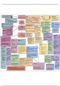
GIS Questions and Answers Graded A What does GIS stand for GIS stands for Geographic Information Systems. What is GIS? GIS is a mapping technology that allows the user to create and interact with a variety of maps and data sources. Spatial Analysis Spatial analysis is a set of techniques for analyzing spatial data. The results of spatial analysis are dependent on the locations of the objects being analyzed. Componets of a GIS system Hardware capabilities: A GIS can run on a wide range of hardware types, ranging from desktop computers to large computer servers. Other hardware components include graphics devices, plotters, printers and scanners. Software tools: provide the functions and tools required to store analyse and display the spatial data. This includes the GIS software, database and drawing software. Data: is the core of any GIS. There are two types of data used in a GIS - spatial and tabular (also known as attribute data). The availability and accuracy of data will affect the results of any analysis. A GIS can integrate data from a number of different sources and store in a database management system. Procedures: are the defined methods used to analyse the data and produce accurate results. The procedures include access protocols, standards and guidelines. People: are responsible for the day-to-day operations of the GIS. Users include technical experts, managers, administrators and end users. What is GIS used for A geographic information system, or GIS, is a computerized data management system used to capture, store, manage, retrieve, analyze, and display spatial information. Data captured and used in a GIS commonly are represented on paper or other hard-copy maps.
Written for
- Institution
- GIS
- Course
- GIS
Document information
- Uploaded on
- September 13, 2023
- Number of pages
- 2
- Written in
- 2023/2024
- Type
- Exam (elaborations)
- Contains
- Questions & answers
Subjects
-
gis questions and answers graded a
Also available in package deal