
•
Geomorphology
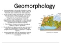
Geomorphology is the study of landforms, their
processes, form and sediments at the surface of
the Earth (and sometimes on other planets).
• Study includes looking at landscapes to work out
how the earth surface processes, such as air,
water and ice, can mould the landscape
• Landforms are produced by erosion or
deposition, as rock and sediment is worn away by
these earth-surface processes and transported
and deposited to different localities.
• The different climatic environments produce
different suites of landforms.
• The landforms of deserts, such as sand dunes and
ergs, are a world apart from the glacial and
periglacial features found in polar and sub-polar
regions.
• Geomorphologists map the distribution of these
landforms so as to understand better their
occurrence
, Geomorphology
• Earth-surface processes are forming landforms today, changing the
landscape, albeit often very slowly.
• Most geomorphic processes operate at a slow rate, but sometimes
large event, such as a landslide or flood, occurs causing rapid chang
to the environment, and sometimes threatening humans.
• So geological hazards, such as volcanic eruptions, earthquakes,
tsunamis and landslides, fall within the interests of geomorphologi
• Advancements in remote sensing from satellites and GIS mapping h
benefited geomorphologists greatly over the past few decades,
allowing them to understand global distributions
, Drainage systems in SA
• Drainage system
• Refer to river systems
• A number of small streams and rivers join to form a river system
• A river is a body of water flowing downslope in a defined channel from a
source to a mouth
• Drainage basin and catchment area
• The area drained by a river system or stream network is called the drainag
basin
• The catchment area is the drainage area that supplies water to a river
• This water comes from the rainwater that flows down the slope of the hig
ground, as well as from the underground water that seeps into the river
• The are of land forming the catchment area of a river is not always the sam
size as the drainage basin as it is determined by the origin of underground
water
, Drainage systems in SA
• What happens to the precipitation that falls in a drainage basin?
• A drainage basin is an open system of inputs, stores, flows and outputs
• The drainage basin collects precipitation, allows water to infiltrate or seep
underground to become groundwater, and store water in lakes, in wetland
and underground
• Rainwater that does not infiltrate underground flows over the surface as
surface runoff
• This runoff flows into streams that join the main river that flows our of the
basin – eventually this water flows into the ocean when the river reaches
level
• Precipitation that does not infiltrate underground or flow over the surface
may evaporate, be intercepted by vegetation or be transported as water
vapour
Geomorphology
Geomorphology is the study of landforms, their
processes, form and sediments at the surface of
the Earth (and sometimes on other planets).
• Study includes looking at landscapes to work out
how the earth surface processes, such as air,
water and ice, can mould the landscape
• Landforms are produced by erosion or
deposition, as rock and sediment is worn away by
these earth-surface processes and transported
and deposited to different localities.
• The different climatic environments produce
different suites of landforms.
• The landforms of deserts, such as sand dunes and
ergs, are a world apart from the glacial and
periglacial features found in polar and sub-polar
regions.
• Geomorphologists map the distribution of these
landforms so as to understand better their
occurrence
, Geomorphology
• Earth-surface processes are forming landforms today, changing the
landscape, albeit often very slowly.
• Most geomorphic processes operate at a slow rate, but sometimes
large event, such as a landslide or flood, occurs causing rapid chang
to the environment, and sometimes threatening humans.
• So geological hazards, such as volcanic eruptions, earthquakes,
tsunamis and landslides, fall within the interests of geomorphologi
• Advancements in remote sensing from satellites and GIS mapping h
benefited geomorphologists greatly over the past few decades,
allowing them to understand global distributions
, Drainage systems in SA
• Drainage system
• Refer to river systems
• A number of small streams and rivers join to form a river system
• A river is a body of water flowing downslope in a defined channel from a
source to a mouth
• Drainage basin and catchment area
• The area drained by a river system or stream network is called the drainag
basin
• The catchment area is the drainage area that supplies water to a river
• This water comes from the rainwater that flows down the slope of the hig
ground, as well as from the underground water that seeps into the river
• The are of land forming the catchment area of a river is not always the sam
size as the drainage basin as it is determined by the origin of underground
water
, Drainage systems in SA
• What happens to the precipitation that falls in a drainage basin?
• A drainage basin is an open system of inputs, stores, flows and outputs
• The drainage basin collects precipitation, allows water to infiltrate or seep
underground to become groundwater, and store water in lakes, in wetland
and underground
• Rainwater that does not infiltrate underground flows over the surface as
surface runoff
• This runoff flows into streams that join the main river that flows our of the
basin – eventually this water flows into the ocean when the river reaches
level
• Precipitation that does not infiltrate underground or flow over the surface
may evaporate, be intercepted by vegetation or be transported as water
vapour



