

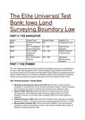
The Elite Universal Test
Bank: Iowa Land
Surveying Boundary Law
PART 0: THE NAVIGATOR
Section Content Focus Question Range Cognitive Tier
Part I The Primer & Critical N/A Foundational Theory
Axioms
Part II Tier 1: Foundational Q1 – Q28 Recall & Direct
Syntax & Application Application
Part II Tier 2: Complex Q29 – Q58 Variable Analysis &
Application & Troubleshooting
Simulation
Part II Tier 3: Grandmaster Q59 – Q88 High-Stakes
Synthesis Multi-Disciplinary
Resolution
PART I: THE PRIMER
The Hook: Mastering this elite test bank transforms foundational boundary law comprehension
into razor-sharp legal and spatial intuition, directly bridging the gap between historical Public
Land Survey System (PLSS) doctrine and high-stakes modern litigation. By absorbing these 88
expertly crafted scenarios, you will forge the definitive academic and professional competence
required to execute globally recognized, defensible land surveys within the State of Iowa.
The "Critical Axioms" Cheat Sheet
● Boundary by Acquiescence (Iowa Code § 650.14): Demands 10 years of mutual
recognition of a boundary line, proven by clear and positive evidence. Transfer of property
from a trust does not reset or cut off this claim. Permissive use defeats the claim.
● Riparian Rights Hierarchy: Meandered streams are state-owned to the ordinary
high-water mark. Non-meandered stream beds are privately owned to the thread
(midpoint of current), but the public retains navigation rights if the stream supports a
watercraft.
● Positional Tolerance (193C-11.6): At the 95% confidence level, subdivision boundaries
demand ±(0.13 feet + 1:10,000); all other land surveying demands ±(0.26 feet + 1:5,000).
● Monumentation (Chapter 355): Control monuments mandate an inert cap bearing an
embossed or stencil-cut Iowa license number. Plats must be recorded within 30 days of
signature, excluding subdivision plats.
, ● Historical PLSS Controls: The "Dodds Iowa book" governs historical retracement. The
1840 Iowa law dictating the center of a section as the equidistant midpoint of the quarter
lines was explicitly overruled by the 1868 Federal rule, which demands the intersection of
straight lines from opposite quarter corners.
PART II: THE ELITE TEST BANK
Tier 1: Foundational Syntax & Application
Q1: An applicant seeks to understand the early administration of the Dubuque office. Based on
the history of Iowa Surveyors General, which timeline is MOST ACCURATE? A) The Dubuque
office was established by Robert T. Lytle in 1835. B) The Dubuque office was opened by Ezekiel
S. Haines in 1838. C) The Dubuque office was opened by Albert G. Ellis in 1839 and closed
under Henry A. Wiltse in 1866. D) The Dubuque office transferred its final duties to the Surveyor
General of Illinois.
● The Answer: C (The Dubuque office was opened by Albert G. Ellis in 1839 and closed
under Henry A. Wiltse in 1866.)
● Distractor Analysis:
○ A is incorrect: Lytle was based in Cincinnati for Ohio, Indiana, and Michigan, not
Dubuque.
○ B is incorrect: Haines was also based in Cincinnati.
○ D is incorrect: Final duties transferred to the Surveyor General of Nebraska, not
Illinois.
The Mentor's Analysis: Knowing the administrative chain of custody authenticates historical field
notes. When tracing Dubuque office records, the immediate priority is bounding the search
between Ellis (1839) and Wiltse (1866). By utilizing these exact dates, you bypass wasted
research in extraneous jurisdictions. Professional/Academic Intuition: Always map the correct
Surveyor General to the specific era and territory to validate the jurisdictional authority of
historical PLSS records.
Q2: A surveyor is tasked with placing control monuments on a new tract. Based on Iowa Code
Chapter 355, which action FIRST fulfills the legal standard? A) Placing standard steel rebars
painted in high-visibility orange. B) Placing a wooden stake at all right-of-way intersections. C)
Placing a solid monument detectable by magnetic equipment with an inert cap bearing the
surveyor's embossed Iowa license number. D) Placing reference monuments 10 feet away from
the actual corners to avoid disturbance.
● The Answer: C (Placing a solid monument detectable by magnetic equipment with an
inert cap bearing the surveyor's embossed Iowa license number.)
● Distractor Analysis:
○ A is incorrect: Paint does not fulfill the statutory requirement for an embossed
license cap.
○ B is incorrect: Wooden stakes are not "reasonably permanent material" detectable
by magnetic equipment.
○ D is incorrect: Reference monuments are only used when placement at the
prescribed location is physically impractical.
The Mentor's Analysis: Chapter 355 establishes a non-negotiable physical footprint. When
placing monuments, the immediate priority is permanent, legally identifiable tracking. By utilizing
embossed inert caps, you bypass anonymity and claim professional responsibility.
,Professional/Academic Intuition: A monument without a distinctly embossed or stencil-cut
Iowa license number is legally invisible under Chapter 355.
Q3: A landowner erects a barbed-wire fence directly across a non-meandered stream to confine
cattle. Based on Iowa riparian rights, which conclusion is MOST ACCURATE? A) The fence is
strictly prohibited because all water in Iowa is federally navigable. B) The fence is legal,
provided it allows river users safe passage and navigation without injury. C) The fence is illegal
because the state owns the bed of all non-meandered streams. D) The fence is legal, and
paddlers must portage around the landowner's entire property.
● The Answer: B (The fence is legal, provided it allows river users safe passage and
navigation without injury.)
● Distractor Analysis:
○ A is incorrect: Non-meandered streams allow cross-stream fencing if safe passage
is afforded.
○ C is incorrect: The state only owns the bed of meandered streams; non-meandered
beds are privately owned.
○ D is incorrect: Paddlers maintain the right to float the surface of the water; portaging
around the property implies a loss of public navigation rights.
The Mentor's Analysis: Riparian rights balance private bed ownership with public water usage.
When encountering non-meandered streams, the immediate priority is protecting public
navigation. By utilizing safe-passage fence designs, the landowner bypasses nuisance claims.
Professional/Academic Intuition: On non-meandered streams, private ownership of the bed
never extinguishes the public's inherent right to navigate the surface.
Q4: A surveyor completes a plat of survey for a rural metes and bounds parcel. Based on Iowa
Administrative Code 193C Chapter 11, what is the MAXIMUM time allowed to record this plat
with the county recorder? A) 10 days after the field survey is complete. B) 30 days after the
surveyor signs the plat. C) 60 days after the client pays the invoice. D) Plats of survey are
strictly exempt from recording.
● The Answer: B (30 days after the surveyor signs the plat.)
● Distractor Analysis:
○ A is incorrect: The clock starts upon the surveyor's signature, not the completion of
fieldwork.
○ C is incorrect: Financial disputes do not toll statutory recording deadlines.
○ D is incorrect: Only subdivision plats (and specific acquisition plats) are exempt
from this specific 30-day rule.
The Mentor's Analysis: The public record relies on prompt, chronological accuracy. When
finalizing a rural plat, the immediate priority is strict statutory filing compliance. By utilizing the
30-day window from the signature date, you bypass professional disciplinary action.
Professional/Academic Intuition: A surveyor's signature triggers an unyielding 30-day
countdown for recording standard property plats in Iowa.
Q5: In 1839, the Iowa Territory and Missouri nearly engaged in armed conflict over an
overlapping boundary. Based on historical boundary law, which statement regarding the "Honey
War" is MOST ACCURATE? A) The conflict was resolved by adopting the Brown Line
established in 1836. B) The conflict centered on the federal government's refusal to survey the
Des Moines River. C) The United States Supreme Court resolved the dispute in 1849 by
permanently validating the original 1816 Sullivan Line. D) The dispute resulted in the permanent
loss of Van Buren County to Missouri.
● The Answer: C (The United States Supreme Court resolved the dispute in 1849 by
permanently validating the original 1816 Sullivan Line.)
, ● Distractor Analysis:
○ A is incorrect: The Brown line was Missouri's claim, which the Supreme Court
rejected.
○ B is incorrect: The dispute was over differing survey lines (Sullivan vs. Brown)
regarding the northern border.
○ D is incorrect: Iowa retained its territory, and the border was settled peacefully by
the Court.
The Mentor's Analysis: Historical errors in original surveys often hold more legal weight than
modern corrections. When analyzing the Iowa-Missouri border, the immediate priority is
acknowledging judicial precedent. By utilizing the 1849 Supreme Court decree, you bypass the
mathematical errors of the original magnetic declination. Professional/Academic Intuition: In
boundary disputes, original lines recognized by federal treaties (like the Sullivan Line)
supersede mathematically "purer" subsequent surveys.
Q6: Two neighbors have treated an old hedge row as their property line for 12 years. Based on
the Iowa Code § 650.14 doctrine of boundary by acquiescence, what is the legal standard
required to establish this new boundary? A) A preponderance of the evidence proving
permissive use. B) Clear and positive evidence of mutual recognition and acquiescence for at
least 10 consecutive years. C) A registered warranty deed confirming the hedge row location. D)
Proof that property taxes were split equally between the neighbors.
● The Answer: B (Clear and positive evidence of mutual recognition and acquiescence for
at least 10 consecutive years.)
● Distractor Analysis:
○ A is incorrect: Permissive use defeats an acquiescence claim; it must be treated as
the actual boundary.
○ C is incorrect: Acquiescence operates outside of the recorded deed language.
○ D is incorrect: While paying taxes supports adverse possession, it is not the
statutory trigger for acquiescence.
The Mentor's Analysis: Real-world behavior can overwrite paper titles. When evaluating an
acquiescence claim, the immediate priority is proving mutual, decade-long recognition. By
utilizing clear and positive evidentiary standards, you bypass simple trespass or permissive use
defenses. Professional/Academic Intuition: Boundary by acquiescence transforms a
physical barrier into a legal property line only when mutually respected as such for a
decade.
Q7: A surveyor is running a closed traverse for a subdivision boundary in Iowa. Based on
193C-11.6 Measurements, what is the allowable relative positional tolerance at the 95 percent
confidence level? A) ±(0.26 feet + 1:5,000) B) ±(0.13 feet + 1:10,000) C) 1 in 5,000 unadjusted
error. D) ±0.50 feet regardless of scale.
● The Answer: B (±(0.13 feet + 1:10,000))
● Distractor Analysis:
○ A is incorrect: This is the standard for "all other land surveying," not subdivisions.
○ C is incorrect: This is the unadjusted closure limit for standard surveys, not the
positional tolerance for subdivisions.
○ D is incorrect: Tolerance scales with distance; a flat ±0.50 feet is a legacy
miscalculation.
The Mentor's Analysis: Urban density demands higher precision. When surveying subdivisions,
the immediate priority is achieving the tightened 1:10,000 baseline. By utilizing the stricter
confidence level, the surveyor bypasses lot-closure overlaps. Professional/Academic Intuition:
Subdivision plats carry a significantly higher mathematical burden of proof, halving the
Bank: Iowa Land
Surveying Boundary Law
PART 0: THE NAVIGATOR
Section Content Focus Question Range Cognitive Tier
Part I The Primer & Critical N/A Foundational Theory
Axioms
Part II Tier 1: Foundational Q1 – Q28 Recall & Direct
Syntax & Application Application
Part II Tier 2: Complex Q29 – Q58 Variable Analysis &
Application & Troubleshooting
Simulation
Part II Tier 3: Grandmaster Q59 – Q88 High-Stakes
Synthesis Multi-Disciplinary
Resolution
PART I: THE PRIMER
The Hook: Mastering this elite test bank transforms foundational boundary law comprehension
into razor-sharp legal and spatial intuition, directly bridging the gap between historical Public
Land Survey System (PLSS) doctrine and high-stakes modern litigation. By absorbing these 88
expertly crafted scenarios, you will forge the definitive academic and professional competence
required to execute globally recognized, defensible land surveys within the State of Iowa.
The "Critical Axioms" Cheat Sheet
● Boundary by Acquiescence (Iowa Code § 650.14): Demands 10 years of mutual
recognition of a boundary line, proven by clear and positive evidence. Transfer of property
from a trust does not reset or cut off this claim. Permissive use defeats the claim.
● Riparian Rights Hierarchy: Meandered streams are state-owned to the ordinary
high-water mark. Non-meandered stream beds are privately owned to the thread
(midpoint of current), but the public retains navigation rights if the stream supports a
watercraft.
● Positional Tolerance (193C-11.6): At the 95% confidence level, subdivision boundaries
demand ±(0.13 feet + 1:10,000); all other land surveying demands ±(0.26 feet + 1:5,000).
● Monumentation (Chapter 355): Control monuments mandate an inert cap bearing an
embossed or stencil-cut Iowa license number. Plats must be recorded within 30 days of
signature, excluding subdivision plats.
, ● Historical PLSS Controls: The "Dodds Iowa book" governs historical retracement. The
1840 Iowa law dictating the center of a section as the equidistant midpoint of the quarter
lines was explicitly overruled by the 1868 Federal rule, which demands the intersection of
straight lines from opposite quarter corners.
PART II: THE ELITE TEST BANK
Tier 1: Foundational Syntax & Application
Q1: An applicant seeks to understand the early administration of the Dubuque office. Based on
the history of Iowa Surveyors General, which timeline is MOST ACCURATE? A) The Dubuque
office was established by Robert T. Lytle in 1835. B) The Dubuque office was opened by Ezekiel
S. Haines in 1838. C) The Dubuque office was opened by Albert G. Ellis in 1839 and closed
under Henry A. Wiltse in 1866. D) The Dubuque office transferred its final duties to the Surveyor
General of Illinois.
● The Answer: C (The Dubuque office was opened by Albert G. Ellis in 1839 and closed
under Henry A. Wiltse in 1866.)
● Distractor Analysis:
○ A is incorrect: Lytle was based in Cincinnati for Ohio, Indiana, and Michigan, not
Dubuque.
○ B is incorrect: Haines was also based in Cincinnati.
○ D is incorrect: Final duties transferred to the Surveyor General of Nebraska, not
Illinois.
The Mentor's Analysis: Knowing the administrative chain of custody authenticates historical field
notes. When tracing Dubuque office records, the immediate priority is bounding the search
between Ellis (1839) and Wiltse (1866). By utilizing these exact dates, you bypass wasted
research in extraneous jurisdictions. Professional/Academic Intuition: Always map the correct
Surveyor General to the specific era and territory to validate the jurisdictional authority of
historical PLSS records.
Q2: A surveyor is tasked with placing control monuments on a new tract. Based on Iowa Code
Chapter 355, which action FIRST fulfills the legal standard? A) Placing standard steel rebars
painted in high-visibility orange. B) Placing a wooden stake at all right-of-way intersections. C)
Placing a solid monument detectable by magnetic equipment with an inert cap bearing the
surveyor's embossed Iowa license number. D) Placing reference monuments 10 feet away from
the actual corners to avoid disturbance.
● The Answer: C (Placing a solid monument detectable by magnetic equipment with an
inert cap bearing the surveyor's embossed Iowa license number.)
● Distractor Analysis:
○ A is incorrect: Paint does not fulfill the statutory requirement for an embossed
license cap.
○ B is incorrect: Wooden stakes are not "reasonably permanent material" detectable
by magnetic equipment.
○ D is incorrect: Reference monuments are only used when placement at the
prescribed location is physically impractical.
The Mentor's Analysis: Chapter 355 establishes a non-negotiable physical footprint. When
placing monuments, the immediate priority is permanent, legally identifiable tracking. By utilizing
embossed inert caps, you bypass anonymity and claim professional responsibility.
,Professional/Academic Intuition: A monument without a distinctly embossed or stencil-cut
Iowa license number is legally invisible under Chapter 355.
Q3: A landowner erects a barbed-wire fence directly across a non-meandered stream to confine
cattle. Based on Iowa riparian rights, which conclusion is MOST ACCURATE? A) The fence is
strictly prohibited because all water in Iowa is federally navigable. B) The fence is legal,
provided it allows river users safe passage and navigation without injury. C) The fence is illegal
because the state owns the bed of all non-meandered streams. D) The fence is legal, and
paddlers must portage around the landowner's entire property.
● The Answer: B (The fence is legal, provided it allows river users safe passage and
navigation without injury.)
● Distractor Analysis:
○ A is incorrect: Non-meandered streams allow cross-stream fencing if safe passage
is afforded.
○ C is incorrect: The state only owns the bed of meandered streams; non-meandered
beds are privately owned.
○ D is incorrect: Paddlers maintain the right to float the surface of the water; portaging
around the property implies a loss of public navigation rights.
The Mentor's Analysis: Riparian rights balance private bed ownership with public water usage.
When encountering non-meandered streams, the immediate priority is protecting public
navigation. By utilizing safe-passage fence designs, the landowner bypasses nuisance claims.
Professional/Academic Intuition: On non-meandered streams, private ownership of the bed
never extinguishes the public's inherent right to navigate the surface.
Q4: A surveyor completes a plat of survey for a rural metes and bounds parcel. Based on Iowa
Administrative Code 193C Chapter 11, what is the MAXIMUM time allowed to record this plat
with the county recorder? A) 10 days after the field survey is complete. B) 30 days after the
surveyor signs the plat. C) 60 days after the client pays the invoice. D) Plats of survey are
strictly exempt from recording.
● The Answer: B (30 days after the surveyor signs the plat.)
● Distractor Analysis:
○ A is incorrect: The clock starts upon the surveyor's signature, not the completion of
fieldwork.
○ C is incorrect: Financial disputes do not toll statutory recording deadlines.
○ D is incorrect: Only subdivision plats (and specific acquisition plats) are exempt
from this specific 30-day rule.
The Mentor's Analysis: The public record relies on prompt, chronological accuracy. When
finalizing a rural plat, the immediate priority is strict statutory filing compliance. By utilizing the
30-day window from the signature date, you bypass professional disciplinary action.
Professional/Academic Intuition: A surveyor's signature triggers an unyielding 30-day
countdown for recording standard property plats in Iowa.
Q5: In 1839, the Iowa Territory and Missouri nearly engaged in armed conflict over an
overlapping boundary. Based on historical boundary law, which statement regarding the "Honey
War" is MOST ACCURATE? A) The conflict was resolved by adopting the Brown Line
established in 1836. B) The conflict centered on the federal government's refusal to survey the
Des Moines River. C) The United States Supreme Court resolved the dispute in 1849 by
permanently validating the original 1816 Sullivan Line. D) The dispute resulted in the permanent
loss of Van Buren County to Missouri.
● The Answer: C (The United States Supreme Court resolved the dispute in 1849 by
permanently validating the original 1816 Sullivan Line.)
, ● Distractor Analysis:
○ A is incorrect: The Brown line was Missouri's claim, which the Supreme Court
rejected.
○ B is incorrect: The dispute was over differing survey lines (Sullivan vs. Brown)
regarding the northern border.
○ D is incorrect: Iowa retained its territory, and the border was settled peacefully by
the Court.
The Mentor's Analysis: Historical errors in original surveys often hold more legal weight than
modern corrections. When analyzing the Iowa-Missouri border, the immediate priority is
acknowledging judicial precedent. By utilizing the 1849 Supreme Court decree, you bypass the
mathematical errors of the original magnetic declination. Professional/Academic Intuition: In
boundary disputes, original lines recognized by federal treaties (like the Sullivan Line)
supersede mathematically "purer" subsequent surveys.
Q6: Two neighbors have treated an old hedge row as their property line for 12 years. Based on
the Iowa Code § 650.14 doctrine of boundary by acquiescence, what is the legal standard
required to establish this new boundary? A) A preponderance of the evidence proving
permissive use. B) Clear and positive evidence of mutual recognition and acquiescence for at
least 10 consecutive years. C) A registered warranty deed confirming the hedge row location. D)
Proof that property taxes were split equally between the neighbors.
● The Answer: B (Clear and positive evidence of mutual recognition and acquiescence for
at least 10 consecutive years.)
● Distractor Analysis:
○ A is incorrect: Permissive use defeats an acquiescence claim; it must be treated as
the actual boundary.
○ C is incorrect: Acquiescence operates outside of the recorded deed language.
○ D is incorrect: While paying taxes supports adverse possession, it is not the
statutory trigger for acquiescence.
The Mentor's Analysis: Real-world behavior can overwrite paper titles. When evaluating an
acquiescence claim, the immediate priority is proving mutual, decade-long recognition. By
utilizing clear and positive evidentiary standards, you bypass simple trespass or permissive use
defenses. Professional/Academic Intuition: Boundary by acquiescence transforms a
physical barrier into a legal property line only when mutually respected as such for a
decade.
Q7: A surveyor is running a closed traverse for a subdivision boundary in Iowa. Based on
193C-11.6 Measurements, what is the allowable relative positional tolerance at the 95 percent
confidence level? A) ±(0.26 feet + 1:5,000) B) ±(0.13 feet + 1:10,000) C) 1 in 5,000 unadjusted
error. D) ±0.50 feet regardless of scale.
● The Answer: B (±(0.13 feet + 1:10,000))
● Distractor Analysis:
○ A is incorrect: This is the standard for "all other land surveying," not subdivisions.
○ C is incorrect: This is the unadjusted closure limit for standard surveys, not the
positional tolerance for subdivisions.
○ D is incorrect: Tolerance scales with distance; a flat ±0.50 feet is a legacy
miscalculation.
The Mentor's Analysis: Urban density demands higher precision. When surveying subdivisions,
the immediate priority is achieving the tightened 1:10,000 baseline. By utilizing the stricter
confidence level, the surveyor bypasses lot-closure overlaps. Professional/Academic Intuition:
Subdivision plats carry a significantly higher mathematical burden of proof, halving the


