

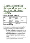
S-Tier Kentucky Land
Surveying Boundary Law
Test Bank | PLS Exam
Mastery
PART 0: THE TABLE OF CONTENTS
Section Content Focus Target Cognitive Level Question Range
PART I The Preview & Critical Foundational N/A
Axioms Familiarity
PART II Tier 1: Foundational Statutory Definitions & Q1 – Q10
Syntax & Application Direct Application
PART II Tier 2: Complex Jurisprudence & Q11 – Q20
Application & Single-Variable
Simulation Analysis
PART II Tier 3: Grandmaster Multi-Variable Conflicts Q21 – Q30
Synthesis & High-Stakes Logic
PART I: THE PREVIEW
Mastery of this examination translates directly into elite performance by transforming abstract
legal theory into precise, legally defensible boundary determinations. The resulting proficiency
ensures the practitioner's surveys withstand the most rigorous judicial scrutiny, honor the
historical footprint of original surveyors, and avert costly litigation for the citizenry of the
Commonwealth.
● The "Critical Axioms" Cheat Sheet:
○ The Evidentiary Hierarchy (Priority of Calls): Natural Monuments strictly control
over Artificial Monuments, which control over Adjoining Boundaries, which control
over Courses (Bearings), which control over Distances, with Acreage (Area)
yielding to all other elements.
○ Kentucky Adverse Possession Matrix: The standard statutory requirement to
conquer title via adverse possession is 15 continuous years. This threshold
accelerates to exactly 7 continuous years if the claimant possesses a legally
recognized color of title (a flawed or defective instrument purporting to convey
ownership).
○ The Right of Entry Limitation: KRS 322.470 grants the professional land surveyor
immunity from criminal trespass but explicitly does not shield the practitioner or their
agents from civil liability for physical damages caused to the property.
, ○ Riparian Sovereignty: In Kentucky, inland non-navigable boundary lines extend to
the filum aquae (the thread of the stream). Conversely, the northern sovereign
border along the Ohio River is permanently frozen at the 1792 low-water mark on
the northern shore, defying ambulatory riparian mechanics.
○ 201 KAR 18:150 Closure Minimums: A boundary survey is classified as Urban
(mandating a 1:10,000 unadjusted closure) if the tract is within city limits,
commercial zones, or residential areas outside city limits containing subdivided lots
smaller than 5.0 acres.
PART II: THE ELITE TEST BANK
Tier 1 - Foundational Syntax & Application
Q1: A boundary survey is performed on a 4.5-acre subdivided residential lot located
immediately outside the municipal city limits of Lexington. According to the Minimum Standards
of Practice outlined in 201 KAR 18:150, which minimum unadjusted closure standard is the
MOST ACCURATE requirement for this specific survey? A) Rural classification requiring a
1:5,000 unadjusted closure. B) Suburban classification requiring a 1:7,500 unadjusted closure.
C) Urban classification requiring a 1:10,000 unadjusted closure. D) Urban classification
requiring a 1:15,000 unadjusted closure.
● The Answer: C (Urban classification requiring a 1:10,000 unadjusted closure.)
● Distractor Analysis:
○ A is incorrect: Although the lot resides outside the formal city limits, 201 KAR
18:150 specifically defines residential areas with subdivided lots smaller than 5.0
acres as legally demanding the stricter Urban standard.
○ B is incorrect: The Kentucky Administrative Regulations do not recognize a distinct
"Suburban" closure mathematical standard in this context; classifications are strictly
binary (Urban or Rural).
○ D is incorrect: While a practitioner may exceed the standard using modern total
stations, 1:15,000 is not the statutory minimum. The legal threshold for an Urban
survey is 1:10,000.
The Mentor's Analysis: The determination of closure standards relies entirely on zoning use
and parcel density, not merely municipal borders. By utilizing the Urban classification for dense,
subdivided residential lots under 5.0 acres, the practitioner bypasses the novice error of
assuming all land outside city limits defaults to a rural tolerance. Professional/Academic
Intuition: Always evaluate the size of subdivided residential lots outside city limits; if
under 5.0 acres, the Urban 1:10,000 standard is an absolute statutory mandate.
Q2: When a professional land surveyor in Kentucky encounters an irreconcilable conflict
between the elements of a written description, which evidentiary hierarchy correctly dictates the
MOST APPROPRIATE resolution? A) Courses control over distances, which control over
natural monuments, which control over area. B) Artificial monuments control over natural
monuments, which control over adjoiners. C) Natural monuments control over artificial
monuments, which control over courses and distances. D) Adjoiners control over natural
monuments, which control over area, which controls over distance.
● The Answer: C (Natural monuments control over artificial monuments, which control over
courses and distances.)
● Distractor Analysis:
, ○ A is incorrect: Natural monuments hold the highest evidentiary weight and
absolutely control over courses (bearings) and distances, not the reverse.
○ B is incorrect: Artificial monuments (man-made markers like iron pins) yield to
natural monuments (rivers, boulders, established trees) because natural features
are less prone to human error, displacement, or deterioration.
○ D is incorrect: Area is universally recognized as the weakest and least reliable
element of a description; it never controls over distances or adjoiners.
The Mentor's Analysis: The rules of construction exist to ascertain the original intent of the
parties by prioritizing the most permanent, visible, and certain evidence. By utilizing the Priority
of Calls, the practitioner bypasses the novice error of forcing a mathematical closure that
ignores physical reality on the ground. Professional/Academic Intuition: Visible permanence
supersedes mathematics; natural monuments hold supreme evidentiary weight, while
stated acreage represents a mere calculation of intent.
Q3: A claimant has occupied a disputed tract of land in Kentucky openly, notoriously,
exclusively, and continuously for exactly 8 years. The claimant possesses a deed that purports
to convey the property to them, but the deed is later discovered to be legally defective. Which
conclusion regarding the claimant's adverse possession claim is the MOST ACCURATE? A)
The claim fails because the general statutory requirement for adverse possession in Kentucky is
15 years. B) The claim fails because a defective deed automatically invalidates any claim of
right or hostility. C) The claim is valid because possessing a color of title reduces the statutory
period to 7 years. D) The claim is valid because the payment of property taxes for 5 consecutive
years automatically vests title.
● The Answer: C (The claim is valid because possessing a color of title reduces the
statutory period to 7 years.)
● Distractor Analysis:
○ A is incorrect: While 15 years is the standard requirement under KRS 413.010, the
presence of a flawed deed triggers the statutory exception under KRS 413.060,
lowering the threshold to 7 years.
○ B is incorrect: A defective deed provides the exact legal basis for color of title. It
establishes the boundaries of the claim and satisfies the definiteness requirement
of the hostile occupation.
○ D is incorrect: Kentucky law does not require the payment of property taxes to vest
adverse possession, nor does a 5-year tax payment period exist in the statute.
The Mentor's Analysis: Adverse possession typically requires 15 years of continuous
occupation, but statutory leniency is granted to those acting under a good-faith, albeit flawed,
written instrument. By utilizing the color of title doctrine, the practitioner bypasses the novice
error of universally applying the 15-year rule without investigating the origins of the occupant's
paper claim. Professional/Academic Intuition: A flawed deed accelerates the vesting of
adverse title from 15 years to 7 years by establishing a legally recognized color of title.
Q4: A professional land surveyor must enter an adjoining property to search for a critical
reference monument. During the search, a crew member inadvertently drives a survey truck
over the adjoiner's newly planted garden, destroying it. Under KRS 322.470, which legal
consequence is MOST ACCURATE? A) The surveyor is liable for civil damages to the garden,
despite being immune from criminal trespass. B) The surveyor is entirely immune from both
criminal trespass and civil liability because the entry was a statutory necessity. C) The surveyor
is guilty of criminal trespass because written permission was not obtained prior to entry. D) The
surveyor is immune from liability, provided a documented reasonable effort was made to notify
the landowner beforehand.
Surveying Boundary Law
Test Bank | PLS Exam
Mastery
PART 0: THE TABLE OF CONTENTS
Section Content Focus Target Cognitive Level Question Range
PART I The Preview & Critical Foundational N/A
Axioms Familiarity
PART II Tier 1: Foundational Statutory Definitions & Q1 – Q10
Syntax & Application Direct Application
PART II Tier 2: Complex Jurisprudence & Q11 – Q20
Application & Single-Variable
Simulation Analysis
PART II Tier 3: Grandmaster Multi-Variable Conflicts Q21 – Q30
Synthesis & High-Stakes Logic
PART I: THE PREVIEW
Mastery of this examination translates directly into elite performance by transforming abstract
legal theory into precise, legally defensible boundary determinations. The resulting proficiency
ensures the practitioner's surveys withstand the most rigorous judicial scrutiny, honor the
historical footprint of original surveyors, and avert costly litigation for the citizenry of the
Commonwealth.
● The "Critical Axioms" Cheat Sheet:
○ The Evidentiary Hierarchy (Priority of Calls): Natural Monuments strictly control
over Artificial Monuments, which control over Adjoining Boundaries, which control
over Courses (Bearings), which control over Distances, with Acreage (Area)
yielding to all other elements.
○ Kentucky Adverse Possession Matrix: The standard statutory requirement to
conquer title via adverse possession is 15 continuous years. This threshold
accelerates to exactly 7 continuous years if the claimant possesses a legally
recognized color of title (a flawed or defective instrument purporting to convey
ownership).
○ The Right of Entry Limitation: KRS 322.470 grants the professional land surveyor
immunity from criminal trespass but explicitly does not shield the practitioner or their
agents from civil liability for physical damages caused to the property.
, ○ Riparian Sovereignty: In Kentucky, inland non-navigable boundary lines extend to
the filum aquae (the thread of the stream). Conversely, the northern sovereign
border along the Ohio River is permanently frozen at the 1792 low-water mark on
the northern shore, defying ambulatory riparian mechanics.
○ 201 KAR 18:150 Closure Minimums: A boundary survey is classified as Urban
(mandating a 1:10,000 unadjusted closure) if the tract is within city limits,
commercial zones, or residential areas outside city limits containing subdivided lots
smaller than 5.0 acres.
PART II: THE ELITE TEST BANK
Tier 1 - Foundational Syntax & Application
Q1: A boundary survey is performed on a 4.5-acre subdivided residential lot located
immediately outside the municipal city limits of Lexington. According to the Minimum Standards
of Practice outlined in 201 KAR 18:150, which minimum unadjusted closure standard is the
MOST ACCURATE requirement for this specific survey? A) Rural classification requiring a
1:5,000 unadjusted closure. B) Suburban classification requiring a 1:7,500 unadjusted closure.
C) Urban classification requiring a 1:10,000 unadjusted closure. D) Urban classification
requiring a 1:15,000 unadjusted closure.
● The Answer: C (Urban classification requiring a 1:10,000 unadjusted closure.)
● Distractor Analysis:
○ A is incorrect: Although the lot resides outside the formal city limits, 201 KAR
18:150 specifically defines residential areas with subdivided lots smaller than 5.0
acres as legally demanding the stricter Urban standard.
○ B is incorrect: The Kentucky Administrative Regulations do not recognize a distinct
"Suburban" closure mathematical standard in this context; classifications are strictly
binary (Urban or Rural).
○ D is incorrect: While a practitioner may exceed the standard using modern total
stations, 1:15,000 is not the statutory minimum. The legal threshold for an Urban
survey is 1:10,000.
The Mentor's Analysis: The determination of closure standards relies entirely on zoning use
and parcel density, not merely municipal borders. By utilizing the Urban classification for dense,
subdivided residential lots under 5.0 acres, the practitioner bypasses the novice error of
assuming all land outside city limits defaults to a rural tolerance. Professional/Academic
Intuition: Always evaluate the size of subdivided residential lots outside city limits; if
under 5.0 acres, the Urban 1:10,000 standard is an absolute statutory mandate.
Q2: When a professional land surveyor in Kentucky encounters an irreconcilable conflict
between the elements of a written description, which evidentiary hierarchy correctly dictates the
MOST APPROPRIATE resolution? A) Courses control over distances, which control over
natural monuments, which control over area. B) Artificial monuments control over natural
monuments, which control over adjoiners. C) Natural monuments control over artificial
monuments, which control over courses and distances. D) Adjoiners control over natural
monuments, which control over area, which controls over distance.
● The Answer: C (Natural monuments control over artificial monuments, which control over
courses and distances.)
● Distractor Analysis:
, ○ A is incorrect: Natural monuments hold the highest evidentiary weight and
absolutely control over courses (bearings) and distances, not the reverse.
○ B is incorrect: Artificial monuments (man-made markers like iron pins) yield to
natural monuments (rivers, boulders, established trees) because natural features
are less prone to human error, displacement, or deterioration.
○ D is incorrect: Area is universally recognized as the weakest and least reliable
element of a description; it never controls over distances or adjoiners.
The Mentor's Analysis: The rules of construction exist to ascertain the original intent of the
parties by prioritizing the most permanent, visible, and certain evidence. By utilizing the Priority
of Calls, the practitioner bypasses the novice error of forcing a mathematical closure that
ignores physical reality on the ground. Professional/Academic Intuition: Visible permanence
supersedes mathematics; natural monuments hold supreme evidentiary weight, while
stated acreage represents a mere calculation of intent.
Q3: A claimant has occupied a disputed tract of land in Kentucky openly, notoriously,
exclusively, and continuously for exactly 8 years. The claimant possesses a deed that purports
to convey the property to them, but the deed is later discovered to be legally defective. Which
conclusion regarding the claimant's adverse possession claim is the MOST ACCURATE? A)
The claim fails because the general statutory requirement for adverse possession in Kentucky is
15 years. B) The claim fails because a defective deed automatically invalidates any claim of
right or hostility. C) The claim is valid because possessing a color of title reduces the statutory
period to 7 years. D) The claim is valid because the payment of property taxes for 5 consecutive
years automatically vests title.
● The Answer: C (The claim is valid because possessing a color of title reduces the
statutory period to 7 years.)
● Distractor Analysis:
○ A is incorrect: While 15 years is the standard requirement under KRS 413.010, the
presence of a flawed deed triggers the statutory exception under KRS 413.060,
lowering the threshold to 7 years.
○ B is incorrect: A defective deed provides the exact legal basis for color of title. It
establishes the boundaries of the claim and satisfies the definiteness requirement
of the hostile occupation.
○ D is incorrect: Kentucky law does not require the payment of property taxes to vest
adverse possession, nor does a 5-year tax payment period exist in the statute.
The Mentor's Analysis: Adverse possession typically requires 15 years of continuous
occupation, but statutory leniency is granted to those acting under a good-faith, albeit flawed,
written instrument. By utilizing the color of title doctrine, the practitioner bypasses the novice
error of universally applying the 15-year rule without investigating the origins of the occupant's
paper claim. Professional/Academic Intuition: A flawed deed accelerates the vesting of
adverse title from 15 years to 7 years by establishing a legally recognized color of title.
Q4: A professional land surveyor must enter an adjoining property to search for a critical
reference monument. During the search, a crew member inadvertently drives a survey truck
over the adjoiner's newly planted garden, destroying it. Under KRS 322.470, which legal
consequence is MOST ACCURATE? A) The surveyor is liable for civil damages to the garden,
despite being immune from criminal trespass. B) The surveyor is entirely immune from both
criminal trespass and civil liability because the entry was a statutory necessity. C) The surveyor
is guilty of criminal trespass because written permission was not obtained prior to entry. D) The
surveyor is immune from liability, provided a documented reasonable effort was made to notify
the landowner beforehand.


