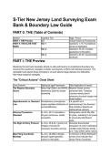
S-Tier New Jersey Land Surveying Exam
Bank & Boundary Law Guide
PART 0: THE (Table of Contents)
Section Cognitive Tier Page / Focus
PART I: THE Preview N/A Critical Axioms & Frameworks
PART II: THE ELITE TEST Tier 1 Questions 1–15: Foundational
BANK Syntax & Application
Tier 2 Questions 16–35: Complex
Application & Simulation
Tier 3 Questions 36–60: Grandmaster
Synthesis
PART I: THE Preview
Mastering this test bank translates directly to elite performance in jurisdictional boundary law,
ensuring the practitioner navigates complex real property conflicts with absolute precision. The
candidate must absorb these principles to convert abstract legal statutes into defensible,
field-ready analytical strategies.
The "Critical Axioms" Cheat Sheet
Core Doctrine Statutory/Legal Framework Field Application & Impact
The Riparian Boundary Mean High Water Line (MHWL) Riparian Grants convey
Axiom determines State fee simple permanent title; Tidelands
ownership. Licenses merely permit
temporary structural usage over
flowed waters.
Apportionment vs. Remnant Simultaneous conveyances If a specific lot is
Law require equitable distribution of undimensioned, the Remnant
excess/deficiency. Rule dictates it absorbs all
mathematical variance.
Adverse Possession N.J.S.A. 2A:14 mandates a Extinguishes record title after
Standard 20-year continuous, hostile 20 years, extending to 40 years
occupation. for previously tidal-flowed
lands.
The Right of Entry Protocol N.J.S.A. 45:8-44.1 grants civil Demands documented
trespass immunity for exhaustion of owner notification
necessary boundary surveys. (certified mail) followed strictly
by a 7-day written police notice.
Map Filing Coordinate N.J.S.A. 46:26B-2 dictates A minimum of three distributed
Mandate absolute spatial geodetic corners must indicate New
control on filed plats. Jersey Plane Coordinate
,Core Doctrine Statutory/Legal Framework Field Application & Impact
System values.
PART II: THE ELITE TEST BANK
Tier 1: Foundational Syntax & Application
Q1: A practitioner is contracted to perform a boundary survey for conveyancing. A required
property corner cannot be physically set due to an existing concrete retaining wall. Based on the
principles of N.J.A.C. 13:40-5.1, which action is the MOST APPROPRIATE? A) Establish a
theoretical corner on the plat without setting any physical marker. B) Obtain a written corner
marker waiver signed solely by the licensed surveyor. C) Set a witness marker and explicitly
note it upon the plat of survey. D) Omit the corner entirely and reference the municipal tax map
for boundary definition.
● The Answer: C (Set a witness marker and explicitly note it upon the plat of survey.)
● Distractor Analysis:
○ A is incorrect: Establishing a theoretical corner without offset monumentation
violates the mandate to delineate the property physically.
○ B is incorrect: A corner marker waiver must be signed by the ultimate user and
witnessed by a third party, not the surveyor.
○ D is incorrect: Referencing a municipal tax map to comply with deed description
requirements is explicitly prohibited professional misconduct.
The Mentor's Analysis: When physical constraints prevent the setting of a true property corner,
the practitioner must secure the boundary's intent through offset monumentation. By utilizing a
witness marker, the professional bypasses the common trap of leaving boundaries undefined on
the ground. Professional/Academic Intuition: A witness marker preserves the integrity of
the survey when the true corner is physically inaccessible, ensuring the boundary
remains mathematically recoverable.
Q2: A survey crew must enter an adjoining property to locate controlling monuments. After two
unsuccessful certified mail attempts to contact the owner, entry is still required. Based on the
principles of the New Jersey Right of Entry Statute (N.J.S.A. 45:8-44.1), which action is the
FIRST priority? A) Enter the property immediately, as two certified mail attempts satisfy the
standard. B) Send a third certified mail attempt before initiating any physical entry. C) Issue a
7-day written notice to the municipal police department detailing the entry. D) Request a police
escort to force entry onto the adjoiner's property.
● The Answer: C (Issue a 7-day written notice to the municipal police department detailing
the entry.)
● Distractor Analysis:
○ A is incorrect: Two attempts do not automatically grant entry; police notification is
the mandated next step.
○ B is incorrect: A third attempt is only required if the surveyor chooses not to involve
the police, but the statute permits police notification after failed attempts.
○ D is incorrect: The statute grants immunity from civil trespass but does not
authorize forced police escorts for civil surveys.
The Mentor's Analysis: Statutory immunity from trespass is a privilege requiring strict
procedural adherence. By utilizing written police notification, the practitioner bypasses the
common trap of facing civil trespass liabilities. Professional/Academic Intuition: Statutory
immunity requires documented exhaustion of owner notification followed strictly by
, municipal police notification.
Q3: A major subdivision plat is being prepared for filing with the county clerk. Based on the
principles of the New Jersey Map Filing Law (N.J.S.A. 46:26B-2), which geometric control is
REQUIRED on the final plat? A) At least one corner must indicate an assumed elevation
baseline. B) All lot corners must display geographic coordinates in latitude and longitude. C) A
minimum of three distributed corners must indicate New Jersey Plane Coordinate System
values. D) The plat must omit all non-radial lines to simplify county archiving.
● The Answer: C (A minimum of three distributed corners must indicate New Jersey Plane
Coordinate System values.)
● Distractor Analysis:
○ A is incorrect: The statute specifies horizontal coordinate values, not assumed
elevation baselines.
○ B is incorrect: The law explicitly requires the New Jersey Plane Coordinate System,
not generic latitude and longitude.
○ D is incorrect: Non-radial lines are permitted but must be explicitly labeled as such
on the plat.
The Mentor's Analysis: Subdivisions must integrate seamlessly into the state's broader
geodetic framework. By utilizing the New Jersey Plane Coordinate System on at least three
distributed corners, the surveyor bypasses the common trap of localized, unrecoverable
boundary systems. Professional/Academic Intuition: Three distributed coordinate values
anchor the localized subdivision to the universal state grid, ensuring perpetual
recoverability.
Q4: An upland owner wishes to build a permanent dock extending over currently flowed
tidelands. Based on the principles of New Jersey Riparian Law, which instrument is the MOST
ACCURATE requirement for this structure? A) A Tidelands License B) A Riparian Grant C) A
Statement of No Interest D) An Adverse Possession Claim
● The Answer: A (A Tidelands License)
● Distractor Analysis:
○ B is incorrect: A Riparian Grant conveys fee simple title and is generally only issued
for formerly flowed (filled) tidelands, not currently flowed waters.
○ C is incorrect: A Statement of No Interest is issued when the state relinquishes a
claim, which it will not do for currently flowed tidal waters.
○ D is incorrect: State-owned tidelands cannot be acquired via adverse possession
unless specifically historically filled and meeting the 40-year statutory threshold.
The Mentor's Analysis: Structures placed over active, currently flowed tidal waters remain on
sovereign land. By utilizing a Tidelands License, the practitioner bypasses the common trap of
applying for a fee simple grant on active waterways. Professional/Academic Intuition:
Licenses rent active water space for structures; Grants convey permanent title
exclusively for filled tidelands.
Q5: An adjacent neighbor has continuously used a paved driveway that encroaches onto the
subject property. Based on the recently enacted principles of New Jersey Adverse Possession
(N.J.S.A. 2A:14), what is the statutory time period required for the neighbor's title claim to fully
vest? A) 10 years B) 20 years C) 30 years D) 60 years
● The Answer: B (20 years)
● Distractor Analysis:
○ A is incorrect: 10 years is the statutory period for New York, not New Jersey.
○ C is incorrect: 30 years is the outdated legacy statute (formerly N.J.S.A. 2A:14-30)
that was repealed by the new legislative framework.
Bank & Boundary Law Guide
PART 0: THE (Table of Contents)
Section Cognitive Tier Page / Focus
PART I: THE Preview N/A Critical Axioms & Frameworks
PART II: THE ELITE TEST Tier 1 Questions 1–15: Foundational
BANK Syntax & Application
Tier 2 Questions 16–35: Complex
Application & Simulation
Tier 3 Questions 36–60: Grandmaster
Synthesis
PART I: THE Preview
Mastering this test bank translates directly to elite performance in jurisdictional boundary law,
ensuring the practitioner navigates complex real property conflicts with absolute precision. The
candidate must absorb these principles to convert abstract legal statutes into defensible,
field-ready analytical strategies.
The "Critical Axioms" Cheat Sheet
Core Doctrine Statutory/Legal Framework Field Application & Impact
The Riparian Boundary Mean High Water Line (MHWL) Riparian Grants convey
Axiom determines State fee simple permanent title; Tidelands
ownership. Licenses merely permit
temporary structural usage over
flowed waters.
Apportionment vs. Remnant Simultaneous conveyances If a specific lot is
Law require equitable distribution of undimensioned, the Remnant
excess/deficiency. Rule dictates it absorbs all
mathematical variance.
Adverse Possession N.J.S.A. 2A:14 mandates a Extinguishes record title after
Standard 20-year continuous, hostile 20 years, extending to 40 years
occupation. for previously tidal-flowed
lands.
The Right of Entry Protocol N.J.S.A. 45:8-44.1 grants civil Demands documented
trespass immunity for exhaustion of owner notification
necessary boundary surveys. (certified mail) followed strictly
by a 7-day written police notice.
Map Filing Coordinate N.J.S.A. 46:26B-2 dictates A minimum of three distributed
Mandate absolute spatial geodetic corners must indicate New
control on filed plats. Jersey Plane Coordinate
,Core Doctrine Statutory/Legal Framework Field Application & Impact
System values.
PART II: THE ELITE TEST BANK
Tier 1: Foundational Syntax & Application
Q1: A practitioner is contracted to perform a boundary survey for conveyancing. A required
property corner cannot be physically set due to an existing concrete retaining wall. Based on the
principles of N.J.A.C. 13:40-5.1, which action is the MOST APPROPRIATE? A) Establish a
theoretical corner on the plat without setting any physical marker. B) Obtain a written corner
marker waiver signed solely by the licensed surveyor. C) Set a witness marker and explicitly
note it upon the plat of survey. D) Omit the corner entirely and reference the municipal tax map
for boundary definition.
● The Answer: C (Set a witness marker and explicitly note it upon the plat of survey.)
● Distractor Analysis:
○ A is incorrect: Establishing a theoretical corner without offset monumentation
violates the mandate to delineate the property physically.
○ B is incorrect: A corner marker waiver must be signed by the ultimate user and
witnessed by a third party, not the surveyor.
○ D is incorrect: Referencing a municipal tax map to comply with deed description
requirements is explicitly prohibited professional misconduct.
The Mentor's Analysis: When physical constraints prevent the setting of a true property corner,
the practitioner must secure the boundary's intent through offset monumentation. By utilizing a
witness marker, the professional bypasses the common trap of leaving boundaries undefined on
the ground. Professional/Academic Intuition: A witness marker preserves the integrity of
the survey when the true corner is physically inaccessible, ensuring the boundary
remains mathematically recoverable.
Q2: A survey crew must enter an adjoining property to locate controlling monuments. After two
unsuccessful certified mail attempts to contact the owner, entry is still required. Based on the
principles of the New Jersey Right of Entry Statute (N.J.S.A. 45:8-44.1), which action is the
FIRST priority? A) Enter the property immediately, as two certified mail attempts satisfy the
standard. B) Send a third certified mail attempt before initiating any physical entry. C) Issue a
7-day written notice to the municipal police department detailing the entry. D) Request a police
escort to force entry onto the adjoiner's property.
● The Answer: C (Issue a 7-day written notice to the municipal police department detailing
the entry.)
● Distractor Analysis:
○ A is incorrect: Two attempts do not automatically grant entry; police notification is
the mandated next step.
○ B is incorrect: A third attempt is only required if the surveyor chooses not to involve
the police, but the statute permits police notification after failed attempts.
○ D is incorrect: The statute grants immunity from civil trespass but does not
authorize forced police escorts for civil surveys.
The Mentor's Analysis: Statutory immunity from trespass is a privilege requiring strict
procedural adherence. By utilizing written police notification, the practitioner bypasses the
common trap of facing civil trespass liabilities. Professional/Academic Intuition: Statutory
immunity requires documented exhaustion of owner notification followed strictly by
, municipal police notification.
Q3: A major subdivision plat is being prepared for filing with the county clerk. Based on the
principles of the New Jersey Map Filing Law (N.J.S.A. 46:26B-2), which geometric control is
REQUIRED on the final plat? A) At least one corner must indicate an assumed elevation
baseline. B) All lot corners must display geographic coordinates in latitude and longitude. C) A
minimum of three distributed corners must indicate New Jersey Plane Coordinate System
values. D) The plat must omit all non-radial lines to simplify county archiving.
● The Answer: C (A minimum of three distributed corners must indicate New Jersey Plane
Coordinate System values.)
● Distractor Analysis:
○ A is incorrect: The statute specifies horizontal coordinate values, not assumed
elevation baselines.
○ B is incorrect: The law explicitly requires the New Jersey Plane Coordinate System,
not generic latitude and longitude.
○ D is incorrect: Non-radial lines are permitted but must be explicitly labeled as such
on the plat.
The Mentor's Analysis: Subdivisions must integrate seamlessly into the state's broader
geodetic framework. By utilizing the New Jersey Plane Coordinate System on at least three
distributed corners, the surveyor bypasses the common trap of localized, unrecoverable
boundary systems. Professional/Academic Intuition: Three distributed coordinate values
anchor the localized subdivision to the universal state grid, ensuring perpetual
recoverability.
Q4: An upland owner wishes to build a permanent dock extending over currently flowed
tidelands. Based on the principles of New Jersey Riparian Law, which instrument is the MOST
ACCURATE requirement for this structure? A) A Tidelands License B) A Riparian Grant C) A
Statement of No Interest D) An Adverse Possession Claim
● The Answer: A (A Tidelands License)
● Distractor Analysis:
○ B is incorrect: A Riparian Grant conveys fee simple title and is generally only issued
for formerly flowed (filled) tidelands, not currently flowed waters.
○ C is incorrect: A Statement of No Interest is issued when the state relinquishes a
claim, which it will not do for currently flowed tidal waters.
○ D is incorrect: State-owned tidelands cannot be acquired via adverse possession
unless specifically historically filled and meeting the 40-year statutory threshold.
The Mentor's Analysis: Structures placed over active, currently flowed tidal waters remain on
sovereign land. By utilizing a Tidelands License, the practitioner bypasses the common trap of
applying for a fee simple grant on active waterways. Professional/Academic Intuition:
Licenses rent active water space for structures; Grants convey permanent title
exclusively for filled tidelands.
Q5: An adjacent neighbor has continuously used a paved driveway that encroaches onto the
subject property. Based on the recently enacted principles of New Jersey Adverse Possession
(N.J.S.A. 2A:14), what is the statutory time period required for the neighbor's title claim to fully
vest? A) 10 years B) 20 years C) 30 years D) 60 years
● The Answer: B (20 years)
● Distractor Analysis:
○ A is incorrect: 10 years is the statutory period for New York, not New Jersey.
○ C is incorrect: 30 years is the outdated legacy statute (formerly N.J.S.A. 2A:14-30)
that was repealed by the new legislative framework.