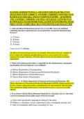
ILLINOIS JURISDICTIONAL LAND SURVEYOR EXAM PRACTICE
QUESTIONS WITH CORRECT ANSWERS (VERIFIED ANSWERS) PLUS
RATIONALES 2026 Q&A | INSTANT DOWNLOAD PDF – QUESTIONS
AND ANSWERS | VERIFIED AND WELL DETAILED ANSWERS PLUS
RATIONALES | GUARANTEED PASS | LATEST EXAM UPDATE | EXAM
PREP | STUDY GUIDE | PRACTICE TEST| DOWNLOAD INSTANT PDF
1. Under the Illinois Professional Land Surveyor Act of 1989, what is the minimum
continuing education requirement per renewal period for a licensed Professional Land
Surveyor?
A. 12 hours
B. 20 hours
C. 24 hours
D. 30 hours
Correct Answer: C. 24 hours
The Illinois Professional Land Surveyor Act mandates that licensed surveyors complete 24
hours of approved continuing education during each two-year renewal cycle to ensure
ongoing professional competence. The other options do not meet the statutory minimum
requirements.
2. Which of the following state bodies is responsible for the administration, examination,
and discipline of licensed land surveyors in Illinois?
A. Illinois Department of Transportation
B. Illinois Department of Financial and Professional Regulation
C. Illinois Department of Natural Resources
D. Illinois State Board of Registration
Correct Answer: B. Illinois Department of Financial and Professional Regulation The
Illinois Department of Financial and Professional Regulation (IDFPR) regulates professional
licenses, conducts enforcement actions, and administers the state boards for land surveying.
Other departments handle infrastructure, environmental resources, or do not exist in this
capacity.
3. In accordance with the Illinois Minimum Standards for a Boundary Survey, when must
a surveyor monument all accessible corners of the survey land?
A. Only when specifically requested in writing by the client
B. Whenever a boundary survey is performed, unless monuments already exist
C. Only for residential subdivisions exceeding five lots
,D. When the survey involves a judicial partition ordered by a court
Correct Answer: B. Whenever a boundary survey is performed, unless monuments already
exist The Illinois Minimum Standards require that monuments be set at all corners or
witnesses set if inaccessible, unless valid monuments already exist. This is a baseline
requirement for a boundary survey, not an optional service.
4. When an Illinois Land Surveyor encounters a discrepancy between the record
description and the actual physical evidence on the ground, what is the primary guiding
principle for resolving the boundary?
A. Prioritize the physical evidence over all written words
B. Follow the intent of the original parties as expressed in the deed
C. Default to the measurements that maximize the client's acreage
D. Use the state plane coordinate system to compute a mathematical average
Correct Answer: B. Follow the intent of the original parties as expressed in the deed The
foundational legal rule in boundary control and Illinois jurisprudence is to determine and
enforce the intent of the original grantor and grantee as evidenced by the deed. Physical
monuments can control, but they do so because they are deemed the best evidence of that
intent.
5. A client requests a survey of a parcel in Cook County bounded by a non-navigable
stream. Under Illinois law, where is the typical boundary line located?
A. The high-water mark on the client's side
B. The low-water mark on the client's side
C. The thread of the stream
D. The center of the geographic valley
Correct Answer: C. The thread of the stream In Illinois, riparian owners along non-
navigable streams generally hold title to the thread (centerline) of the stream. High or low
water marks are typically applied to navigable or specific public bodies of water.
6. Which type of certificate must an Illinois Professional Land Surveyor append to a
completed plat of subdivision before it can be legally recorded?
A. Certificate of General Liability Insurance
B. Surveyor's Certificate of Compliance with State Standards
C. Certificate of Title Insurance clearance
D. Notarized Affidavit of Client Satisfaction
Correct Answer: B. Surveyor's Certificate of Compliance with State Standards The Illinois
Plat Act requires a signed and sealed Surveyor's Certificate stating that the survey is accurate
,and complies with statutory requirements. Insurance or client satisfaction documents are not
valid regulatory certifications for recording plats.
7. An Illinois surveyor is executing a retracement survey of a GLO section line. A quarter-
section corner is determined to be lost. What is the correct procedure to re-establish this
corner?
A. Single proportionate measurement between adjacent verified corners
B. Double proportionate measurement using four known corners
C. Establishing it at a fixed distance of 40 chains from the section corner
D. Relying on local fence line testimonies exclusively without mathematical
verification
Correct Answer: A. Single proportionate measurement between adjacent verified corners
According to Bureau of Land Management (BLM) manual guidelines adopted in Illinois, a
lost quarter-section corner on a section line must be re-established via single proportionate
measurement between the two nearest existing section corners along that specific line. Double
proportion is used for lost corners common to four sections.
8. Under the Illinois Plat Act, any division of land that results in a parcel of less than how
many acres must generally be platted, unless it meets specific statutory exceptions?
A. 1 acre
B. 3 acres
C. 5 acres
D. 10 acres
Correct Answer: C. 5 acres The Illinois Plat Act (765 ILCS 205/) generally stipulates that a
division of any larger tract into two or more parts, any of which is less than 5 acres, requires
the submission and recording of a formal subdivision plat, subject to narrow exceptions.
9. While performing a boundary survey for a commercial real estate transaction, an Illinois
surveyor notices a gravel driveway crossing the property line to serve a landlocked
neighbor. How should the surveyor handle this situation?
A. Ignore it if it is not mentioned in the current title commitment
B. Advise the client to block the driveway immediately
C. Show the physical location of the driveway on the plat and note the
encroachment
D. Verbally notify the neighbor to cease usage before completing the plat
Correct Answer: C. Show the physical location of the driveway on the plat and note the
encroachment Illinois Minimum Standards and general professional diligence require the
surveyor to locate and depict visible physical evidence of potential easements or
, encroachments on the final plat. Resolving the legal right or blocking access is the
responsibility of legal counsel or the owners, not the surveyor.
10. What is the statutory period of continuous, adverse, hostile, open, and notorious
possession required to establish title by adverse possession in Illinois without color of title
or payment of taxes?
A. 7 years
B. 10 years
C. 20 years
D. 25 years
Correct Answer: C. 20 years Under Illinois law (735 ILCS 5/13-101), the standard statutory
period required to acquire title by adverse possession without additional equitable factors like
color of title or tax payments is 20 years.
11. A surveyor is hired to prepare a plat of survey for an existing parcel. The surveyor
discovers that the actual property lines are established by an old, well-maintained fence
that matches historical descriptions but differs from the exact mathematical deed
dimensions by 1.5 feet. What is the best practice under Illinois law?
A. Disregard the fence and monument the mathematical deed location only
B. Change the deed description to match the fence line without client consent
C. Show both the mathematical deed line and the physical location of the fence on
the plat
D. Establish a new corner at the average point between the fence and the deed
location
Correct Answer: C. Show both the mathematical deed line and the physical location of the
fence on the plat To provide a legally sound boundary survey, the surveyor must clearly
depict the relationship between the record title boundary and the physical lines of occupation
(the fence). This alerts stakeholders to potential unwritten rights or discrepancies without
unilaterally altering titles.
12. When evaluating a description that reads "thence North 45 degrees East, 100 feet to a
1-inch iron pipe," which element carries the highest legal weight under the standard
priority of calls in Illinois?
A. The bearing of North 45 degrees East
B. The distance of 100 feet
C. The 1-inch iron pipe monument
D. The calculated area of the resulting figure
QUESTIONS WITH CORRECT ANSWERS (VERIFIED ANSWERS) PLUS
RATIONALES 2026 Q&A | INSTANT DOWNLOAD PDF – QUESTIONS
AND ANSWERS | VERIFIED AND WELL DETAILED ANSWERS PLUS
RATIONALES | GUARANTEED PASS | LATEST EXAM UPDATE | EXAM
PREP | STUDY GUIDE | PRACTICE TEST| DOWNLOAD INSTANT PDF
1. Under the Illinois Professional Land Surveyor Act of 1989, what is the minimum
continuing education requirement per renewal period for a licensed Professional Land
Surveyor?
A. 12 hours
B. 20 hours
C. 24 hours
D. 30 hours
Correct Answer: C. 24 hours
The Illinois Professional Land Surveyor Act mandates that licensed surveyors complete 24
hours of approved continuing education during each two-year renewal cycle to ensure
ongoing professional competence. The other options do not meet the statutory minimum
requirements.
2. Which of the following state bodies is responsible for the administration, examination,
and discipline of licensed land surveyors in Illinois?
A. Illinois Department of Transportation
B. Illinois Department of Financial and Professional Regulation
C. Illinois Department of Natural Resources
D. Illinois State Board of Registration
Correct Answer: B. Illinois Department of Financial and Professional Regulation The
Illinois Department of Financial and Professional Regulation (IDFPR) regulates professional
licenses, conducts enforcement actions, and administers the state boards for land surveying.
Other departments handle infrastructure, environmental resources, or do not exist in this
capacity.
3. In accordance with the Illinois Minimum Standards for a Boundary Survey, when must
a surveyor monument all accessible corners of the survey land?
A. Only when specifically requested in writing by the client
B. Whenever a boundary survey is performed, unless monuments already exist
C. Only for residential subdivisions exceeding five lots
,D. When the survey involves a judicial partition ordered by a court
Correct Answer: B. Whenever a boundary survey is performed, unless monuments already
exist The Illinois Minimum Standards require that monuments be set at all corners or
witnesses set if inaccessible, unless valid monuments already exist. This is a baseline
requirement for a boundary survey, not an optional service.
4. When an Illinois Land Surveyor encounters a discrepancy between the record
description and the actual physical evidence on the ground, what is the primary guiding
principle for resolving the boundary?
A. Prioritize the physical evidence over all written words
B. Follow the intent of the original parties as expressed in the deed
C. Default to the measurements that maximize the client's acreage
D. Use the state plane coordinate system to compute a mathematical average
Correct Answer: B. Follow the intent of the original parties as expressed in the deed The
foundational legal rule in boundary control and Illinois jurisprudence is to determine and
enforce the intent of the original grantor and grantee as evidenced by the deed. Physical
monuments can control, but they do so because they are deemed the best evidence of that
intent.
5. A client requests a survey of a parcel in Cook County bounded by a non-navigable
stream. Under Illinois law, where is the typical boundary line located?
A. The high-water mark on the client's side
B. The low-water mark on the client's side
C. The thread of the stream
D. The center of the geographic valley
Correct Answer: C. The thread of the stream In Illinois, riparian owners along non-
navigable streams generally hold title to the thread (centerline) of the stream. High or low
water marks are typically applied to navigable or specific public bodies of water.
6. Which type of certificate must an Illinois Professional Land Surveyor append to a
completed plat of subdivision before it can be legally recorded?
A. Certificate of General Liability Insurance
B. Surveyor's Certificate of Compliance with State Standards
C. Certificate of Title Insurance clearance
D. Notarized Affidavit of Client Satisfaction
Correct Answer: B. Surveyor's Certificate of Compliance with State Standards The Illinois
Plat Act requires a signed and sealed Surveyor's Certificate stating that the survey is accurate
,and complies with statutory requirements. Insurance or client satisfaction documents are not
valid regulatory certifications for recording plats.
7. An Illinois surveyor is executing a retracement survey of a GLO section line. A quarter-
section corner is determined to be lost. What is the correct procedure to re-establish this
corner?
A. Single proportionate measurement between adjacent verified corners
B. Double proportionate measurement using four known corners
C. Establishing it at a fixed distance of 40 chains from the section corner
D. Relying on local fence line testimonies exclusively without mathematical
verification
Correct Answer: A. Single proportionate measurement between adjacent verified corners
According to Bureau of Land Management (BLM) manual guidelines adopted in Illinois, a
lost quarter-section corner on a section line must be re-established via single proportionate
measurement between the two nearest existing section corners along that specific line. Double
proportion is used for lost corners common to four sections.
8. Under the Illinois Plat Act, any division of land that results in a parcel of less than how
many acres must generally be platted, unless it meets specific statutory exceptions?
A. 1 acre
B. 3 acres
C. 5 acres
D. 10 acres
Correct Answer: C. 5 acres The Illinois Plat Act (765 ILCS 205/) generally stipulates that a
division of any larger tract into two or more parts, any of which is less than 5 acres, requires
the submission and recording of a formal subdivision plat, subject to narrow exceptions.
9. While performing a boundary survey for a commercial real estate transaction, an Illinois
surveyor notices a gravel driveway crossing the property line to serve a landlocked
neighbor. How should the surveyor handle this situation?
A. Ignore it if it is not mentioned in the current title commitment
B. Advise the client to block the driveway immediately
C. Show the physical location of the driveway on the plat and note the
encroachment
D. Verbally notify the neighbor to cease usage before completing the plat
Correct Answer: C. Show the physical location of the driveway on the plat and note the
encroachment Illinois Minimum Standards and general professional diligence require the
surveyor to locate and depict visible physical evidence of potential easements or
, encroachments on the final plat. Resolving the legal right or blocking access is the
responsibility of legal counsel or the owners, not the surveyor.
10. What is the statutory period of continuous, adverse, hostile, open, and notorious
possession required to establish title by adverse possession in Illinois without color of title
or payment of taxes?
A. 7 years
B. 10 years
C. 20 years
D. 25 years
Correct Answer: C. 20 years Under Illinois law (735 ILCS 5/13-101), the standard statutory
period required to acquire title by adverse possession without additional equitable factors like
color of title or tax payments is 20 years.
11. A surveyor is hired to prepare a plat of survey for an existing parcel. The surveyor
discovers that the actual property lines are established by an old, well-maintained fence
that matches historical descriptions but differs from the exact mathematical deed
dimensions by 1.5 feet. What is the best practice under Illinois law?
A. Disregard the fence and monument the mathematical deed location only
B. Change the deed description to match the fence line without client consent
C. Show both the mathematical deed line and the physical location of the fence on
the plat
D. Establish a new corner at the average point between the fence and the deed
location
Correct Answer: C. Show both the mathematical deed line and the physical location of the
fence on the plat To provide a legally sound boundary survey, the surveyor must clearly
depict the relationship between the record title boundary and the physical lines of occupation
(the fence). This alerts stakeholders to potential unwritten rights or discrepancies without
unilaterally altering titles.
12. When evaluating a description that reads "thence North 45 degrees East, 100 feet to a
1-inch iron pipe," which element carries the highest legal weight under the standard
priority of calls in Illinois?
A. The bearing of North 45 degrees East
B. The distance of 100 feet
C. The 1-inch iron pipe monument
D. The calculated area of the resulting figure