
Geographical engineering system (GIS)
➔ A computer-based tool that captures, stores, analyses, and displays geographically referenced
information
➔ Purpose if to create, manage, analyze, and map all types of data →allows users to visualise
and analyze data related to locations on Earth's surface.
Examination of a selection of satellite images
Artificial satellites orbiting earth → some carry remote sensors that record data about earth and
transmit it to ground stations
➔ Give info about: earthquakes, volcanoes, drought, floods, air pollution, crops, animal migration,
deforestation, urban growth, atmospheric process
Atmospheric data - data readings taken at different heights, of air temperature, pressure, humidity,
movement (winds), pollution, gas ingredients, cloudiness
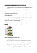
GIS layer - a digital map of a specific element (roads, buildings, power lines, vegetation) that can be
viewed together with other layers for a complete overview of an area
GIS concepts
GIS allows us to create geographical knowledge (data) by:
● Measuring features on earth, in sea + in atmosphere
● Organising this data
● Analysing + modelling many geographical processes and their relationships more precisely
➔ GIS helps scientists, planners and researchers more efficiently and accurately manage its
resources
➔ GIS obtains new geographic data with remote sensing from satellites + aeroplanes
➢ These collect data about the atmosphere, oceans, earth surface + material below
earths surface
, Remote sensing
★ Method of obtaining data about the environment and the surface of earth from a distance
(satellites/air craft)
➔ Every feature on earth (including in the sea/air) reflects electromagnetic energy
➔ Instruments in satellites + aeroplanes called remote sensors measure this reflected energy
They do this by recording the electromagnetic radiation that is:
● Emitted by the sun + then reflected back into space continuously
● Emitted by the satellite in the form of microwave energy that is reflected back to the satellite
Resolution
★ The sharpness of an image; a measure of the accuracy or detail of a graphic display expressed
as dots per inch, pixels per line or lines per millimeter
● Spatial resolution
● Spectral resolution
● Temporal resolution
Spatial resolution
★ The size of an object that can be recorded; and the most usual measure is the pixel size
Pixel - the smallest single element in an image on a computer screen
- each pixel has an address defined by its coordinates
When pixels represent small areas of ground → the image will show greater detail: the image will have
a high spatial resolution
➔ Many pixels used to make high resolution image
High resolution image - fine grained photo
Spectral resolution
★ The bandwidth of the electromagnetic spectrum that is measured by a sensor
➔ Remote sensors can collect data in visible part of the spectrum (to provide images like aerial
photographs)
➔ Other sensors may collect data in invisible sectors like infrared and ultraviolet
➔ A panchromatic (all colours) sensor has low spectral resolution
➔ Sensor that record just green wavelength of light → has higher spectral resolution


