

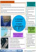
U4: Examining a selection of satellite images
U3: Interpreting vertical
• Differentiated by spatial and spectral resolution.
aerial photographs
• Captured Earth portion size and revisit frequency.
• Meteosat: Low resolution 1km pixel image used for weather forecasting. Includes 12 bands and 30-minute revisit • Vertical Aerial Photography Overview
interval.
• Recording specific areas at specific
• Landsat: 15m pixel image used for land cover classification and change. 7 bands, 16-day revisit interval. Single times.
image size: 185 km x 170 km.
• Showing objects as they appear in
• Wordview 2: High-resolution image used for security, defence, urban planning, and disaster damage monitoring. reality.
• Easier to read than maps.
• Enables observation of object changes
over time.
Sample U3: Aerial photographs • Interpretation from general patterns to
detail.
and orthophoto maps • Uses known to identify unknown.
• Uses 5 recognition elements: shape,
U4: Geographical pattern, size, texture, shadow, and tone.
Information Systems (GIS)
Summaries after sample (A) What are orthophoto
maps and their
identifying features?
Comparing an orthophoto map • Vertical aerial photographs referenced
with a topographic map to precise x:y coordinates.
• True to scale - accurate distance, area,
• Topographic maps and orthophotos have unique characteristics. and angle measurements.
• Use together for landform identification. • Includes scale, place names, contour
• Orthophoto vs Topographic Map Comparison: lines, spot heights, trigonometric
• Orient orthophoto map on topographic map. stations, latitude, and longitude.
• Identify common features: natural, infrastructure, buildings, land use. • All orthophoto maps - 1:100 000 scale.
• Identify corresponding features on both maps. • Uses recognition elements for feature
identification.
• Identify newly built features or landscape changes.
GR12 GEO T1-T4 Mind Map Via Afrika Copyright © www.summariessa.co.za (DO NOT COPY)
,Sample
Summaries after sample
,Sample
Summaries after sample
, What are the impacts of What are the strategies to help What are the general characteristics
tropical cyclones on human prepare for and manage the of tropical cyclones?
activities and the environment? effects of tropical cyclones? • Destructive storms causing significant
loss of life and property damage.
• Issued by disaster risk management centres or local weather offices. • Originates in late summer or autumn
• Tropical Cyclones: Natural Hazards
• Regularly monitored via TV or radio. Adherence to local expert guidance.
• Destructive, impacting people, natural, over warm tropical oceans.
and constructed environments. • Needs Coriolis force to form,
• Not human controllable.
What precautions should be taken? developing within latitudes 5 and 20 o
• Major threat to coastal areas and • Avoid crossing flooded rivers. N and S.
densely populated deltas. • Evacuate homes near rivers or floodplains. • Moves westward at 40-200 km a day,
• Causes: heavy rain, high wind velocity, • Move pumps away from rivers. curved back eastward near 20-30 o N
low pressure. • Return small to medium boats to port. and S at 500-700 km/day.
Sample
• Hurricane Katrina, the third strongest • Secure small fishing boats above normal high water mark. • Rotates clockwise in the Southern
in the USA, caused severe devastation. Hemisphere and anti-clockwise in the
Northern Hemisphere.
• Energy source is latent heat released
Reading and interpreting satellite images and U2: Tropical from rising warm, moist tropical air
condensing.
synoptic weather maps of tropical cyclones
Summaries after sample
cyclones • Associated with heavy rain, storm
• Crucial for tracking cyclone movement and development. surges, and high winds.
• Provides detailed storm top information.
• Wind flags and arrows indicate speed, direction, and convergence Where do tropical cyclones form?
direction.
• Small triangle flags indicate strongest winds.
• Different-coloured bar indicates wind speed.
How do you recognise tropical
cyclones on synoptic maps?
• Tropical Cyclone Characteristics on Synoptic Maps:
• Low-pressure cell with circular isobar patterns.
• Cyclone symbol in eye.
• Cyclone name next to system.
• Map date in late summer/early autumn.
GR12 GEO T1-T1 Mind Map Via Afrika Copyright © www.summariessa.co.za (DO NOT COPY)
U3: Interpreting vertical
• Differentiated by spatial and spectral resolution.
aerial photographs
• Captured Earth portion size and revisit frequency.
• Meteosat: Low resolution 1km pixel image used for weather forecasting. Includes 12 bands and 30-minute revisit • Vertical Aerial Photography Overview
interval.
• Recording specific areas at specific
• Landsat: 15m pixel image used for land cover classification and change. 7 bands, 16-day revisit interval. Single times.
image size: 185 km x 170 km.
• Showing objects as they appear in
• Wordview 2: High-resolution image used for security, defence, urban planning, and disaster damage monitoring. reality.
• Easier to read than maps.
• Enables observation of object changes
over time.
Sample U3: Aerial photographs • Interpretation from general patterns to
detail.
and orthophoto maps • Uses known to identify unknown.
• Uses 5 recognition elements: shape,
U4: Geographical pattern, size, texture, shadow, and tone.
Information Systems (GIS)
Summaries after sample (A) What are orthophoto
maps and their
identifying features?
Comparing an orthophoto map • Vertical aerial photographs referenced
with a topographic map to precise x:y coordinates.
• True to scale - accurate distance, area,
• Topographic maps and orthophotos have unique characteristics. and angle measurements.
• Use together for landform identification. • Includes scale, place names, contour
• Orthophoto vs Topographic Map Comparison: lines, spot heights, trigonometric
• Orient orthophoto map on topographic map. stations, latitude, and longitude.
• Identify common features: natural, infrastructure, buildings, land use. • All orthophoto maps - 1:100 000 scale.
• Identify corresponding features on both maps. • Uses recognition elements for feature
identification.
• Identify newly built features or landscape changes.
GR12 GEO T1-T4 Mind Map Via Afrika Copyright © www.summariessa.co.za (DO NOT COPY)
,Sample
Summaries after sample
,Sample
Summaries after sample
, What are the impacts of What are the strategies to help What are the general characteristics
tropical cyclones on human prepare for and manage the of tropical cyclones?
activities and the environment? effects of tropical cyclones? • Destructive storms causing significant
loss of life and property damage.
• Issued by disaster risk management centres or local weather offices. • Originates in late summer or autumn
• Tropical Cyclones: Natural Hazards
• Regularly monitored via TV or radio. Adherence to local expert guidance.
• Destructive, impacting people, natural, over warm tropical oceans.
and constructed environments. • Needs Coriolis force to form,
• Not human controllable.
What precautions should be taken? developing within latitudes 5 and 20 o
• Major threat to coastal areas and • Avoid crossing flooded rivers. N and S.
densely populated deltas. • Evacuate homes near rivers or floodplains. • Moves westward at 40-200 km a day,
• Causes: heavy rain, high wind velocity, • Move pumps away from rivers. curved back eastward near 20-30 o N
low pressure. • Return small to medium boats to port. and S at 500-700 km/day.
Sample
• Hurricane Katrina, the third strongest • Secure small fishing boats above normal high water mark. • Rotates clockwise in the Southern
in the USA, caused severe devastation. Hemisphere and anti-clockwise in the
Northern Hemisphere.
• Energy source is latent heat released
Reading and interpreting satellite images and U2: Tropical from rising warm, moist tropical air
condensing.
synoptic weather maps of tropical cyclones
Summaries after sample
cyclones • Associated with heavy rain, storm
• Crucial for tracking cyclone movement and development. surges, and high winds.
• Provides detailed storm top information.
• Wind flags and arrows indicate speed, direction, and convergence Where do tropical cyclones form?
direction.
• Small triangle flags indicate strongest winds.
• Different-coloured bar indicates wind speed.
How do you recognise tropical
cyclones on synoptic maps?
• Tropical Cyclone Characteristics on Synoptic Maps:
• Low-pressure cell with circular isobar patterns.
• Cyclone symbol in eye.
• Cyclone name next to system.
• Map date in late summer/early autumn.
GR12 GEO T1-T1 Mind Map Via Afrika Copyright © www.summariessa.co.za (DO NOT COPY)


