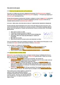
Glaciated landscapes
2.1A Glacial and interglacial periods and the pleistocene
The earth is 4.5 billion years old and is divided into time periods. The Pleistocene epoch started 2
million years ago at the beginning of theQuaternary period (ongoing) - 11,700 years ago (beginning of
Holocene epoch extending until now).
During this period glaciers advanced and retreated, resulting in a series of longerglacials (cold period
of ice-house conditions) where the ice advanced separated by shorter interglacials where the ice
retreated (warmer periods of greenhouse gas conditions).
In the last 1 million years, there have been as many as 10 glacial periods separated by interglacials.
During the glacials, global temperatures were much cooler than today and it was much drier, since
much of the world's water was locked up in massive ice sheets. In the Northern hemisphere glaciers
spread south over large parts of Europe, Asia and Northern America, sea levels fell by 130m during
glacial periods.
● Clear cycle of warmer vs colder.
● Temperature fluctuates (by about 12 degrees).
● Longer colder periods (glacials) than warmer periods (interglacials).
● Fluctuations within each major glacial/interglacial - stadials and
interstadials.
● More data more recently.
● Recent warmer period, increased carbon and temperature correlate.
There are fluctuations within each interglacial and glacials. These relatively short-lived pulses of cold
ice advance as stadials and the warmer periods of retreat as interstadials.
There are many proxy evidence for climate change:
● Long term evidence includes ice core analysis, air bubbles showing CO2 at time.
● Medium-term evidence comes from historical records, glacial landforms and
dendrochronology (tree rings).
● Recent evidence includes changes in biodiversity, climate records and sea ice changes.
2.1B Long term factors for climate change
Milankovitch cycles are the primary ‘driver’ of long-termclimate change. The Milankovitch theory is
based on the earth's orbit changing causing the orbital forcing glacial periods. It takes into account
three main characteristics of the Earth’s Orbit:
● Eccentricity - Orbital Stretch (100,000 year periodicity). This changes the
radiation/temperatures received from the sun. The glacials occur in a more circular orbit and
interglacials in a more elliptical. (Most important factor)
● Obliquity - Axial Tilt (41,000 years periodicity). This changes the intensity of sunlightat the
poles and the seasonality of the earth climate, larger tilts have a larger summer and winter
difference in temperature (more extreme). An increased tilt increases interglacials chances.
Ranging from 21.8-24.4 tilt.
● Precession - Wobble in space (21,000 year periodicity). This changes the time of year the
earth is closest to the sun. This causes long term changes to when different seasons occur.
These orbital cycles combine together to minimise the
amount of solar energy reaching the Northern
Hemisphere during summer months (leading to cooler
summers overall). The theory sees glacials happening
every 100,000 years. The impact is only small of 0.5-1
degree change.
,Milankovitch cycles are a possible trigger for ice-house/greenhouse changes. It
is the climate feedback mechanisms, however, which sustain the drive towards
either colder or warmer conditions and which lead to glacial/interglacial
periods of up to 5 degrees.
Positive feedback mechanisms- Amplify a small change and make it larger (e.g.
increasing the warming or cooling rates).
Negative feedback mechanism- Diminish a change and make it smaller (e.g.
decreasing the warming or cooling rates).
Positive Feedback (increasing the warming or cooling rates):
● Rising temperatures resulting in a reduction in snow/ice cover, decreasing albedo, decreasing
reflectivity and accelerating warming.
● Increases in snow/ice cover increase the surface albedo, more solar radiation reflected and
accelerates cooling and snow/ice cover.
● Melting of permafrost releasing more methane in the atmosphere, more greenhouse gas
conditions and increased temperature.
● Warming seas, giving rise to calving of ice sheets, leading to loss of snow/ice cover,
decreasing reflectivity, decreasing greenhouse effect and accelerating warming.
Negative Feedback (decreasing the warming or cooling rates):
● Increased global warming leading to greater evaporation (combined with increasing pollution
from industrialisation), leading to more global cloud cover, reflecting more solar energy back
to space, causing cooling.
● Warming water in the Arctic, disruption of thermohaline circulation from ice cap melting, less
warm water from Gulf Stream drawn north, leading to cooler temperatures in northern Europe.
Albedo- the reflective coefficient of the surface,very high in the case of snow
Calving- the breaking up of ice chunks to form icebergsas the glacier reaches the ocean e.g.
antarctica ice shelf.
Thermohaline circulation- a global system of surfaceand deep water ocean currents driven by
temperature and salinity across the ocean.
Short term variations causing fluctuations:
Solar output
The amount of energy emitted by the sun varies as a result of the number and density of sunspots.
More sunspots increases emissions and thus the earth's temperature. There are a number of varying
cycles of the amount of sunspots. When there is less sunspot activity it triggers a glacial period. The
variation however by this activity is only 0.1% causing a 0.5 degree change and is not enough to
explain climate fluctuations.
EXAMPLE: The little ice age.
Volcanic eruptions
Volcanic eruptions change the earth's climate when they are big enough. This is as they produce a lot
of ash and sulphur dioxide. If these rise high enough, they spread around the stratosphere due to high
level winds creating a blanket of ash and gas (volcanic aerosols) reflecting solar energy to space
cooling the planet.
EXAMPLE: The 1815 tambora eruption in Indonesia cooled 1816 by 0.4-0.7 degrees causing crop
failure across Europe.
2.1C Shorter term climatic events
LOCH LOMOND STADIAL (The Younger Dryas event) 12,900-11,600 years ago during the Pleistocene:
● Temperatures were colder of up to 7 degrees.
● Caused by drainage of the hugeproglacial lake agassiz disrupting the thermohaline circulation
and decreasing heat from the gulf stream.
● Glaciers re-advanced across the UK e.g. forming ice caps in the scotish highlands.
, THE LITTLE ICE AGE 1550-1850 during the Holocene:
● Temperatures were colder of up to 2 degreesand it was a low trough of cold conditions.
● Arguably this was caused by a lack of sunspot activity(solar minimums occurring in this time)
and increased volcanic eruptions.
● There was glacial advancement in Europe valleys, with some towns in the Alps destroyed.
With arctic sea ice spreading further south into areas like Iceland. Greenland was cut off from
the world due to the ice.
● This led to abandoning upland farms in areas like Iceland where there was crop failure and
shorter growing seasons across Europe leading to famine.
● Rivers in lowland Europe froze over due to colder winters. Curling developed as a national
sport in Scotland due to so many frozen lakes.
2.2A The cryosphere and its role
The cryosphere is the frozen part of the Earth’s hydrologicalsystem and is subject to temperatures
below 0℃ for at least part of each year. It consists of ice sheets and glaciers, together with sea ice,
lake ice, ground ice (permafrost) and snow cover. Mass and energy is constantly transferred between
this and other components of the earth's system, through the albedo effect regulating the earth's
climate. They also provide a store of water.
Ice Mass types:
Ice sheet- Is the complete submergence of regionaltopography forming a gentle sloping
dome of ice several kilometers thick in the centre. This ranges from 10-100,000 km in
size and is unconstrained. E.g. Greenland ice sheet.
Ice cap- Smaller version of an ice sheet occupyingupland areas, outlet glaciers drain
both ice sheets and ice caps. This ranges from 3-10,000km in size and is unconstrained.
E.g. Vatnajokull Iceland.
Ice field- Ice covering an upland area but not thick enough to bury topography, many
don’t extend beyond highland sources. This ranges from 10-100,000 km in size and is
unconstrained. E.g. Patagonia Chile.
Valley glacier- A glacier confined between valley walls and terminating in a narrow
tongue forming ice caps/sheets may terminate in sea as a tideward glacier. It is
3-15,000KM in size and is constrained. E.g. Athabasca Canada.
Cirque glacier- A smaller glacier occupying a hollow on the mountain side, carves out a
cirque, sometimes known as a niche glacier. It is 0.5-8 km in size and is constrained. E.g.
Hodges glacier South Georgia.
Ice shelf- A large area of floating glacier ice extendingfrom the coast where several
glaciers have reached the sea and coalesce. It is 10-10,000km in size and is
unconstrained. E.g. Ronne and Ross Ice shelf Arctic.
2.2B/C Present day ice distribution and landscapes
Present ice cover:
● 85% of all ice is in Antarctica.
● Greenland ice sheet is the second largest glacier ice (11%)
● The remaining are in other cryosphere forms e.g. Vatnajokull, permafrost or high altitude
areas e.g. the European alps.
At the height of ice extent in the Pleistocene, ice covered nearly 30% of the land mass, (three times
more than today):
● Antarctica and Greenland covered a slightly greater area than today.