
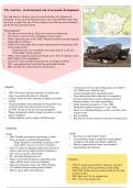
The Aral Sea - environmental risk of economic development
The Aral Sea is in Western Asia, between the borders of Uzbekistan &
Kazakstan. It was once the 4th largest lake in the world (68’000 square km)
but is now a tenth of its size. The two largest rivers flowing from mountains
are the Syr Darya & Amu Darya.
What happened?
• The two rivers (Amu & Syr Darya) have been overabstracted
• The climate is arid so relies on irrigation to grow crops
• 1930s: region was part of the USSR. Planners started to develop irrigated
cotton and rice farming
• USSR’s Five-Year plans led to rapid industrialisation of agriculture with
cotton a major focus
- Uzbekistan was very successful at growing cotton & is still one
of the world’s maim exporters
• 1960s: more irrigation cancels were build - up to 70% of irrigation water
either leaked out or evapourated
• Less & less water started flowing into sea, so it began to shrink
• 1987: seas split into the North Aral Sea and South Aral Sea
• 2003: divided into easters basin & western basin
Impacts: • Aralsk used to be the main fishing port, yet in 2007 it
was 100km away from the coast
• 2009: areas had extremely high rates of salinity and • Caused unemployment and displacement
water was polluted & saline, so fish died • Toxic dust storms led to high rates of respiratory
• Climate: hotter and drier summers & longer and colder diseases (tuberculosis, cancer (throat), growth of
winters anaemia, kidney, liver and eye problems
• Chemical residues from pesticides & sewage led were • Infant mortality increased to 75 per 1000
carried by huge toxic dust storms by local wins. • Maternal mortality increased to 12 per 1000
• In 1990: 70 tons of salt rose into the atmosphere • There was widespread hunger as there was little water
• Plants and animals could no longer live there, so either to grow crops
died or migrated • loss of tourism
• Fishing industry used to employ 40’000 people • Big strain on water resources in the area (Central Asia)
Solutions:
North: South:
• 2003: Kazakh government used money it made • Receives less water than it used to
form oil export to construct Kokaral Dam • Trees & bushes such as saxaul have been planted
- Partly funded by world bank, finished in 2005 to improve soil quality & climate conditions
- Since 2005, water level rose by 10 meters • Plans for improvement: better canal lining &
• Drive to improve irrigation canals with concrete to more fertiliser for nutrients
reduce water loss & improved drop irrigation so
less water is used for cotton fields
• 80+ operating fishing boats now
• Plants to diversify Kazakstan’s agriculture (new Timeline:
crops: alfalfa, melon, maize & sorghum)
• Plans to re-introduce large scale sheep farming • 1960-70: Areal sea level fell by 20cm per year then
• $ 10 million fish processing plant in Aralsk 50-60cm in the 1970s and 80-90cm in the 1980s
• Plan to export fish to EU & Russia • 1960-1998: surface area of sea decreased by 60% and
volume by 80%
• 2004: lake was 1/4 of it original size
• 2007: 10% of its original size
The Aral Sea is in Western Asia, between the borders of Uzbekistan &
Kazakstan. It was once the 4th largest lake in the world (68’000 square km)
but is now a tenth of its size. The two largest rivers flowing from mountains
are the Syr Darya & Amu Darya.
What happened?
• The two rivers (Amu & Syr Darya) have been overabstracted
• The climate is arid so relies on irrigation to grow crops
• 1930s: region was part of the USSR. Planners started to develop irrigated
cotton and rice farming
• USSR’s Five-Year plans led to rapid industrialisation of agriculture with
cotton a major focus
- Uzbekistan was very successful at growing cotton & is still one
of the world’s maim exporters
• 1960s: more irrigation cancels were build - up to 70% of irrigation water
either leaked out or evapourated
• Less & less water started flowing into sea, so it began to shrink
• 1987: seas split into the North Aral Sea and South Aral Sea
• 2003: divided into easters basin & western basin
Impacts: • Aralsk used to be the main fishing port, yet in 2007 it
was 100km away from the coast
• 2009: areas had extremely high rates of salinity and • Caused unemployment and displacement
water was polluted & saline, so fish died • Toxic dust storms led to high rates of respiratory
• Climate: hotter and drier summers & longer and colder diseases (tuberculosis, cancer (throat), growth of
winters anaemia, kidney, liver and eye problems
• Chemical residues from pesticides & sewage led were • Infant mortality increased to 75 per 1000
carried by huge toxic dust storms by local wins. • Maternal mortality increased to 12 per 1000
• In 1990: 70 tons of salt rose into the atmosphere • There was widespread hunger as there was little water
• Plants and animals could no longer live there, so either to grow crops
died or migrated • loss of tourism
• Fishing industry used to employ 40’000 people • Big strain on water resources in the area (Central Asia)
Solutions:
North: South:
• 2003: Kazakh government used money it made • Receives less water than it used to
form oil export to construct Kokaral Dam • Trees & bushes such as saxaul have been planted
- Partly funded by world bank, finished in 2005 to improve soil quality & climate conditions
- Since 2005, water level rose by 10 meters • Plans for improvement: better canal lining &
• Drive to improve irrigation canals with concrete to more fertiliser for nutrients
reduce water loss & improved drop irrigation so
less water is used for cotton fields
• 80+ operating fishing boats now
• Plants to diversify Kazakstan’s agriculture (new Timeline:
crops: alfalfa, melon, maize & sorghum)
• Plans to re-introduce large scale sheep farming • 1960-70: Areal sea level fell by 20cm per year then
• $ 10 million fish processing plant in Aralsk 50-60cm in the 1970s and 80-90cm in the 1980s
• Plan to export fish to EU & Russia • 1960-1998: surface area of sea decreased by 60% and
volume by 80%
• 2004: lake was 1/4 of it original size
• 2007: 10% of its original size


