

GGH3701 ASSIGNMENT 1 2026
DUE 8 APRIL 2026
Sunningdale
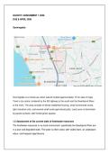
Sunningdale is a mixed-use urban suburb located approximately 15 km east of Cape
Town’s city centre, bordered by the N2 highway to the south and the Swartspruit River
to the north. The area consists of dense residential housing, small commercial zones,
light industrial units, and several small-scale agricultural plots. Land cover is dominated
by paved surfaces, with limited green spaces.
1.2 Assessment of the current state of freshwater resources
The freshwater resources in my local environment specifically the Swartspruit River are
in a poor and degraded state. The water is often turbid, with visible foam, an unpleasant
odour, and frequent algal blooms.
, Figure 1.2: Photograph of the Swartspruit River in Sunningdale, Cape Town,
showing surface foam and discoloured water.
Location: GPS coordinates: 33.9207° S, 18.5369° E
Date and time: 23 October 2025, 14:32 SAST
Description: The photograph shows a thick layer of grey‑white foam accumulating along
the riverbank, with a noticeable oily sheen on the water surface. This indicates high
levels of organic pollution and likely untreated sewage discharge, consistent with
eutrophication and microbial contamination.
State of the resource: Poor water quality fails recreational and ecological standards,
and the river cannot support sensitive aquatic life.
1.3 Five most significant issues related to freshwater in Sunningdale (ranked)
DUE 8 APRIL 2026
Sunningdale
Sunningdale is a mixed-use urban suburb located approximately 15 km east of Cape
Town’s city centre, bordered by the N2 highway to the south and the Swartspruit River
to the north. The area consists of dense residential housing, small commercial zones,
light industrial units, and several small-scale agricultural plots. Land cover is dominated
by paved surfaces, with limited green spaces.
1.2 Assessment of the current state of freshwater resources
The freshwater resources in my local environment specifically the Swartspruit River are
in a poor and degraded state. The water is often turbid, with visible foam, an unpleasant
odour, and frequent algal blooms.
, Figure 1.2: Photograph of the Swartspruit River in Sunningdale, Cape Town,
showing surface foam and discoloured water.
Location: GPS coordinates: 33.9207° S, 18.5369° E
Date and time: 23 October 2025, 14:32 SAST
Description: The photograph shows a thick layer of grey‑white foam accumulating along
the riverbank, with a noticeable oily sheen on the water surface. This indicates high
levels of organic pollution and likely untreated sewage discharge, consistent with
eutrophication and microbial contamination.
State of the resource: Poor water quality fails recreational and ecological standards,
and the river cannot support sensitive aquatic life.
1.3 Five most significant issues related to freshwater in Sunningdale (ranked)


