Geography
Latest uploads at Geography. Looking for notes at Geography? We have lots of notes, study guides and study notes available for your school.
-
855
-
1
-
28
All courses for Geography
-
A-Level 7
-
GEOGRAPHY 842
-
Geography IGCSE 4
-
GEOGRAPHY, 2
Latest content Geography
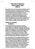
This essay explores volcanic eruptions as powerful natural events that demonstrate Earth's dynamic nature. It discusses both the destructive and beneficial impacts of eruptions, emphasizing the importance of scientific understanding and technological advances in predicting eruptions and reducing their negative effects on society and the environment.
- Essay
- • 3 pages's •
-
Geography•Geography
Geography
- Other
- • 3 pages's •
-
Geography•Geography
These 150 multiple choice questions—with their corresponding correct answers and rationales—provide a thorough review of key topics in Development Geography. They cover foundational concepts, theories, indicators, global disparities, sustainable strategies, globalization, infrastructure, population dynamics, health and education, and policy aspects. Use this set as a study tool or self-assessment guide to deepen your understanding of development geography and its complexities.
- Book
- Exam (elaborations)
- • 43 pages's •
-
GEOGRAPHY•GEOGRAPHY
-
Key Concepts in Development Geography • Rob Potter, Dennis Conway• ISBN 9780857025852
These 100 multiple choice questions, with answers and rationales, provide a broad review of key concepts in geomorphology. Use them as a study tool or self-assessment guide to deepen your understanding of the processes that shape Earth’s surface and the interplay between natural forces and human activities.
- Exam (elaborations)
- • 31 pages's •
-
GEOGRAPHY•GEOGRAPHY
Table of contents 1. Essentials of Geography 2. Solar Energy to Earth and the Seasons 3. Earth's Modern Atmosphere 4. Atmosphere and Surface Energy Balances 5. Global Temperatures 6. Atmospheric and Oceanic Circulations 7. Water and Atmospheric Moisture 8. Weather 9. Water Resources 10.Global Climate Systems 11.Climate Change 12.The Dynamic Planet 13.Tectonics, Earthquakes, and Volcanism 14.Weathering, Karst Landscapes, and Mass Movement 15.River Systems 16.Oceans, Coastal Sys...
- Book
- Exam (elaborations)
- • 1515 pages's •
-
geography•geography
-
Elemental Geosystems • Robert W. Christopherson, Ginger Birkeland• ISBN 9780321985019
As we know climatology is a very important part of Geography and to study climatology the basic requirement is the knowledge of Atmosphere So my notes has all the information of atmosphere composition and structure etc
- Class notes
- • 7 pages's •
-
GEOGRAPHY•GEOGRAPHY

Formation of the universe
- Class notes
- • 11 pages's •
-
Geography•Geography
It is a class notes for Geography subject class 9 chapter 1 it explains everything That is in the chapter in brief
- Class notes
- • 4 pages's •
-
Geography•Geography

Knowing about the Himalayas enriches your understanding of one of the world’s most awe-inspiring natural wonders, home to the planet’s highest peaks, including Mount Everest. This region is a treasure trove of biodiversity, unique cultures, and ancient traditions. It plays a crucial role in global climate regulation and houses numerous sacred sites significant to various religions. Understanding the Himalayas enhances your appreciation for their ecological importance, cultural heritage, and ...
- Class notes
- • 10 pages's •
-
Geography•Geography
Resumen completo de Geografía urbana, definiciones de morfología urbana, plano de ciudad, estructura, emplazamiento y situación de las ciudades.
- Summary
- • 8 pages's •
-
geography•geography