Typhoon Haiyan
Case Study
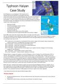
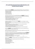
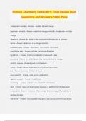
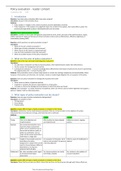
The Philippines is an archipelago of 7107 islands, east of
Vietnam and north of Indonesia, surrounded by the warm
waters of the South China Sea and the Philippines Sea. This causes the Philippines
to be in the world’s most active typhoon belt. The Philippines is a multi-hazard
environment – it is the 3rd most at risk country from natural disasters according to
the world risk index. The Philippines are prone to earthquakes and volcanoes as it
is part of the “Pacific Ring of Fire”.
- GDP ppp of $4700.
- 27% of the population is living in poverty.
- 1.15 doctors per 1000 people.
- Life expectancy of 72 years.
- Literacy rate of 48.7%
- Population of 98.4 million across all the islands.
- Christianity accounts for approximately 90% of the country’s religion.
Since 1990, waters have been rising by about 20cm on average around the world.
This rate has doubled in the last decade. This leads to greater storm surges. The rise around the Philippines is highest
of anywhere in the world. This, along with the abstraction of too much groundwater has caused the Philippines to
sink, putting it even more at risk.
3 weeks prior to the typhoon, an earthquake hit the northern regions of the islands. Haiyan impacted the
northern islands worst. 125,000 people evacuated in these areas.
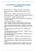
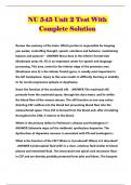
2nd November – low pressure area recorded in Micronesia.
3rd November – moves west. Develops into a tropical depression.
4th November – becomes a tropical storm.
5th November – rapid intensification that brought it up to typhoon intensity. Category 3 in the morning,
category 5 in the afternoon.
7th November – made landfall in Guiuan, eastern Samar.
10th/11th November – reaches Vietnam. Weakens in intensity.
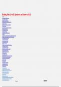
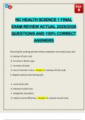
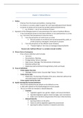
Typhoon Haiyan, a category five typhoon, struck the Philippines, close to Tacloban City on 8th November 2013 at
4.40 am. The tropical storm originated in the northwest Pacific Ocean. It was 100km wide, causing it to cover the
whole of the Philippines at once. The eye of the storm covered a huge area (including Cebu – a city with a population
of 2 million).It is one of the most powerful typhoons to affect the Philippines. It had sustained winds of 150mph with,
10-minute sustained winds of 230km/h and 1-minute sustained wind speeds of 314 kilometres per hour (195 miles
per hour) recorded. It was the 24th storm to hit that year, and it occurred outside of typhoon season. This is likely
because it was an El Nino year, as these years cause unusually warm water in the Pacific Ocean.
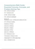
Before the storm, Tacloban had emergency supplies pre-positioned by the Philippines Red Cross. Supplies such as
rice, canned food, oil, salt and sugar were already prepared to be distributed. Tacloban is located at the end of bay
that might have been designed to funnel water in destructive storm surges- puts population in more vulnerable
position. It has a population density of 1100 people per km2 due to rapid rural to urban migration.
It was being monitored by the Japanese Meteorological office.
Primary Impacts
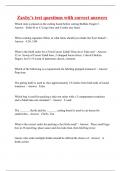
Strong winds battered homes. The worst affected homes were the poorly constructed ones on low, flat land
near the sea.
People were made homeless, particularly around Western and Eastern Visayas
Case Study
The Philippines is an archipelago of 7107 islands, east of
Vietnam and north of Indonesia, surrounded by the warm
waters of the South China Sea and the Philippines Sea. This causes the Philippines
to be in the world’s most active typhoon belt. The Philippines is a multi-hazard
environment – it is the 3rd most at risk country from natural disasters according to
the world risk index. The Philippines are prone to earthquakes and volcanoes as it
is part of the “Pacific Ring of Fire”.
- GDP ppp of $4700.
- 27% of the population is living in poverty.
- 1.15 doctors per 1000 people.
- Life expectancy of 72 years.
- Literacy rate of 48.7%
- Population of 98.4 million across all the islands.
- Christianity accounts for approximately 90% of the country’s religion.
Since 1990, waters have been rising by about 20cm on average around the world.
This rate has doubled in the last decade. This leads to greater storm surges. The rise around the Philippines is highest
of anywhere in the world. This, along with the abstraction of too much groundwater has caused the Philippines to
sink, putting it even more at risk.
3 weeks prior to the typhoon, an earthquake hit the northern regions of the islands. Haiyan impacted the
northern islands worst. 125,000 people evacuated in these areas.
2nd November – low pressure area recorded in Micronesia.
3rd November – moves west. Develops into a tropical depression.
4th November – becomes a tropical storm.
5th November – rapid intensification that brought it up to typhoon intensity. Category 3 in the morning,
category 5 in the afternoon.
7th November – made landfall in Guiuan, eastern Samar.
10th/11th November – reaches Vietnam. Weakens in intensity.
Typhoon Haiyan, a category five typhoon, struck the Philippines, close to Tacloban City on 8th November 2013 at
4.40 am. The tropical storm originated in the northwest Pacific Ocean. It was 100km wide, causing it to cover the
whole of the Philippines at once. The eye of the storm covered a huge area (including Cebu – a city with a population
of 2 million).It is one of the most powerful typhoons to affect the Philippines. It had sustained winds of 150mph with,
10-minute sustained winds of 230km/h and 1-minute sustained wind speeds of 314 kilometres per hour (195 miles
per hour) recorded. It was the 24th storm to hit that year, and it occurred outside of typhoon season. This is likely
because it was an El Nino year, as these years cause unusually warm water in the Pacific Ocean.
Before the storm, Tacloban had emergency supplies pre-positioned by the Philippines Red Cross. Supplies such as
rice, canned food, oil, salt and sugar were already prepared to be distributed. Tacloban is located at the end of bay
that might have been designed to funnel water in destructive storm surges- puts population in more vulnerable
position. It has a population density of 1100 people per km2 due to rapid rural to urban migration.
It was being monitored by the Japanese Meteorological office.
Primary Impacts
Strong winds battered homes. The worst affected homes were the poorly constructed ones on low, flat land
near the sea.
People were made homeless, particularly around Western and Eastern Visayas