Comprehensive Study 1 Up to Date Content
JROTC study guide Latest
Questions and Graded Answers
Your map shows a series of U-shaped or V-shaped contour
lines that point to lower elevation. This means you'll see a
_______ at that location.
Ans: B.)Draw
As you lead your team through a compass course, you keep
looking at your map so that you can tell them what kind of
terrain is ahead. At one point, you notice that three of the
contour lines on the map come together just ahead of your
current location. What should you tell your team?
Ans: D.) " We need to stop and re-plan our route."
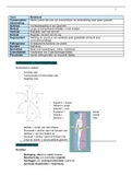
What landform is shown here?
Ans: D.) Saddle
You have a map where the contour interval is 20 meters. A
depression on a map is drawn on the third contour line below
the index contour line at 400 meters. What is the elevation at
the edge of the depression?
Ans: B.) 340 meters
At the end of a map reading competition, four teams were
tied for first place. The tie breaker was a question on the
elevation of a hilltop. The contour interval for the map was 10
meters. The hilltop was located in the center of two circular
contour lines above the index contour line at 600 meters.
What would the correct elevation be?
Up to Date Content
, Comprehensive Study 2 Up to Date Content
Ans: C.) 625
In the map below, how would you describe North Butte?
Ans: c.) a steep flat area
Which of these points show a mountain peak?
Ans: B) Point B
What is the elevation at Point A?
Ans: B) 300
A __________ slope curves inward.
Ans: A) concave
Concentric lines are lines that __________.
Ans: C) are circles with a common center
The vertical distance between contour lines is called the
_____.
Ans: D) contour interval
A contour line indicates __________.
Ans: A) elevation and relief
A line that curves outward is a __________ line.
Ans: B) convex
Up to Date Content
JROTC study guide Latest
Questions and Graded Answers
Your map shows a series of U-shaped or V-shaped contour
lines that point to lower elevation. This means you'll see a
_______ at that location.
Ans: B.)Draw
As you lead your team through a compass course, you keep
looking at your map so that you can tell them what kind of
terrain is ahead. At one point, you notice that three of the
contour lines on the map come together just ahead of your
current location. What should you tell your team?
Ans: D.) " We need to stop and re-plan our route."
What landform is shown here?
Ans: D.) Saddle
You have a map where the contour interval is 20 meters. A
depression on a map is drawn on the third contour line below
the index contour line at 400 meters. What is the elevation at
the edge of the depression?
Ans: B.) 340 meters
At the end of a map reading competition, four teams were
tied for first place. The tie breaker was a question on the
elevation of a hilltop. The contour interval for the map was 10
meters. The hilltop was located in the center of two circular
contour lines above the index contour line at 600 meters.
What would the correct elevation be?
Up to Date Content
, Comprehensive Study 2 Up to Date Content
Ans: C.) 625
In the map below, how would you describe North Butte?
Ans: c.) a steep flat area
Which of these points show a mountain peak?
Ans: B) Point B
What is the elevation at Point A?
Ans: B) 300
A __________ slope curves inward.
Ans: A) concave
Concentric lines are lines that __________.
Ans: C) are circles with a common center
The vertical distance between contour lines is called the
_____.
Ans: D) contour interval
A contour line indicates __________.
Ans: A) elevation and relief
A line that curves outward is a __________ line.
Ans: B) convex
Up to Date Content