Prüfung
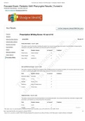
Sketching Assignment - Topographic Maps - Already Graded A+
Bewertung
Verkauft
-
seiten
6
Klasse
A+
Hochgeladen auf
14-07-2023
geschrieben in
2022/2023
ESC1000L, GLY1010L Lab 2: Topographic Maps Elaborate A: Understanding Elevations and Topographic Contours 1. The map below shows topographic contours at an interval of 20 m. Starting from the 0 m contour at the shoreline, label the elevations of the contours on the map below. Note that the closed contours with the inward hatches are depressions where the elevation decreases towards the center.
Mehr anzeigen
Weniger lesen
Hochschule
Florida International University
Ups! Dein Dokument kann gerade nicht geladen werden. Versuch es erneut oder kontaktiere den Support.
Schule, Studium & Fach
Dokument Information
- Hochgeladen auf
- 14. juli 2023
- Anzahl der Seiten
- 6
- geschrieben in
- 2022/2023
- Typ
- Prüfung
- Enthält
- Fragen & Antworten
Themen
-
sketching assignment topographic maps
$10.49
Vollständigen Zugriff auf das Dokument erhalten:
100% Zufriedenheitsgarantie
Sofort verfügbar nach Zahlung
Sowohl online als auch als PDF
Du bist an nichts gebunden