Ruimtelijke informatiekunde 2; Geografische Informatie Systemen –
Hoorcollege 1:
Definities GIS:
- A computer-based system designed to manage and use geospatial data to
solve spatial problems.
- The collection of software, hardware, outputs, personnel, and practices
that together facilitate the analysis and mapping of geographic entities
and phenomena.
- A Geographic Information System is a computerized system that facilitates
the phases of data entry, data analysis and data presentation especially in
case when we are dealing with georeferenced data.
Componenten GIS:
- Hardware, Software, Humanware, Data, Workflows
Lagenbenadering: De werkelijkheid beter begrijpen door de weergave van (een
deel van) de werkelijkheid in lagen. Het analyseren van ruimtelijke data in een
laag, of tussenlagen.
Ontwikkelingen GIS:
- WebGIS/CloudGIS, MobileGIS, GIS users as prosumers, Big Data, Qualitative
GIS
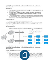
Werkelijkheid Conceptueel
model Geodata model!
Ruimtelijke data analyse door overlay, distance en network tools!
Ruimtelijke informatiekunde 2; Geografische Informatie Systemen –
Hoorcollege 2:
Vraag + Geodata + Kennis = Informatie Besluiten!
In situ data:
- In situ data are collected on the ground by a human being or special data
collection instruments. One of the most important characteristics of these
in situ datasets is that you identify where each measurement was collected
in geographic space. One of the most important instruments used to locate
the data collected in the field is a global positioning system device.
, Voor GPS zijn 4 satellieten nodig voor nauwkeurige metingen!
Sampling/steekproef:
Selecteren van een
subset van individuen
uit een populatie om
kennis over de hele
populatie te
verkrijgen, wanneer
niet alle data van de
hele populatie
verzameld kan
worden.
Systematic Sampling:
- Makkelijk te ontwerpen en beschrijven en minder subjectief maar mogelijk
biased, ontoegankelijke locaties en mogelijk minder efficiënt.
Simple Random Sample:
- Totaal random, weinig kans op bias, hogere variatie niet per se hogere
sample intensiteit en in homogene gebieden niet per se lagere intensiteit.
Clustered Sampling:
- Afstanden tussen clusters groter dan tussen punten in een cluster,
centrum van clusters random of systematisch, heeft als voordeel minder
reistijd en erg efficiënt vooral voor natuurlijke gebieden.
Stratified Sampling:
- Bepalen van variatie van verschijnsel,
hogere intensiteit waar verschijnsel is
meer variabel en efficiënt.
Optimale hoeveelheid samples moeilijk te
bepalen, meestal te weinig door hoge
kosten!
Data via internet, arcgis online en CBS etc.
Naast de data zelf is ook de tijd heel
belangrijk daarnaast zijn er veel toepassing
voor het toepassen van 3d in gis waardoor
line-of-sight en/of schaduw analyses kunnen
worden gemaakt.
Ruimtelijke informatiekunde 2; Geografische Informatie Systemen –
Hoorcollege 3:
Onderzoeksproces:
Probleemdefinitie, Vaststellen doelstelling, Bepalen vraagstelling, Afbakening
(geografisch, tijd, thematisch), Literatuur (wat is er al bekend/gedaan?),
Hoorcollege 1:
Definities GIS:
- A computer-based system designed to manage and use geospatial data to
solve spatial problems.
- The collection of software, hardware, outputs, personnel, and practices
that together facilitate the analysis and mapping of geographic entities
and phenomena.
- A Geographic Information System is a computerized system that facilitates
the phases of data entry, data analysis and data presentation especially in
case when we are dealing with georeferenced data.
Componenten GIS:
- Hardware, Software, Humanware, Data, Workflows
Lagenbenadering: De werkelijkheid beter begrijpen door de weergave van (een
deel van) de werkelijkheid in lagen. Het analyseren van ruimtelijke data in een
laag, of tussenlagen.
Ontwikkelingen GIS:
- WebGIS/CloudGIS, MobileGIS, GIS users as prosumers, Big Data, Qualitative
GIS
Werkelijkheid Conceptueel
model Geodata model!
Ruimtelijke data analyse door overlay, distance en network tools!
Ruimtelijke informatiekunde 2; Geografische Informatie Systemen –
Hoorcollege 2:
Vraag + Geodata + Kennis = Informatie Besluiten!
In situ data:
- In situ data are collected on the ground by a human being or special data
collection instruments. One of the most important characteristics of these
in situ datasets is that you identify where each measurement was collected
in geographic space. One of the most important instruments used to locate
the data collected in the field is a global positioning system device.
, Voor GPS zijn 4 satellieten nodig voor nauwkeurige metingen!
Sampling/steekproef:
Selecteren van een
subset van individuen
uit een populatie om
kennis over de hele
populatie te
verkrijgen, wanneer
niet alle data van de
hele populatie
verzameld kan
worden.
Systematic Sampling:
- Makkelijk te ontwerpen en beschrijven en minder subjectief maar mogelijk
biased, ontoegankelijke locaties en mogelijk minder efficiënt.
Simple Random Sample:
- Totaal random, weinig kans op bias, hogere variatie niet per se hogere
sample intensiteit en in homogene gebieden niet per se lagere intensiteit.
Clustered Sampling:
- Afstanden tussen clusters groter dan tussen punten in een cluster,
centrum van clusters random of systematisch, heeft als voordeel minder
reistijd en erg efficiënt vooral voor natuurlijke gebieden.
Stratified Sampling:
- Bepalen van variatie van verschijnsel,
hogere intensiteit waar verschijnsel is
meer variabel en efficiënt.
Optimale hoeveelheid samples moeilijk te
bepalen, meestal te weinig door hoge
kosten!
Data via internet, arcgis online en CBS etc.
Naast de data zelf is ook de tijd heel
belangrijk daarnaast zijn er veel toepassing
voor het toepassen van 3d in gis waardoor
line-of-sight en/of schaduw analyses kunnen
worden gemaakt.
Ruimtelijke informatiekunde 2; Geografische Informatie Systemen –
Hoorcollege 3:
Onderzoeksproces:
Probleemdefinitie, Vaststellen doelstelling, Bepalen vraagstelling, Afbakening
(geografisch, tijd, thematisch), Literatuur (wat is er al bekend/gedaan?),