

Sample
Summaries after sample
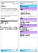
, U6: A globe and map of the world U1: Side views and plan views
• The world is round like a ball. Side views and views from above of simple objects:
• The seven continents of the world - North America, South America, • Side view - what you see when you look: at something from the side.
Africa, Europe, Asia, Australasia and Antarctica. • Plan view - what you see if you look at something from above.
• The 4 oceans - Pacific Ocean, Indian Ocean, Atlantic Ocean and the • Maps - drawings that look at places from above – they are plan views.
Arctic Ocean. • A plan view can be drawn as a simple map that shows you where
different places, roads and landmarks are.
U5: A map of South Africa
• South Africa is a country that is on the continent of Africa. U2: Symbols and keys
• There are oceans (sea) along the east, west and south Maps, symbols and keys:
coasts of South Africa.
Sample • A map shows part of a town, country or even the whole
world.
• Map is always drawn with north at the top.
• Shows the size of areas and the distances between places.
M2: Map
skills
• People who make maps draw symbols onto their
maps to show where things are, and to find a place
or area.
• Symbols - simple pictures or letters that have
Summaries after sample • Land is shown as brown or green, water like oceans, rivers
and lakes, is shown as blue.
• South Africa has 9 provinces – Limpopo, North West,
Mpumalanga, Gauteng, Kwazulu-Natal, Free State,
special meaning on a map.
• They make it easier to draw and read maps.
• Maps usually have a key.
• Key lists - explains all the symbols used on the map.
Eastern-Cape, Northern-Cape and Western Cape.
U4: Compass directions U3: Grid references
North, south, east and west in local: • A grid is a pattern of straight lines that are drawn
over a map - help us find places on the map.
• North, south, east and west are the four main directions
or points of a compass. • Spaces between the lines are given numbers along
the top and letters down the side of the map.
• We can also find our direction without using a compass,
by looking at the position of the sun and shadows. • These numbers and letters give grid references.
• The sun rises in the east and sets in the west. • Grid references help you to find a place on a map.
• A compass needle always points to north.
GR4 SS-GEO T2-M2 Mind Map Study&Master Copyright © www.summariessa.co.za (DO NOT COPY)
Summaries after sample
, U6: A globe and map of the world U1: Side views and plan views
• The world is round like a ball. Side views and views from above of simple objects:
• The seven continents of the world - North America, South America, • Side view - what you see when you look: at something from the side.
Africa, Europe, Asia, Australasia and Antarctica. • Plan view - what you see if you look at something from above.
• The 4 oceans - Pacific Ocean, Indian Ocean, Atlantic Ocean and the • Maps - drawings that look at places from above – they are plan views.
Arctic Ocean. • A plan view can be drawn as a simple map that shows you where
different places, roads and landmarks are.
U5: A map of South Africa
• South Africa is a country that is on the continent of Africa. U2: Symbols and keys
• There are oceans (sea) along the east, west and south Maps, symbols and keys:
coasts of South Africa.
Sample • A map shows part of a town, country or even the whole
world.
• Map is always drawn with north at the top.
• Shows the size of areas and the distances between places.
M2: Map
skills
• People who make maps draw symbols onto their
maps to show where things are, and to find a place
or area.
• Symbols - simple pictures or letters that have
Summaries after sample • Land is shown as brown or green, water like oceans, rivers
and lakes, is shown as blue.
• South Africa has 9 provinces – Limpopo, North West,
Mpumalanga, Gauteng, Kwazulu-Natal, Free State,
special meaning on a map.
• They make it easier to draw and read maps.
• Maps usually have a key.
• Key lists - explains all the symbols used on the map.
Eastern-Cape, Northern-Cape and Western Cape.
U4: Compass directions U3: Grid references
North, south, east and west in local: • A grid is a pattern of straight lines that are drawn
over a map - help us find places on the map.
• North, south, east and west are the four main directions
or points of a compass. • Spaces between the lines are given numbers along
the top and letters down the side of the map.
• We can also find our direction without using a compass,
by looking at the position of the sun and shadows. • These numbers and letters give grid references.
• The sun rises in the east and sets in the west. • Grid references help you to find a place on a map.
• A compass needle always points to north.
GR4 SS-GEO T2-M2 Mind Map Study&Master Copyright © www.summariessa.co.za (DO NOT COPY)


