
- Guías de estudio, Notas de estudios & Resúmenes
¿Buscas las mejores guías de estudio, notas de estudio y resúmenes para ? En esta página encontrarás 180 documentos de estudio para .
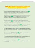
Examen
GIS Map Projection Exam Comprehensive Questions and Answers | A+ Graded | With Expert Solutions
NuevoGIS Map Projection Exam Comprehensive Questions and Answers | A+ Graded | With Expert Solutions
 Favorgrades
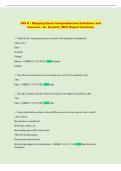
Examen
GIS II : Mapping Exam Comprehensive Questions and Answers | A+ Graded | With Expert Solutions
NuevoGIS II : Mapping Exam Comprehensive Questions and Answers | A+ Graded | With Expert Solutions
Favorgrades
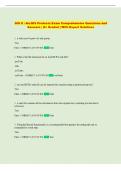
Examen
GIS II : ArcGIS Products Exam Comprehensive Questions and Answers | A+ Graded | With Expert Solutions
NuevoGIS II : ArcGIS Products Exam Comprehensive Questions and Answers | A+ Graded | With Expert Solutions
Favorgrades
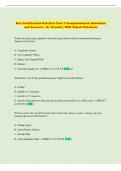
Examen
Esri Certification Practice Test 1 Comprehensive Questions and Answers | A+ Graded | With Expert Solutions
NuevoEsri Certification Practice Test 1 Comprehensive Questions and Answers | A+ Graded | With Expert Solutions
Favorgrades
Examen
Esri Pro Associate Certification Exam Comprehensive Questions and Answers | A+ Graded | With Expert Solutions
NuevoEsri Pro Associate Certification Exam Comprehensive Questions and Answers | A+ Graded | With Expert Solutions
Favorgrades
Examen
Esri Desktop Associate Exam Comprehensive Questions and Answers | A+ Graded | With Expert Solutions
NuevoEsri Desktop Associate Exam Comprehensive Questions and Answers | A+ Graded | With Expert Solutions
Favorgrades
Examen
ArcGIS Pro Foundation 2101 Esri Certification Exam Comprehensive Questions and Answers | A+ Graded | With Expert Solutions
NuevoArcGIS Pro Foundation 2101 Esri Certification Exam Comprehensive Questions and Answers | A+ Graded | With Expert Solutions
Favorgrades
Examen
GIS Final Exam Comprehensive Questions and Answers | A+ Graded | With Expert Solutions
NuevoGIS Final Exam Comprehensive Questions and Answers | A+ Graded | With Expert Solutions
Favorgrades
Examen
Esri Technical Certification: Sample for ArcGIS Desktop Entry Exam Comprehensive Questions and Answers | A+ Graded | With Expert Solutions
NuevoEsri Technical Certification: Sample for ArcGIS Desktop Entry Exam Comprehensive Questions and Answers | A+ Graded | With Expert Solutions
Favorgrades
Examen
Arcgis Pro Foundation 2101 Esri Ce...ion Questions With Correct Answers
NuevoArcgis Pro Foundation 2101 Esri Ce...ion Questions With Correct Answers
 Edufiles
Examen
Arcgis Pro Associate 2101 Revision Exam With Questions And Correct Answers
NuevoArcgis Pro Associate 2101 Revision Exam With Questions And Correct Answers
 MugiyaLearning
Examen
Arcgis Pro Associate 2101 Revision Questions And Correct Answers
NuevoArcgis Pro Associate 2101 Revision Questions And Correct Answers
MugiyaLearning
Examen
ArcGIS Final Exam Everything Questions with complete solution 2025/2026
NuevoArcGIS Final Exam Everything Questions with complete solution 2025/2026
 Academia199
Examen
ArcGIS quiz Question and answers already passed 2025/2026
NuevoArcGIS quiz Question and answers already passed 2025/2026 Map extent - correct answer The limit of the geographic area shown on a map, usually defined by a rectangle. In a dynamic map display, the map extent can be changed by zooming and panning. North arrow - correct answer A map symbol that shows the direction of north on the map, thereby showing how the map is oriented Scale bar - correct answer A map element used to graphically represent the scale of map. A scale bar is typica...
Academia199
Examen
ArcGIS midterm Question and answers rated A+ 2025/2026
NuevoArcGIS midterm Question and answers rated A+ 2025/2026 1: What is GIS - correct answer What does GIS stand for? - Geographic Information Systems (GIS) - The hardware and software that allow for computer based analysis, manipulation, visualization, and retrieval of location- related data 2: How do you connect to folder - correct answer - You use Catalog- then press plus folder symbol- then folder Connections 3: What is ArcCatalog and what is it used for - correct answer - The co...
Academia199
Examen
ArcGIS Exam 2 Question and answers verified to pass 2025/2026
NuevoArcGIS Exam 2 Question and answers verified to pass 2025/2026 What are the five types of data accuracy that you must consider when preparing specifications for a data capture effort? - correct answer - Logical - Temporal - Attribute - Positional - completeness Refer to the diagram below and identify the steps in the data capture process: - correct answer A: Real World B: Modeling C: Quality Evaluation D: Production E: Data Sets F: Quality Evaluation
Academia199
Lote
ArcGIS Bundled Exam Questions WITH CORRECT Answers
ArcGIS Bundled Exam Questions WITH CORRECT Answers
 STANFORDGRADESS
Examen
Modeling Barriers for Delivery Routes in ArcGIS Pro UPDATED ACTUAL Questions and CORRECT Answers
Modeling Barriers for Delivery Routes in ArcGIS Pro UPDATED ACTUAL Questions and CORRECT Answers
STANFORDGRADESS
Examen
Arcgis Pro Associate Updated Actual Questions And Correct Answers
Arcgis Pro Associate Updated Actual Questions And Correct Answers
STANFORDGRADESS
Examen
ArcGIS Pro REV UPDATED ACTUAL Questions and CORRECT Answers
ArcGIS Pro REV UPDATED ACTUAL Questions and CORRECT Answers
STANFORDGRADESS