CST Level 1 Land Surveyor Test
Certification Exam Questions + Verified
Answers 100% correct, Update 2026
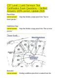
Parcel Map -
correct answer ✅Map that divides a large parcel into *four or
fewer parcels.*
Subdivision Map -
correct answer ✅Map that divides a large parcel into *five or more
parcels.*
Base plan -
correct answer ✅Existing conditions plan that is created from the
,CST Level 1 Land Surveyor Test
Certification Exam Questions + Verified
Answers 100% correct, Update 2026
initial full topographic survey of a property. This plan would include
existing buildings, walls, waterways, trees, and contours along with
the boundary information for the site.
Profile View Drawing -
correct answer ✅An xy plot, typically used to represent the
existing elevation of the project. *Cross Sections* are usually
depicted on this type of drawing
Legal description -
correct answer ✅Written document that describes in detail the
property boundary lines or easements by the lengths, orientations,
and areas of those boundaries or easements.
Total Station -
correct answer ✅electronic distancing measure (EDM), and it can
also measure vertical and horizontal angles and record data. It
consists of a simple microprocessor, an angle measuring instrument
(Theodolite), and a distance measuring instrument (EDM)
,CST Level 1 Land Surveyor Test
Certification Exam Questions + Verified
Answers 100% correct, Update 2026
Should a Total Station ever be carried while mounted on a tripod? -
correct answer ✅No, Total Stations and levels should be moved
only by a carry case.
Theodolite -
correct answer ✅Precision instrument used to measure angles in
the vertical and horizontal planes. Theodolites are used primarily
for surveying applications, and have been modified for unique uses
such as meteorology and rocket launching.
How often should an EDM/all equipment be calibrated? -
correct answer ✅Once a year
What is a peg test? -
correct answer ✅A common level test using two known points to
check levelness and line of sight
What instrument most commonly gets effected by temperature? -
correct answer ✅100ft Steel tapes
, CST Level 1 Land Surveyor Test
Certification Exam Questions + Verified
Answers 100% correct, Update 2026
A 100 foot cloth or fiber tape is most likely used for measuring
_________. -
correct answer ✅Traverse measurements
Property corners
Slope stake locations <----
Centerline
The needle of the surveyor's compass points to: -
correct answer ✅Magnetic North
What is a "dumpy level?" -
correct answer ✅A conventional level with fixed crosshairs and no
internal compensator.
Laser Level -
correct answer ✅a rotating, level laser beam can be detected by a
sensor attached to a rod. Commonly used on construction sites
Digital level/self-leveling level -
correct answer ✅Initially leveled by operator and reads a level rod
as a bar code
Certification Exam Questions + Verified
Answers 100% correct, Update 2026
Parcel Map -
correct answer ✅Map that divides a large parcel into *four or
fewer parcels.*
Subdivision Map -
correct answer ✅Map that divides a large parcel into *five or more
parcels.*
Base plan -
correct answer ✅Existing conditions plan that is created from the
,CST Level 1 Land Surveyor Test
Certification Exam Questions + Verified
Answers 100% correct, Update 2026
initial full topographic survey of a property. This plan would include
existing buildings, walls, waterways, trees, and contours along with
the boundary information for the site.
Profile View Drawing -
correct answer ✅An xy plot, typically used to represent the
existing elevation of the project. *Cross Sections* are usually
depicted on this type of drawing
Legal description -
correct answer ✅Written document that describes in detail the
property boundary lines or easements by the lengths, orientations,
and areas of those boundaries or easements.
Total Station -
correct answer ✅electronic distancing measure (EDM), and it can
also measure vertical and horizontal angles and record data. It
consists of a simple microprocessor, an angle measuring instrument
(Theodolite), and a distance measuring instrument (EDM)
,CST Level 1 Land Surveyor Test
Certification Exam Questions + Verified
Answers 100% correct, Update 2026
Should a Total Station ever be carried while mounted on a tripod? -
correct answer ✅No, Total Stations and levels should be moved
only by a carry case.
Theodolite -
correct answer ✅Precision instrument used to measure angles in
the vertical and horizontal planes. Theodolites are used primarily
for surveying applications, and have been modified for unique uses
such as meteorology and rocket launching.
How often should an EDM/all equipment be calibrated? -
correct answer ✅Once a year
What is a peg test? -
correct answer ✅A common level test using two known points to
check levelness and line of sight
What instrument most commonly gets effected by temperature? -
correct answer ✅100ft Steel tapes
, CST Level 1 Land Surveyor Test
Certification Exam Questions + Verified
Answers 100% correct, Update 2026
A 100 foot cloth or fiber tape is most likely used for measuring
_________. -
correct answer ✅Traverse measurements
Property corners
Slope stake locations <----
Centerline
The needle of the surveyor's compass points to: -
correct answer ✅Magnetic North
What is a "dumpy level?" -
correct answer ✅A conventional level with fixed crosshairs and no
internal compensator.
Laser Level -
correct answer ✅a rotating, level laser beam can be detected by a
sensor attached to a rod. Commonly used on construction sites
Digital level/self-leveling level -
correct answer ✅Initially leveled by operator and reads a level rod
as a bar code