
- Guías de estudio, Notas de estudios & Resúmenes
¿Buscas las mejores guías de estudio, notas de estudio y resúmenes para ? En esta página encontrarás 11 documentos de estudio para .

Examen
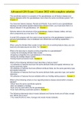
Advanced GIS Exam 1 Latest 2022 with complete solution
Advanced GIS Exam 1 Latest 2022 with complete solution
 Wiseman
Examen
Advanced GIS Exam 1 Latest 2022 with complete solution Document Content and Description Below
PopularAdvanced GIS Exam 1 Latest 2022 with complete solution Document Content and Description Below Advanced GIS Exam 1 Latest 2022 with complete solution The coordinate system is a property of the geodatabase, so all feature classes and feature datasets within the geodatabase must share the same coordinate system ToF - Answer- F You have two feature classes: Parcels and Roads. If you want to use a geodatabase topology to help protect spatial relationships between them, you must store them in a feat...
 Savior

Examen
Advanced Gis Exam 1 Questions And Answers
ADVANCED GIS EXAM 1 QUESTIONS AND ANSWERS The coordinate system is a property of the geodatabase, so all feature classes and feature datasets within the geodatabase must share the same coordinate system ToF - CORRECT ANSWERF
STANGRADES

Examen
Exam Bank for Advanced GIS- Questions and Answers Solved 100%
Exam Bank for Advanced GIS- Questions and Answers Solved 100% A raster with a larger cell size has a higher resolution than a raster with a smaller cell size. - Answers False A vegetation raster is most likely a(n)_________ raster - Answers integer Which type of raster typically does not have an attribute table associated with it? - Answers floating-point raster Which of the following data sources can produce elevation data with the highest level of vertical accuracy? - Answers 1/9 arc-secon...
TutorJosh

Examen
Advanced GIS Exam 2024 | GIS Advanced Exam Latest Update 2024-2025 Questions and Correct Answers Rated A+
Advanced GIS Exam 2024 | GIS Advanced Exam Latest Update 2024 Questions and Correct Answers Rated A+
nurselyn

Examen
Advanced GIS Exam 2024 | GIS Advanced Exam Latest Update 2024 Questions and Correct Answers Rated A+
Advanced GIS Exam 2024 | GIS Advanced Exam Latest Update 2024 Questions and Correct Answers Rated A+
nurselyn

Examen
Advanced GIS Exam 1 UPDATED ACTUAL Exam Questions and CORRECT Answers
Advanced GIS Exam 1 UPDATED ACTUAL Exam Questions and CORRECT Answers John Snow - CORRECT ANSWER- English Physician, used GIS to locate Cholera outbreaks by contaminated wells -GIS on paper maps Ian McHarg - CORRECT ANSWER- - Grandfather of GIS in 1969 made popular overlays for analysis and decision making- no computers
 STANFORDGRADESS

Examen
Advanced GIS Exam 1 UPDATED Exam Questions and CORRECT Answers
Advanced GIS Exam 1 UPDATED Exam Questions and CORRECT Answers The coordinate system is a property of the geodatabase, so all feature classes and feature datasets within the geodatabase must share the same coordinate system ToF - CORRECT ANSWER- F You have two feature classes: Parcels and Roads. If you want to use a geodatabase topology to help protect spatial relationships between them, you must store them in a feature dataset in the geodatabase. torf - CORRECT ANSWER- t
STANFORDGRADESS
Examen
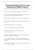
Advanced GIS Exam 1 ACTUAL Exam Questions and CORRECT Answers
Advanced GIS Exam 1 ACTUAL Exam Questions and CORRECT Answers Geographic data model - CORRECT ANSWER- structure for organizing geospatial data Object Class - CORRECT ANSWER- collection of objects in tabular format Feature Class - CORRECT ANSWER- collection of Geographic Objects in tabular format that have the same behavior and attributes and geometry
STANFORDGRADESS
Examen
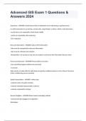
Advanced GIS Exam 1 Questions & Answers 2024
Advanced GIS Exam 1 Questions & Answers 2024 Empiricism - ANSWER--Small choices that an individual has to make during a spatial process. ex which parameter to use during a certain task, using integers vs bytes vs float vs text data types -results have to be repeatable, which shows validity -results are repeatable with empiricism -GIS is empirical Data and Information - ANSWER--Data is NOT information -data must be manipulated to become information -data must be collected and analy...
 Bensuda
Examen
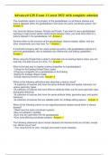
Advanced GIS Exam 1 Latest 2022 with complete solution
Advanced GIS Exam 1 Latest 2022 with complete solution The coordinate system is a property of the geodatabase, so all feature classes and feature datasets within the geodatabase must share the same coordinate system ToF - Answer- F You have two feature classes: Parcels and Roads. If you want to use a geodatabase topology to help protect spatial relationships between them, you must store them in a feature dataset in the geodatabase. torf -Answer- t Schema refers to the structure of the ...
Brainboost