Tentamen (uitwerkingen)
CDASA INTs Exam Questions and Answers (Graded A)
Beoordeling
Verkocht
-
Pagina's
3
Cijfer
A+
Geüpload op
29-03-2024
Geschreven in
2023/2024
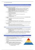
CDASA INTs Exam Questions and Answers (Graded A)CDASA INTs Exam Questions and Answers (Graded A)CDASA INTs Exam Questions and Answers (Graded A)CDASA INTs Exam Questions and Answers (Graded A) Geospatial Intelligence (GEOINT) - ANSWER--the exploitation and analysis of imagery and geospatial information to describe, assess, and visually depict physical features & geographically referenced activities on the Earth what are the 3 components of GEOINT? - ANSWER-1. imagery 2. IMINT 3. geospatial information Imagery - ANSWER--A likeness or presentation of any natural or man-made feature, or related object or activity and the positional data acquired at the same time the likeness
Meer zien
Lees minder
Instelling
CDASA INTs
Vak
CDASA INTs
Oeps! We kunnen je document nu niet laden. Probeer het nog eens of neem contact op met support.

Geschreven voor
- Instelling
- CDASA INTs
- Vak
- CDASA INTs
Documentinformatie
- Geüpload op
- 29 maart 2024
- Aantal pagina's
- 3
- Geschreven in
- 2023/2024
- Type
- Tentamen (uitwerkingen)
- Bevat
- Vragen en antwoorden
Onderwerpen
-
cdasa ints exam questions and answers graded a
-
cdasa ints exam questions and answers stuvia
-
geospatial intelligence geoint answer the e
€9,17
Krijg toegang tot het volledige document:
100% tevredenheidsgarantie
Direct beschikbaar na je betaling
Lees online óf als PDF
Geen vaste maandelijkse kosten
Ook beschikbaar in voordeelbundel
Voordeelbundel
CDASA EXAM PACKAGE DEAL (BUNDLE) WITH COMPLETE QUESTIONS AND ANSWERS 100% ACCURATE
36
2024
€ 342,94
Meer info