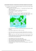
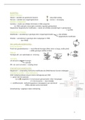
Ocean-atmosphere interactions - how physical processes link Earth’s atmospheric and ocean systems
● The operation of ocean currents, including their distribution, nutrient and energy transfers and the
importance of oceanic conveyor belts
○ Around 70% of the world covered by sea - 5 interconnected oceans (pacific, Atlantic,
indian, Southern, arctic)
○ Chemical composition of seawater is similar but varies year to year
○ Loss of water due to evaporation = inputs of water
○ Constant salinity
○ Composition of seawater is even due to the circulation of water between oceans
○ North pacific and atlantic: clockwise; Indian, South Pacific, South Atlantic:
anti-clockwise - change in direction due to the Coriolis Force (earth’s rotation)
○ Ocean currents occur because there’s very little friction between the ocean waters and the
solid earth
○ Speed depends on depth, deep: slow, shallow: fast current
○ South America and Africa used to be stuck together, drifted apart due to ocean current
○ Earth’s crust consists of crustal plates and tectonic plates, they move due to the mantle’s
current
○ Mid-ocean ridges form, either collide and destroy plate OR crumps upwards to form
mountain ranges (destructive) OR crustal material forced downwards (subduction zone)
○ Ocean trenches can form at subduction zones
○ Ocean temperature varies due to season, latitude, depth
○ Waters near the equator is warmer than the ones towards the poles
○ Water’s temperature suddenly decreases after 800m (200m - 800m: thermocline)
○ Salinity and density of seawater increases as depth increases
○ At poles, when seawater is turned to ice due to severe cold temperatures, it rejects salt so
it is consumable
, ○ Oceanic conveyor belts allows water in each ocean to mix
○ Gulf stream (warm sea current from the carribean to the atlantic) → reaches cold polar
North Atlantic (chill and high density seawater) → reaches equatorial areas of the Indian
and Pacific oceans (water becomes less dense) → returns to the North Pacific Ocean
○ Seawater enriched with nutrients as it goes deeper, nutrients passed on by the oceanic
conveyor belt
○ Also transports heat from equatorial regions to the poles - some suspect this to be the
reason of melting ice caps
○ Faster flow rate of oceanic conveyor belt means more carbon dioxide rich currents -
contributes to global warming
● Atmosphere-oceanic interactions associated with El Nino-Southern Oscillation (ENSO) and
LaNina cycles and their climatic, environmental and economic effects
○ El Nino refers to the significant warming of the water that occurs every few years in the
Pacific Ocean
○ When El Nino is operating, the cold/nutrient rich current does not reach the coast of
Australia and Peru - warm currents instead, less food supply
○ South American experiences flooding (excessive rainfall)
○ Ocean experiences thunderstorms which releases heat energy (affects circulation of
earth’s atmosphere)
○ La Nino refers to the cold phase of El Nino
○ Aggregates tropical cyclones on the ocean
○ Severe flooding on Australia and Peru, increases tornadoes in the USA
● Detailed examples of the geographic impacts of El Niño and La Niña
○ El nino - South Africa
○ Droughts since 2014 affecting social and ecological systems
, ○ Decrease in crop yields and farmers income → huge impact for a country having a large
agricultural sector and employment → impact on food security
○ Increasing population and unstable food supply affecting water and energy too (nexus)
○ Country not being able to take strategies due to its lack of financial revenue and
technology
○ La nina - Australia
○ Decrease in sea temperatures by 5 degrees, strong and eastward moving wind
○ Rainfall leading to flooding, mudslides, tropical cyclones → impact on agriculture
○ Leading to deaths and casualties of residents too
● The formation, distribution and physical impacts of hurricanes on coastal margins, including
storm surges
○ Hurricanes also known as typhoons and strong tropical cyclones, are highly intense low
pressure cells
○ Generates heavy heavy rainfall and high waves
○ They form when, temp over 27, depth at least 60m, humid, little wind shear, unstable
atmospheric condition, far from the equator for Coriolis force
○ Unstable air starts to rotate anticlockwise in the northern hemisphere and clockwise in the
southern hemisphere → as the air spins, it rises and condenses vast quantities of moisture
→ releases latent energy → heats the air and accelerates
○ Impacts: infrastructure destruction (roads, houses, power lines → could start fire), debris
blown away, uproot trees (destroys vegetation), contamination of drinking water,
additional hazards such as coastal flooding and storm surge, coastal erosion
○ Coastal areas are attractive and comfortable place to live but is very vulnerable to natural
hazards
○ Hazard mitigation: sustained action that reduces or eliminates long-term risk to people
and property from natural hazards and their effects - important because it minimises
losses
○ Coastal changes - erosion of beaches, dunes and sand-cliffs, pose significant hazards to
buildings → costly for the society
○ Highly unpredictable
● The changing role of oceans as a store and source of carbon dioxide and the impacts of ocean
acidification on coral reefs
○ Large amounts of carbon dioxide is dissolved in the water of the oceans
○ Sea acts as a carbon sink because it traps carbon dioxide more than it releases it to the
atmosphere
○ Precipitation adds carbon dioxide to the sea, some dissolve, some are eaten by the
plankton - eaten by fish which are eaten by humans - higher level in the food chain the
concentration of carbon increases