

Escrito por estudiantes que aprobaron Inmediatamente disponible después del pago Leer en línea o como PDF ¿Documento equivocado? Cámbialo gratis 4,6 TrustPilot
logo-home
Document preview thumbnail
Vista previa 2 fuera de 9 páginas
Examen

NR 658 Exam 2 With Complete Solution

Document preview thumbnail
Vista previa 2 fuera de 9 páginas

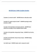
NR 658 Exam 2 With Complete Solution Example of a network model? - ANSWER-Resource allocation model .Examples of a spatio-temporal model? - ANSWER-hydrologic model, stochastic, LANDIS .Examples of interpolating by drawing boundaries - ANSWER-fixed radius/local averaging, inverse weighted distance (IWD) .Examples of interpolation using gradual change - ANSWER-Trend surface, Splines .Examples of interpolation using moving averages - ANSWER-Kriging, moving windows .four buffer types - ANSWER-simple, point, compound, nested .four local raster functions - ANSWER-mathematical, boolean, reclassification, multilayer overlay .four types of sampling - ANSWER-random, systematic, stratified, cluster .four types of spatial data accuracy - ANSWER-positional, attribute, logical, completeness .How is attribute accuracy measured? - ANSWER-An error matrix table .How many spatial operations are there? - ANSWER-100's .Manual classification vs automatic classification - ANSWER-manual- cumbersome (-), control boundaries (+) automatic- uses rules, saves time (+), do not control boundaries (-) .Obvious sources of error - ANSWER-data age, areal coverage, map scale .other names for classification - ANSWER-reclassification, recoding .processing errors - ANSWER-numeric errors, misuse of logic, classification/generalization issues .Raster vs Vector buffers - ANSWER-Raster- buffer around individual cells. Count the cells to create. Vector- buffers around points, lines, polygons. Creates POLYGONS as output. simple buffers will dissolve features if they overlap (use compound/nested instead). .Raster vs Vector overlay - ANSWER-Raster- simple (align cells). Cell size might need resample. Vector- more complex alignment (slivers) .Sources of error from natural variation - ANSWER-positional accuracy, data entry error, training .Three interpolation methods - ANSWER-Interpolation by drawing boundaries, interpolation using gradual change, methods using moving averages .three types of standards - ANSWER-data standards, analysis standards, professional or certification standards .What are four overlay tools? - ANSWER-clip- takes information from the clipped layer union- combines data from both layers where there is data intersect- combines all data from both layers erase- opposite of clip, takes out layer area .What are overlay functions? - ANSWER-Powerful spatial analysis tool that combines spatial and attribute data from two or more layers. .What are raster neighborhood operations? - ANSWER-Raster data technique that utilizes a moving window (kernel) for filtering and computing interspersion, juxtaposition, and fragmentation.

Vista previa del contenido

NR 658 Exam 2 With Complete Solution


Example of a network model? - ANSWER-Resource allocation model


.Examples of a spatio-temporal model? - ANSWER-hydrologic model,
stochastic, LANDIS


.Examples of interpolating by drawing boundaries - ANSWER-fixed
radius/local averaging, inverse weighted distance (IWD)


.Examples of interpolation using gradual change - ANSWER-Trend surface,
Splines


.Examples of interpolation using moving averages - ANSWER-Kriging,
moving windows


.four buffer types - ANSWER-simple, point, compound, nested

, .four local raster functions - ANSWER-mathematical, boolean,
reclassification, multilayer overlay


.four types of sampling - ANSWER-random, systematic, stratified, cluster


.four types of spatial data accuracy - ANSWER-positional, attribute, logical,
completeness


.How is attribute accuracy measured? - ANSWER-An error matrix table


.How many spatial operations are there? - ANSWER-100's


.Manual classification vs automatic classification - ANSWER-manual-
cumbersome (-), control boundaries (+)

automatic- uses rules, saves time (+), do not control boundaries (-)


.Obvious sources of error - ANSWER-data age, areal coverage, map scale


.other names for classification - ANSWER-reclassification, recoding


.processing errors - ANSWER-numeric errors, misuse of logic,

Información del documento

Subido en
9 de abril de 2025
Número de páginas
9
Escrito en
2024/2025
Tipo
Examen
Contiene
Preguntas y respuestas
$9.49

¿Documento equivocado? Cámbialo gratis Dentro de los 14 días posteriores a la compra y antes de descargarlo, puedes elegir otro documento. Puedes gastar el importe de nuevo.
Escrito por estudiantes que aprobaron
Inmediatamente disponible después del pago
Leer en línea o como PDF

Seller avatar
Los indicadores de reputación están sujetos a la cantidad de artículos vendidos por una tarifa y las reseñas que ha recibido por esos documentos. Hay tres niveles: Bronce, Plata y Oro. Cuanto mayor reputación, más podrás confiar en la calidad del trabajo del vendedor.
Docwyne6
3.5
(6)
Vendido
33
Seguidores
11
Artículos
1700
Última venta
2 semanas hace


Por qué los estudiantes eligen Stuvia

Creado por compañeros estudiantes, verificado por reseñas

Calidad en la que puedes confiar: escrito por estudiantes que aprobaron y evaluado por otros que han usado estos resúmenes.

¿No estás satisfecho? Elige otro documento

¡No te preocupes! Puedes elegir directamente otro documento que se ajuste mejor a lo que buscas.

Paga como quieras, empieza a estudiar al instante

Sin suscripción, sin compromisos. Paga como estés acostumbrado con tarjeta de crédito y descarga tu documento PDF inmediatamente.

Student with book image

“Comprado, descargado y aprobado. Así de fácil puede ser.”

Alisha Student

Preguntas frecuentes