GISP: All Sets (1-10 and Extra) Latest Update Graded A+
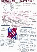
GISP: All Sets (1-10 and Extra) Latest Update Graded A+ What are some ways generalization can be achieved in a map? -Aggregating - combining into a new composite feature -Only selecting certain features to be displayed -Removing detail -Dissolving/Merging (e.g. combine similar neighbor elements) -Exaggerating - make features larger than they are -Smoothing out detailed /complicated features (e.g. rivers do not need every curve) What are some arguments why government-owned GIS data should be freely available to the public? -Citizens should have access to information government uses in order to have effective input into decisions. -Costs can be prohibitive to any but very large organizations. -Government branches may horde data for bargaining power with other agencies. -Liability increased if data sold in commercial transaction. -Research opportunities lost due to expense -Sales don't really recoup the costs for the agency anyway. Distribution is cheap. What are some basic trends in geospatial technology? -COMPUTING CAPACITY for Research, Apps -EXPANDING Wireless and Web NETWORKS -REAL TIME Data -MINIATURIZATION of Technology -MOBILE Geospatial Sensor PLATFORMS What are the three general categories that temporal data may refer to? -DISCRETE events (e.g. lightning strikes) -MOVING objects (e.g. trains) -REPEATED observations (e.g. counts from traffic sensors) Data symbols that represent measurements of phenomena What are some GIS-related work activities that are regulated by specific policies and procedures? editing, storing, and archiving data Datum Shift A change from one datum to another, such as from NAD27 to NAD83, which can result in substantial horizontal shifts of point positions What are the three main transfer constructs (based on data models)? 1. logical constructs solely pertaining to this standard 2. constructs relating to the implementation method 3. constructs solely pertaining to the transfer media Dot map -Uses uniform point symbols to show partial data, with each symbol representing a unit value -Create a visual impression of density by placing a dot or some other symbol in the approximate location of the variable being mapped. What is georeferencing? Associating a map (eg pdf or jpg without spatial information) or image (e.g. aerial image without spatial information) with spatial locations What are the ways you can SELECT features based on ATTRIBUTE? -Add to Selection -Clear Selection -New Selection -Remove from Selection -Subset Selection -Switch Selection What is a SCHEMA (in context of database object relationships)? - structure or design of the database or object - defines tables, fields in each table, relationships between fields - will include information on which fields have domains and what those domains are What is resolution of AFPO scanned imagery? -0.5 meters -12.5 microns -2136 DPI Are most larger scale print maps 2D or 3D? 2D What are the sections of the GISCI Rules of Conduct for Certified GISPs? I. Obligations to Society II. Obligations to Employers and Funders III. Obligations to Colleagues and the Profession IV. Obligations to Individuals in Society Data symbols that represent measurements of phenomena Geospatial Data is to Food as Metadata is to: Nutrition Label What is the difference between primary and secondary data? Primary data is collected specifically for the researchers use, while secondary data is collected for another purpose by someone other than the r
Escuela, estudio y materia
- Institución
- GISP - Geographic Information Systems Professional
- Grado
- GISP - Geographic Information Systems Professional
Información del documento
- Subido en
- 19 de mayo de 2023
- Número de páginas
- 31
- Escrito en
- 2022/2023
- Tipo
- Examen
- Contiene
- Preguntas y respuestas
Temas
-
gisp all sets 1 10 and extra latest update graded a
-
what are some ways generalization can be achieved in a map aggregating combining into a new composite feature only selecting certain featur
Documento también disponible en un lote