Integrating Data in ArcGIS Pro
Study online at https://quizlet.com/_9hqhn7
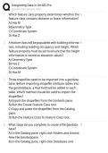
1. Which feature class property determines whether the A
feature class contains distance or linear information?
A) Has M
B)Geometry Type
C) Coordinate System
D) Has Z
2. A feature class will be populated with building informa- B
tion, including building occupancy and height. Which
feature property must be set to ensure that the height
information is stored as elevation values?
A) Geometry Type
B) Has Z
C) Coordinate System
D) Has M
3. Three shapefiles need to be imported into a geodata-
base. Before importing shapefile attribute tables into
the geodatabase, a Year field will be added to each
table. Which method should be used to import the
shapefiles?
A) Export the shapefiles from the Contents pane.
B) Run the Create Feature Class tool.
C) Copy and paste the shapefiles from the Catalog
pane.
D) Run the Feature Class To Feature Class tool.
4. What steps do you complete to create a file geodata- B
base?
A) In the Catalog pane, right-click Folders and choose
New File Geodatabase.
B) In the Catalog pane, right-click Databases and
1/3
Study online at https://quizlet.com/_9hqhn7
1. Which feature class property determines whether the A
feature class contains distance or linear information?
A) Has M
B)Geometry Type
C) Coordinate System
D) Has Z
2. A feature class will be populated with building informa- B
tion, including building occupancy and height. Which
feature property must be set to ensure that the height
information is stored as elevation values?
A) Geometry Type
B) Has Z
C) Coordinate System
D) Has M
3. Three shapefiles need to be imported into a geodata-
base. Before importing shapefile attribute tables into
the geodatabase, a Year field will be added to each
table. Which method should be used to import the
shapefiles?
A) Export the shapefiles from the Contents pane.
B) Run the Create Feature Class tool.
C) Copy and paste the shapefiles from the Catalog
pane.
D) Run the Feature Class To Feature Class tool.
4. What steps do you complete to create a file geodata- B
base?
A) In the Catalog pane, right-click Folders and choose
New File Geodatabase.
B) In the Catalog pane, right-click Databases and
1/3