THE
PILOT
general
navigation
ATPL
STUDENT
pilot
resume
all info you need to pass atpl exams
, GNAV
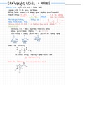
The solar system:
st
1 law Kepler: Planets move in elliptical orbits with the sun at one of the foci
nd
2 law Kepler: Radius vector sun-earth sweeps out equal areas in equal time
Sun’s declination:
- Angle between earth’s equator & sun rays
- Northerly: Daylight in S hemisphere shorter
- Angular distance of the sun N/S of the celestial equator
- Sun’s position relative to the plane of the Equator
Plane of ecliptic:
o
- Plane of which the earth travels around the sun, the earth’s axis is 23.5 tilted tangent to ecliptic plane
o
- Polar axis with a 66.5 inclination with the ecliptic plane
- Yearly apparent path of the SUN around the EARTH
- Inclination is the main reason for occurrence of the seasons
Apparent sun: Visible sun, always in the plane of ecliptic
Mean sun: Fictitious sun coinciding each year at spring equinox & travelling along celestial equator at uniform/constant speed
Difference between mean sun & apparent sun highest in February & November
Midnight sun: Sun visible for 24 hours
Perihelion: Closest, beginning of January [Highest speed of earth’s orbit]
Aphelion: Furthest, beginning of July
o
Cancer/Capricorn: 23.5N/S [Highest altitude sun reaches 90 above horizon, occurs once a year]
Polar circles: 66.5N/S
Equinoxes: Length of day/night & rate of change of declination of the sun highest
- Spring: Declination = 0
- Autumn: Declination = 0
Earth’s rotation: Viewed from above North Pole = Counter clockwise
Solstice: Summer/winter, point when sun reaches its highest/lowest declination
Sidereal day: Describe a relationship concerning the stars
Apparent solar day: Varies continuously due to tilt of Earth’s axis & elliptical orbit around the sun
Solar system doesn’t include stars
The earth:
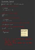
1NM = 1.852km
Circumference = π x d
1 in 60 rule used for small angles ONLY
Convergence = Change in longitude x sin latitude
Convergence = Great circle initial true track – great circle final true track
Conversion angle = ½ Change in longitude x sin latitude
Departure (NM) = 60 x cos latitude
One degree on equator =60NM
One degree near equator = Less than 60NM
Track error = (Distance off track x 60) ÷ 150
Earth is an oblate spheroid. Diameter = 12700km
Circumference: 21600NM
Halfway between two points, GCT = RLT
Convergence of meridians: Angular difference between meridians
Convergence angle: Angular difference between RLT & GCT
Great circle track (Orthodrome, radio bearings)
- Rhumb line closer to equator
- GC run through area of higher latitude
- GC shorter than RL
Small circle: Does not pass earth’s axis. Unlimited number can be drawn between 2 points on the earth
Highest value of longitude: Greenwich anti-meridian
Following rhumb line track (Non-cardinal directions) you will fly a spiral to North Pole
Meridians:
- Parallel only at the equator
- All meridians run south to north
Vertex:
PILOT
general
navigation
ATPL
STUDENT
pilot
resume
all info you need to pass atpl exams
, GNAV
The solar system:
st
1 law Kepler: Planets move in elliptical orbits with the sun at one of the foci
nd
2 law Kepler: Radius vector sun-earth sweeps out equal areas in equal time
Sun’s declination:
- Angle between earth’s equator & sun rays
- Northerly: Daylight in S hemisphere shorter
- Angular distance of the sun N/S of the celestial equator
- Sun’s position relative to the plane of the Equator
Plane of ecliptic:
o
- Plane of which the earth travels around the sun, the earth’s axis is 23.5 tilted tangent to ecliptic plane
o
- Polar axis with a 66.5 inclination with the ecliptic plane
- Yearly apparent path of the SUN around the EARTH
- Inclination is the main reason for occurrence of the seasons
Apparent sun: Visible sun, always in the plane of ecliptic
Mean sun: Fictitious sun coinciding each year at spring equinox & travelling along celestial equator at uniform/constant speed
Difference between mean sun & apparent sun highest in February & November
Midnight sun: Sun visible for 24 hours
Perihelion: Closest, beginning of January [Highest speed of earth’s orbit]
Aphelion: Furthest, beginning of July
o
Cancer/Capricorn: 23.5N/S [Highest altitude sun reaches 90 above horizon, occurs once a year]
Polar circles: 66.5N/S
Equinoxes: Length of day/night & rate of change of declination of the sun highest
- Spring: Declination = 0
- Autumn: Declination = 0
Earth’s rotation: Viewed from above North Pole = Counter clockwise
Solstice: Summer/winter, point when sun reaches its highest/lowest declination
Sidereal day: Describe a relationship concerning the stars
Apparent solar day: Varies continuously due to tilt of Earth’s axis & elliptical orbit around the sun
Solar system doesn’t include stars
The earth:
1NM = 1.852km
Circumference = π x d
1 in 60 rule used for small angles ONLY
Convergence = Change in longitude x sin latitude
Convergence = Great circle initial true track – great circle final true track
Conversion angle = ½ Change in longitude x sin latitude
Departure (NM) = 60 x cos latitude
One degree on equator =60NM
One degree near equator = Less than 60NM
Track error = (Distance off track x 60) ÷ 150
Earth is an oblate spheroid. Diameter = 12700km
Circumference: 21600NM
Halfway between two points, GCT = RLT
Convergence of meridians: Angular difference between meridians
Convergence angle: Angular difference between RLT & GCT
Great circle track (Orthodrome, radio bearings)
- Rhumb line closer to equator
- GC run through area of higher latitude
- GC shorter than RL
Small circle: Does not pass earth’s axis. Unlimited number can be drawn between 2 points on the earth
Highest value of longitude: Greenwich anti-meridian
Following rhumb line track (Non-cardinal directions) you will fly a spiral to North Pole
Meridians:
- Parallel only at the equator
- All meridians run south to north
Vertex: