Examen
CDASA INTs Exam Questions and Answers (Graded A)
Puntuación
Vendido
-
Páginas
3
Grado
A+
Subido en
29-03-2024
Escrito en
2023/2024
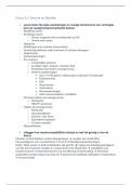
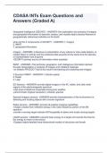
CDASA INTs Exam Questions and Answers (Graded A)CDASA INTs Exam Questions and Answers (Graded A)CDASA INTs Exam Questions and Answers (Graded A)CDASA INTs Exam Questions and Answers (Graded A) Geospatial Intelligence (GEOINT) - ANSWER--the exploitation and analysis of imagery and geospatial information to describe, assess, and visually depict physical features & geographically referenced activities on the Earth what are the 3 components of GEOINT? - ANSWER-1. imagery 2. IMINT 3. geospatial information Imagery - ANSWER--A likeness or presentation of any natural or man-made feature, or related object or activity and the positional data acquired at the same time the likeness
Mostrar más
Leer menos
Institución
CDASA INTs
Grado
CDASA INTs
Ups! No podemos cargar tu documento ahora. Inténtalo de nuevo o contacta con soporte.
Escuela, estudio y materia
- Institución
- CDASA INTs
- Grado
- CDASA INTs
Información del documento
- Subido en
- 29 de marzo de 2024
- Número de páginas
- 3
- Escrito en
- 2023/2024
- Tipo
- Examen
- Contiene
- Preguntas y respuestas
Temas
-
cdasa ints exam questions and answers graded a
-
cdasa ints exam questions and answers stuvia
-
geospatial intelligence geoint answer the e
9,17 €
Accede al documento completo:
100% de satisfacción garantizada
Inmediatamente disponible después del pago
Tanto en línea como en PDF
No estas atado a nada
Documento también disponible en un lote
Package deal
CDASA EXAM PACKAGE DEAL (BUNDLE) WITH COMPLETE QUESTIONS AND ANSWERS 100% ACCURATE
36
2024
€ 342,68
Más información