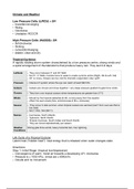
Climate and Weather
Low Pressure Cells: (LIRCU) = SH
• Inwards/converging
• Rising
• Clockwise
• Unstable= RCCCR
High Pressure Cells: (HASOS)= SH
• Anticlockwise
• Sinking
• outwards/diverging
• stable= clear and dry
Tropical Cyclones
A rapidly rotating storm system characterised by a low pressure centre, strong winds and
a spiral arrangement of thunderstorms that produce heavy rain. They last 3-8 days.
Latitude • They occur between 5° and 20° N&S
• Not 0°- 5° N&S= Coriolis force to weak to create cyclonic action (Right- NH & Left- SH)
• 20° or more= Oceans are too cold for dramatic evaporation rate/ uplift
Pressure • Intense LP system where the eye can reach at least 960 hPa
Isobars • Isobars are circular and close together= very steep pressure gradient & gale force winds
Oceans • They form over tropical oceans where temperatures are greater than 27℃
Winds • Moved by the tropical easterlies (E-W), curving away from the equator
• A ect the east coasts (NH= anticlockwise & SH= clockwise)
Season • They occur in late summer- when tropical oceans are warmest (can’t form over sea that is
too cold)
• SH (11/04) ; NH (06/11)
Names • Hurricanes- North Atlantic
• Typhoons- North Paci c
• Tropical Cyclones- South Indian and South Paci c
• They are named alphabetically per season
Weather Strong gale force winds, heavy torrential rain, hail, lightning
Conditions
Life Cycle of a Tropical Cyclone
Latent heat (“hidden heat”)- heat energy that is released when water changes state.
Directions:
Step 1: Initial Stage- (tropical low/depression)
• Convergence of warm, moist air towards a developing LP= clockwise.
• Pressure is ± 1002 hPa ; winds are ± 60Km/hr.
• Clouds and no movement.
ff fi fi
, Step 2: Developing Stage- (Tropical Storm)
• Surface area convergence continues. Air rises in the LP centre- intensi es the storm.
• Upper air divergence occurs- drawing more air into the system.
• Pressure is ± 996 hPa ; winds are ± 120Km/hr (gale force).
• In the centre of the LP a distinct ‘eye’ forms, surrounded by huge Cumulonimbus clouds
(vortex).
• Small area.
Step 3: Mature Stage- (Tropical cyclone- given a name)
• Pressure is ± 950 hPa ; winds are >120Km/ hr.
• The eye has clear, cloudless condition (eye= 50KM).
• Well developed vortex with a diameter of up to 600Km.
• Heavy rain, Huge Cumulonimbus clouds, lightning and strong winds= hurricane strength
torrential rain.
• Large area.
Step 4: Decaying Stage
• The cyclone enters temperature latitudes and cools down, increasing pressure.
• If it moves inland the moisture supply is cuto and surface friction slows it down.
• No more moisture= over land= friction= wind speed slows down= cold ocean.
Ingredients:
> 5° N/S of the equator
• The Coriolis force de ects winds towards the LP centre causing cyclonic movement of
air.
Tropical ocean water (27℃)
• Results in increased evaporation and high humidity = sustained convection.
• A smooth surface reducing frictional drag.
Rapid cooling & increased condensation of humid air
• To release more latent heat, which fuels the system.
Low wind shear (light, variable winds) & a period of calm weather
• High shear winds disrupt circulation into the storm.
• Strong prevailing winds stop vortex formation as they disturb the disruption of water
vapour and cool surface waters.
fl ff fi