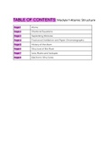
Mapwork
1. Types of maps
2. Types of symbols
3. Map code
4. Co-ordinates
5. Scale
6. Speed, distance, time
7. Mapwork and photo interpretation
8. Direction
9. Bearing
10. Magnetic declination
11. Magnetic bearing
12. Area
Happy studying!
, 2
Types of maps
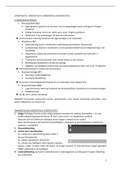
Types of maps Description
Topographical - Most accurate - Produced from detailed
land surveys and ariel photographs
- Has both natural features and
man-made
- Scale 1:50 000 (divide by 2)
Cadastral - Property boundaries or administrative
boundaries
- If topographical information is also
included on the map then it’s called
topocadastral
Orthophoto - Contour lines and symbols and lines are
added to an aerial photograph.
- For detailed planning
- Scale: 1:10 000
Isopleth - Isolines join points with equal values so
these maps show contours that join
points of equal value.
Thematic - Information on particular themes such
as agriculture, urban growth, poverty,
tourism, etc.
- Thematic maps can be drawn as
choropleth maps which contain areas
that are shaded, coloured or
cross-hatched to show the value of that
area in relation to the theme of the map
, 3
Types of symbols
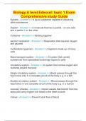
Types of symbol Description
Point symbols Used to show features on a map that are too small to be shown in detail.
Linear symbols Used for features which are linear in shapes such as roads, rivers, and
railways
Area symbols Used for features that cover a large area
Map symbols that represent real-life features and objects.
• Color specific:
- Green (vegetation); Brown (contours); Blue (water);
- Red (Human); Grey & Black (Human) & White (natural veld).
• Symbol Specific:
- Point; Line; and Area
1. Types of maps
2. Types of symbols
3. Map code
4. Co-ordinates
5. Scale
6. Speed, distance, time
7. Mapwork and photo interpretation
8. Direction
9. Bearing
10. Magnetic declination
11. Magnetic bearing
12. Area
Happy studying!
, 2
Types of maps
Types of maps Description
Topographical - Most accurate - Produced from detailed
land surveys and ariel photographs
- Has both natural features and
man-made
- Scale 1:50 000 (divide by 2)
Cadastral - Property boundaries or administrative
boundaries
- If topographical information is also
included on the map then it’s called
topocadastral
Orthophoto - Contour lines and symbols and lines are
added to an aerial photograph.
- For detailed planning
- Scale: 1:10 000
Isopleth - Isolines join points with equal values so
these maps show contours that join
points of equal value.
Thematic - Information on particular themes such
as agriculture, urban growth, poverty,
tourism, etc.
- Thematic maps can be drawn as
choropleth maps which contain areas
that are shaded, coloured or
cross-hatched to show the value of that
area in relation to the theme of the map
, 3
Types of symbols
Types of symbol Description
Point symbols Used to show features on a map that are too small to be shown in detail.
Linear symbols Used for features which are linear in shapes such as roads, rivers, and
railways
Area symbols Used for features that cover a large area
Map symbols that represent real-life features and objects.
• Color specific:
- Green (vegetation); Brown (contours); Blue (water);
- Red (Human); Grey & Black (Human) & White (natural veld).
• Symbol Specific:
- Point; Line; and Area