GISP Study questions with
answers
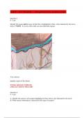
Georeferencing - CORRECT ANSWERS ✔✔101- associating
a map or image with spatial location
control points - CORRECT ANSWERS ✔✔101- points come
in pairs that match the spatial location with a point on an
unreferenced image or map
Spatial Reference Systems (SRS) - CORRECT ANSWERS
✔✔101- coordinate based local, regional, or global system
used to location geographical entities (aka Coordinate
Reference System (CRS))
Coordinate Reference System (CRS) - CORRECT ANSWERS
✔✔101- coordinate based local, regional, or global system
used to location geographical entities (aka Spatial
Reference Systems (SRS))
International Terrestrial Reference System (ITRS) -
CORRECT ANSWERS ✔✔101- a three-dimensional
coordinate system with a well-defined origin (the center
,of mass of the Earth) and three orthogonal coordinate
axes (X,Y,Z)
Map projection - CORRECT ANSWERS ✔✔101-
transforming coordinated from a curved surface (Earth) to
a flat map
Horizontal datum - CORRECT ANSWERS ✔✔101- model of
the earth as a spheroid (2 components, reference
ellipsoid and a set of survey points both the shape of the
spheroid and its position relative to the earth)
Vertical Datum - CORRECT ANSWERS ✔✔101- reference
point for measuring elevations
NAVD88 - CORRECT ANSWERS ✔✔101- Gravity based
geodetic datum in North America
WGS 84 (World Geodetic System) - CORRECT ANSWERS
✔✔101- reference coordinate system used by the Global
Positioning System (GPS)
SRID integer - CORRECT ANSWERS ✔✔101- Spatial
reference system id numbers, including EPSG codes
,defined by the International Association of Oil and Gas
Producers
types of distortion - CORRECT ANSWERS ✔✔101-
Distance, Direction, Shape, Area (sometimes bearing and
scale)
Mercator Projection- distortions - CORRECT ANSWERS
✔✔101- preserves shape and direction, area gets
distorted
Mercator Projection - CORRECT ANSWERS ✔✔101-
projecting the Earth onto a cylinder tangent to a meridian
Azimuthal Projection- distortions - CORRECT ANSWERS
✔✔101- distance from center is true, other properties
distort with distance
Azimuthal Projection - CORRECT ANSWERS ✔✔101- planar
or tangent (meaning they are formed when a flat piece of
paper is placed on top of the globe and a light source
projects the surrounding areas on to a map.) Either the
North Pole or the South pole is orientated at the center of
the map, giving the viewer an impression of looking up or
down at Earth.
, Cylindrical Projection- distortions - CORRECT ANSWERS
✔✔101- preserve area and shape, distance gets distorted,
especially on upper and lower regions of the map
Cylindrical Projection - CORRECT ANSWERS ✔✔101- 2
types Tangent (1 intersect) and Secant (2 intersects)
Straight meridians and parallels
meridians are equally spaced while parallels are not
Conical Projection- distortions - CORRECT ANSWERS
✔✔101- preserves direction and area in limited areas,
distorts distance and scale except along standard
parallels
Conic Projections - CORRECT ANSWERS ✔✔101- mapped
to equally spaced lines by projecting a spherical surface
onto a cone
Choosing a Projection- Low LATITUDE, (near Equator) -
CORRECT ANSWERS ✔✔101- use conical projection
Choosing a Projection- High LATITUDE, Polar Regions -
CORRECT ANSWERS ✔✔101- use azimuthal planar
projections
answers
Georeferencing - CORRECT ANSWERS ✔✔101- associating
a map or image with spatial location
control points - CORRECT ANSWERS ✔✔101- points come
in pairs that match the spatial location with a point on an
unreferenced image or map
Spatial Reference Systems (SRS) - CORRECT ANSWERS
✔✔101- coordinate based local, regional, or global system
used to location geographical entities (aka Coordinate
Reference System (CRS))
Coordinate Reference System (CRS) - CORRECT ANSWERS
✔✔101- coordinate based local, regional, or global system
used to location geographical entities (aka Spatial
Reference Systems (SRS))
International Terrestrial Reference System (ITRS) -
CORRECT ANSWERS ✔✔101- a three-dimensional
coordinate system with a well-defined origin (the center
,of mass of the Earth) and three orthogonal coordinate
axes (X,Y,Z)
Map projection - CORRECT ANSWERS ✔✔101-
transforming coordinated from a curved surface (Earth) to
a flat map
Horizontal datum - CORRECT ANSWERS ✔✔101- model of
the earth as a spheroid (2 components, reference
ellipsoid and a set of survey points both the shape of the
spheroid and its position relative to the earth)
Vertical Datum - CORRECT ANSWERS ✔✔101- reference
point for measuring elevations
NAVD88 - CORRECT ANSWERS ✔✔101- Gravity based
geodetic datum in North America
WGS 84 (World Geodetic System) - CORRECT ANSWERS
✔✔101- reference coordinate system used by the Global
Positioning System (GPS)
SRID integer - CORRECT ANSWERS ✔✔101- Spatial
reference system id numbers, including EPSG codes
,defined by the International Association of Oil and Gas
Producers
types of distortion - CORRECT ANSWERS ✔✔101-
Distance, Direction, Shape, Area (sometimes bearing and
scale)
Mercator Projection- distortions - CORRECT ANSWERS
✔✔101- preserves shape and direction, area gets
distorted
Mercator Projection - CORRECT ANSWERS ✔✔101-
projecting the Earth onto a cylinder tangent to a meridian
Azimuthal Projection- distortions - CORRECT ANSWERS
✔✔101- distance from center is true, other properties
distort with distance
Azimuthal Projection - CORRECT ANSWERS ✔✔101- planar
or tangent (meaning they are formed when a flat piece of
paper is placed on top of the globe and a light source
projects the surrounding areas on to a map.) Either the
North Pole or the South pole is orientated at the center of
the map, giving the viewer an impression of looking up or
down at Earth.
, Cylindrical Projection- distortions - CORRECT ANSWERS
✔✔101- preserve area and shape, distance gets distorted,
especially on upper and lower regions of the map
Cylindrical Projection - CORRECT ANSWERS ✔✔101- 2
types Tangent (1 intersect) and Secant (2 intersects)
Straight meridians and parallels
meridians are equally spaced while parallels are not
Conical Projection- distortions - CORRECT ANSWERS
✔✔101- preserves direction and area in limited areas,
distorts distance and scale except along standard
parallels
Conic Projections - CORRECT ANSWERS ✔✔101- mapped
to equally spaced lines by projecting a spherical surface
onto a cone
Choosing a Projection- Low LATITUDE, (near Equator) -
CORRECT ANSWERS ✔✔101- use conical projection
Choosing a Projection- High LATITUDE, Polar Regions -
CORRECT ANSWERS ✔✔101- use azimuthal planar
projections