

Sample
Summaries after sample
, U3: Information from atlases U1: Latitude and longitude
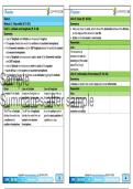
Inside an atlas: Hemispheres:
• Contain maps of countries, provinces, major towns, • The equator (0° latitude) divides the world into the
transport routes and physical relief. northern hemisphere and southern hemisphere.
• Use the contents page to see where to find the map • Lines of latitude indicate how far a place is north or
and information you need. M1: Map Skills south of the equator.
• The Greenwich meridian (0° longitude) – divides the
world into the eastern hemisphere and western
The world’s greatest: hemisphere.
• Longest rivers – Nile River, Amazon River and Yangtze River. • Measured in degrees east or west of the Greenwich
• Highest mountains – Mt Everest/Sagarmatha, K2/Qogir and Kanchenjunga. meridian.
• Biggest deserts - Antarctica Desert, Sahara Desert and Arctic Desert. •
Sample •
•
•
Countries with the biggest forests – Russia, Brazil and Canada.
Biggest oceans – Pacific Ocean, Atlantic Ocean and Indian Ocean.
Largest countries – Russia, Canada and China.
Locating places using lines of
latitude and longitude:
• Latitude is written first and longitude second – the place
Summaries after sample U2: Scale
•
where the 2 lines meet is the co-ordinates of the place.
• Drawing to scale means that everything is the exact number of
times smaller than it is in real life.
• Places further from the equator look larger than they really area.
GR6 SS-GEO T1-M1 Mind Map Study & Master Copyright © www.summariessa.co.za (DO NOT COPY)
Summaries after sample
, U3: Information from atlases U1: Latitude and longitude
Inside an atlas: Hemispheres:
• Contain maps of countries, provinces, major towns, • The equator (0° latitude) divides the world into the
transport routes and physical relief. northern hemisphere and southern hemisphere.
• Use the contents page to see where to find the map • Lines of latitude indicate how far a place is north or
and information you need. M1: Map Skills south of the equator.
• The Greenwich meridian (0° longitude) – divides the
world into the eastern hemisphere and western
The world’s greatest: hemisphere.
• Longest rivers – Nile River, Amazon River and Yangtze River. • Measured in degrees east or west of the Greenwich
• Highest mountains – Mt Everest/Sagarmatha, K2/Qogir and Kanchenjunga. meridian.
• Biggest deserts - Antarctica Desert, Sahara Desert and Arctic Desert. •
Sample •
•
•
Countries with the biggest forests – Russia, Brazil and Canada.
Biggest oceans – Pacific Ocean, Atlantic Ocean and Indian Ocean.
Largest countries – Russia, Canada and China.
Locating places using lines of
latitude and longitude:
• Latitude is written first and longitude second – the place
Summaries after sample U2: Scale
•
where the 2 lines meet is the co-ordinates of the place.
• Drawing to scale means that everything is the exact number of
times smaller than it is in real life.
• Places further from the equator look larger than they really area.
GR6 SS-GEO T1-M1 Mind Map Study & Master Copyright © www.summariessa.co.za (DO NOT COPY)


