QGIS Studienführer, Klassennotizen & Zusammenfassungen
Suchst du nach den besten Studienführern, Studiennotizen und Zusammenfassungen über QGIS? Auf dieser Seite findest du 14 Studienunterlagen zu QGIS.
All 14 Ergebnisse
Sortieren nach
-
GISP 9: Systems Design & Management questions with correct answers
- Prüfung • 10 Seiten • 2023
- 15,01 €
- + erfahre mehr
What are some basic trends in geospatial technology? -Real-time Data -Miniaturization of Technology -Mobile Geospatial Sensor Platforms -Expanding Wireless and Web Networks -Computing Capacity for Geospatial Research, Apps What are some ways to be aware of where GIS is heading? -Blogs -Conferences -Webinars -Local and online GIS groups -Review job postings for skills required -LinkedIn profiles of similar GIS professionals -Reddit What are the most commonly known types of G...

-
GISP 9: Systems Design & Management questions with correct answers|100% verified
- Prüfung • 10 Seiten • 2024
- 10,16 €
- + erfahre mehr
GISP 9: Systems Design & Management questions with correct answers What are some basic trends in geospatial technology? -Real-time Data -Miniaturization of Technology -Mobile Geospatial Sensor Platforms -Expanding Wireless and Web Networks -Computing Capacity for Geospatial Research, Apps What are some ways to be aware of where GIS is heading? -Blogs -Conferences -Webinars -Local and online GIS groups -Review job postings for skills required -LinkedIn profiles of similar GIS pro...
-
GEO24 Geographische Informationssysteme Vorlesung Zusammenfassung
- Zusammenfassung • 63 Seiten • 2021
- 6,49 €
- + erfahre mehr
Zusammenfassung der Vorlesung GEO24 Geographische Informationssysteme im Sommersemester 2021 an der Uni Tübingen
-
100 Multiple Choice Questions on Soil Erosion
- Prüfung • 7 Seiten • 2023
- 6,77 €
- + erfahre mehr
Soil erosion is the natural process by which the top layer of soil is gradually worn away and transported from one location to another by the action of wind, water, or other environmental factors. This process can be accelerated by human activities such as deforestation, agriculture, and construction, leading to the depletion of fertile soil, reduced land productivity, and environmental degradation. Soil erosion can have significant impacts on ecosystems, water quality, and food production, maki...
-
ANALYTICAL METHODS (GISP EXAM) WITH 100% CORRECT ANSWERS 2023
- Prüfung • 6 Seiten • 2023
- 10,65 €
- + erfahre mehr
ANALYTICAL METHODS (GISP EXAM) Quantitative revolution - Correct Answer-a paradigm shift that sought to develop a more rigorous and systematic methodology for the discipline of geography. ... The main claim for the _________ _________ is that it led to a shift from a descriptive (idiographic) geography to an empirical law-making (nomothetic) geography Overlay analysis - Correct Answer-A group of methodologies applied in optimal site selection or suitability modeling (identify the best or m...

Möchtest du deine Ausgaben wieder reinholen?

-
Analytics and Business Intelligence Assignment - Analyse spatial and geographic data (QGIS)
- Andere • 92 Seiten • 2020
- 8,95 €
- + erfahre mehr
Application of GIS and related tools, techniques, and methodologies to generate business intelligence. Those are essential for informed decision making. I Got a Distinction pass(1st class) for this Assignment.
-
Analytics and Business Intelligence and QGIS Assignments - BUNDLE
- Paket-deal • 2 Sachen • 2020
- 13,54 €
- + erfahre mehr
I got Distinction passes for both Assignments. All the tasks are clearly explained with images.

-
Analytics & Business Intelligence
- Fallstudie • 130 Seiten • 2021
- 39,23 €
- + erfahre mehr
Analytics & Business Intelligence - Research using R Programming Language and QGIS Tool.
-
Big Data Analytics - LECTURE NOTES & QGIS MANUAL
- Paket-deal • 2 Sachen • 2019
- 2,99 €
- 4x verkauft
- + erfahre mehr
The complete package for Big Data Analytics using GIS (previously called GeoMarketing): the theoretical part, and the practical part.
-
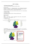
QGIS-Anleitung für die QGIS-Version 3.10
- Anleitung • 9 Seiten • 2020
- 3,49 €
- + erfahre mehr
Anleitung zum Erstellen von Karten, orientiert an den Übungsaufgaben der Vorlesung Kartographie (WiSe 19/20) an der Uni Heidelberg. Schrittweise Erklärungen wie man Daten aus Geopackages in QGIS bekommt, die Layer gestaltet und eine vollständige Karte erstellt. Speziell für die Übungsaufgabe 6 auch wie man mehrere Karten in ein Kartenlayout bekommt. Dabei geht es nur um die Schritte zur Erstellung der Karte nicht um die Richtigkeit bspw. der Klasseneinteilung. Die Farbwahl wurde willkürl...
